Midday Nowcast: Not as Cold, but Some Snow
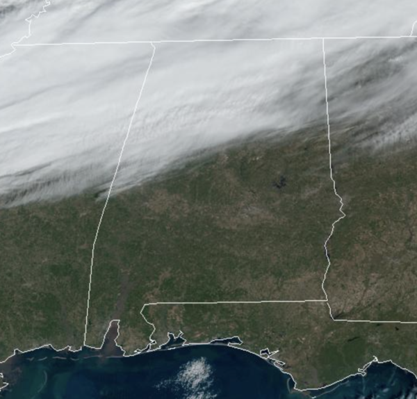
THAWING OUT SOME: Still cold, but most locations are finally above freezing with upper 30s to lower 40s common across North/Central Alabama. An “Alberta Clipper” is bringing clouds into Alabama today, along with a little light snow, or snow flurries to the northern third of the state this afternoon and early tonight.
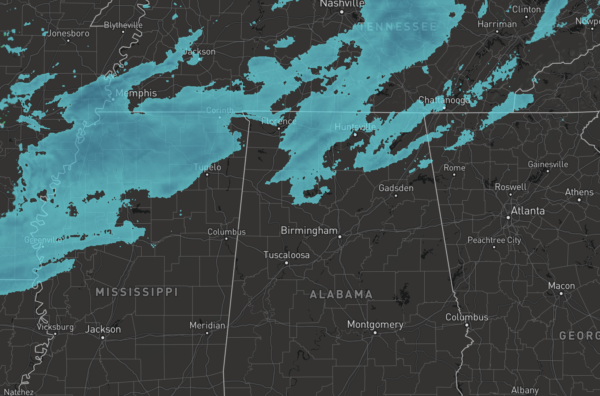
However, limited moisture means precipitation will be very light. Best chances for accumulation would occur late this afternoon into the evening as air temperatures fall back below freezing, and mainly on grassy areas. This is a low impact situation; there are no advisories in effect for any part of Alabama. But, there could be a few slick spots on roads, so as always, drive carefully.
WARMER DAYS AHEAD: The story this week will be the big warm-up this week. It will be sunny each day with temperatures rising into the 40s and 50s tomorrow with 50s areawide Wednesday.We will see more clouds on Thursday and we rise into the 60s as southerly flow increases. Overnight lows will warm as well, we should mainly 20s again tonight, and be closer to freezing tomorrow night. By Wednesday night, all locations should remain in the 40s.
FRIDAY & WEEKEND: Clouds return and rain and storms return to Alabama during the day Friday lasting Friday night and into Saturday. This will be a good soaking, with some spots seeing two inches of rain. For North/Central Alabama, severe storms are not anticipated at this time, but some model data suggest there will be enough instability across South Alabama where some strong storms may be possible. We will keep an eye on trends in the coming days. On Sunday, the first day of 2023, the weather looks drier with highs in the mid and upper 60s.
BEACH FORECAST CENTER: Get the latest weather and rip current forecasts for the beaches from Fort Morgan to Panama City on our Beach Forecast Center page. There, you can select the forecast of the region that you are interested in visiting.
WORLD TEMPERATURE EXTREMES: Over the last 24 hours, the highest observation outside the U.S. was 114.1F at Eucla, Australia. The lowest observation was -51.0F at Ojmjakon, Russia.
CONTIGUOUS TEMPERATURE EXTREMES: Over the last 24 hours, the highest observation was 88F at San Pasqual, CA. The lowest observation was -20F at Cano and Langdon, ND.
Category: Alabama's Weather, ALL POSTS
About the Author (Author Profile)
Macon, Georgia Television Chief Meteorologist, Birmingham native, and long time Contributor on AlabamaWX. Stormchaser. I did not choose Weather, it chose Me. College Football Fanatic. @Ryan_StinnetSubscribe
If you enjoyed this article, subscribe to receive more just like it.


