Sunday Weather Brunch: Wet For The Foreseeable Future
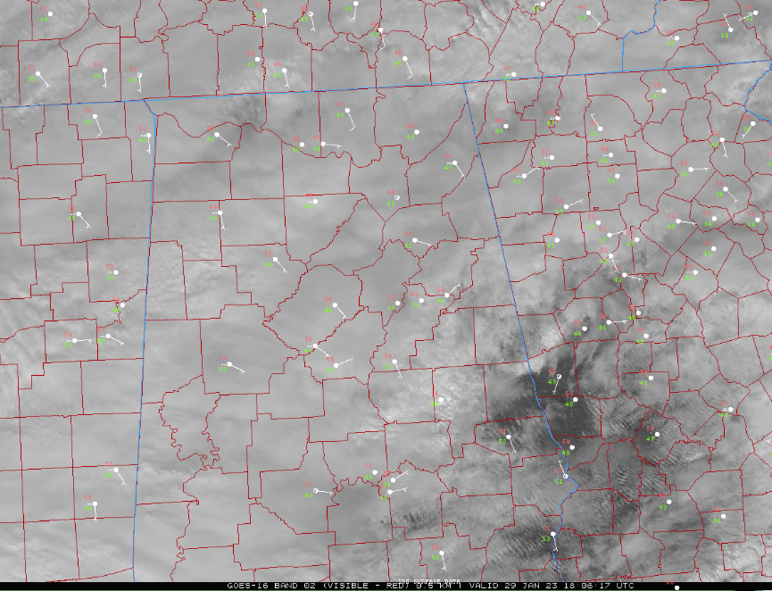
Clouds have most of the state of Alabama socked in on this January Sunday afternoon. The only peeks of sunshine are down US-280 toward Alex City and Eufaula.
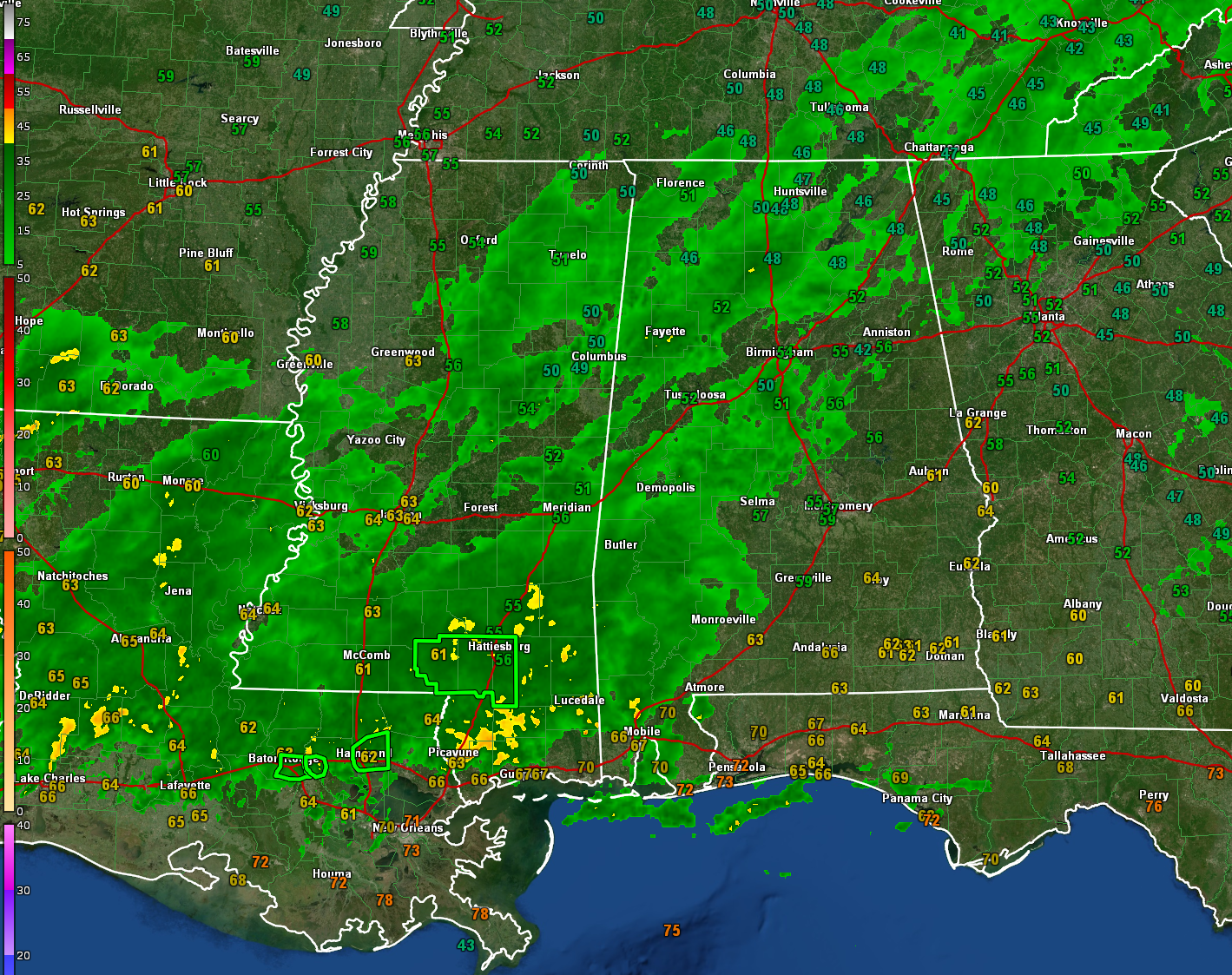
Radar shows much of the northwestern half of Alabama in light to moderate rain with more moderate to heavy rain over Mississippi and Louisiana that is heading this way. Several flash flood warnings are in effect to the southwest of Alabama.
Temperatures are in the 40s Northeast, 50s over the rest of the northern half of the state, and 60s down south.
The rain will continue to increase and become more widespread through the afternoon until beginning to taper later tonight.
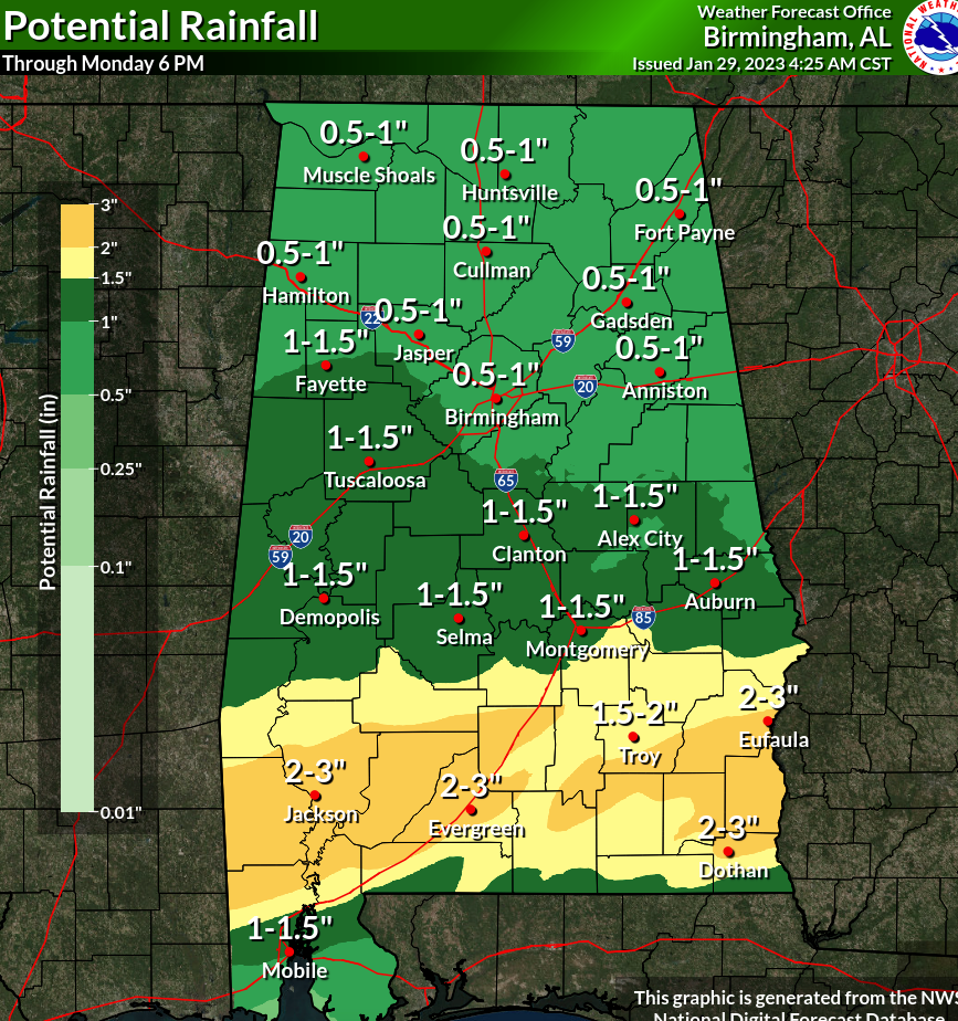
Here is expected rainfall:
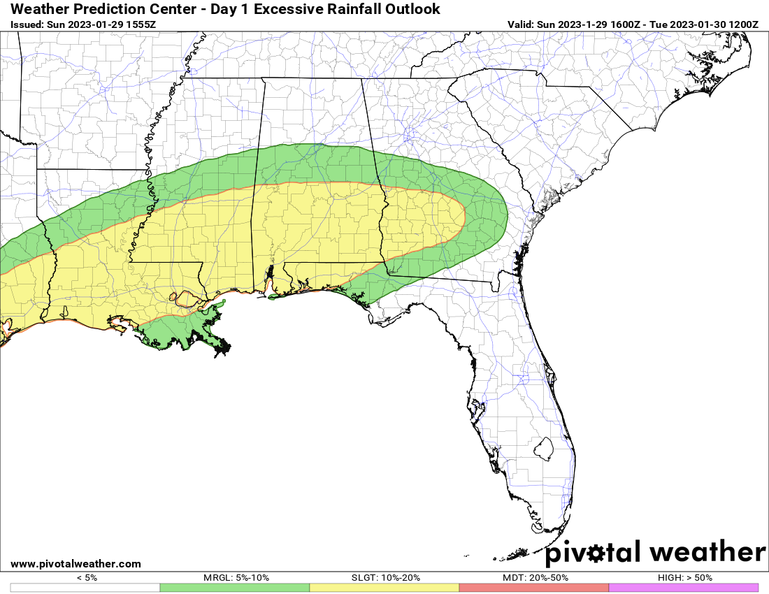
Here is the WPC excessive rainfall outlook:
There could be a few strong storms over far south Alabama.
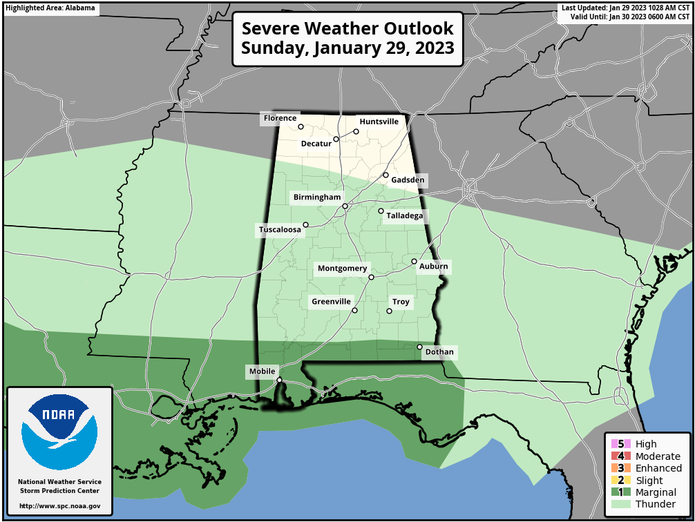
It is a low end threat, with a 2% probability of a tornado within 25 miles of a point across The Gulf Coast. The wind threat is greater.
Tomorrow will feature scattered showers and highs in the 60s and 70s ranging from 61F up North to around 68F in Auburn to 71F at Troy.
Another wave of mostly light rain will move through after midnight Monday night. Rain chances will remain high through the end of the week as more waves of rain move through.
Category: Alabama's Weather, ALL POSTS
About the Author (Author Profile)
Bill Murray is the President of The Weather Factory. He is the site's official weather historian and a weekend forecaster. He also anchors the site's severe weather coverage. Bill Murray is the proud holder of National Weather Association Digital Seal #0001 @wxhistorianSubscribe
If you enjoyed this article, subscribe to receive more just like it.


