Nice Warm-Up Today; Severe Storms Possible Thursday
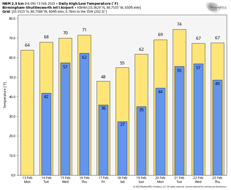
COLD START: Temperatures are in the 27-35 degree range at daybreak across Alabama, but we expect a nice warm-up today with sunshine in full supply. Most communities be in the 60s this afternoon under a cobalt blue sky. Tomorrow will even warmer with a high around 70 degrees; the sky will be partly sunny.
A surface front will push a band of showers and storms into the state after midnight tomorrow night; rain remains possible at times during the day Wednesday as the front becomes nearly stationary over the region. The weather will stay mild with highs in the low 70s.
THURSDAY: Conditions will favor strong to severe thunderstorms across Alabama, especially during the afternoon and evening hours. Global models suggest a decent degree of surface based instability along with strong wind fields, but large differences exist in the placement of a surface low Thursday and its forecast evolution. SPC has all of Alabama in a severe weather risk Thursday, but there are still many questions about how the small scale features will play out, which will determine the magnitude of the event and the specific threats.
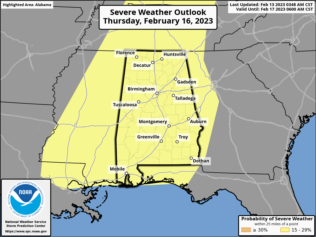
Please understand that days like this are common in Alabama this time of the year; our tornado season runs from November through May. There is no need to be anxious, but understand that you need to be weather aware Thursday in the event we do have severe storm formation. Have a reliable way of hearing warnings, and a good plan. We will get through the day together just fine.
FRIDAY AND THE WEEKEND: The weather turns sharply colder Friday with a clear sky; highs will be in the 40s and 50s with a brisk north wind. Temperatures will drop into the 20s Saturday morning. But, the rest of the weekend will feature a warming trend with sunny days and clear nights. The high Saturday will be in the 53-60 degree range, and most all communities will be in the 60s by Sunday.
NEXT WEEK: Dry and mild weather is the story Monday and Tuesday; global models suggests rain returns in the Wednesday/Thursday time frame… too early to know if severe storms will be an issue. See the daily Weather Briefing video for maps, graphics, and more details.
ON THIS DATE IN 1899: One of the coldest air masses ever observed in the U.S. made it all the way to the Gulf Coast. It was 7F in New Orleans and Pensacola. Mobile dropped to a numbing -1F. The reading of -2F at Tallahassee still is the state’s coldest reading ever. At the old Fountain Heights weather office in Birmingham the official low on that frigid morning was -10F.
ON THIS DATE IN 1952: At least three tornadoes touched down in Alabama. One estimated F3 tornado moved through the northern suburbs of Birmingham. Nine homes and 17 buildings were destroyed while 55 homes and 54 other buildings were damaged. The tornado also scattered debris for hundreds of yards. There were 26 injuries. The NWS Birmingham list the path of the tornado as being 15 miles.
Another estimated F3 moved northeastward along Fayette–Tuscaloosa County line; one person was killed. In New Lexington, two homes were destroyed and seven others were damaged. Eight more homes were damaged in Fayette County. The third tornado was in Cullman County near Garden City.
BEACH FORECAST: Click here to see the AlabamaWx Beach Forecast Center page.
Look for the next Weather Briefing video here by 3:00 this afternoon… enjoy the day!
Category: Alabama's Weather, ALL POSTS, Weather Xtreme Videos
About the Author (Author Profile)
James Spann is one of the most recognized and trusted television meteorologists in the industry. He holds the AMS CCM designation and television seals from the AMS and NWA. He is a past winner of the Broadcast Meteorologist of the Year from both professional organizations.Subscribe
If you enjoyed this article, subscribe to receive more just like it.


