Midday Nowcast: Improving Weather Today
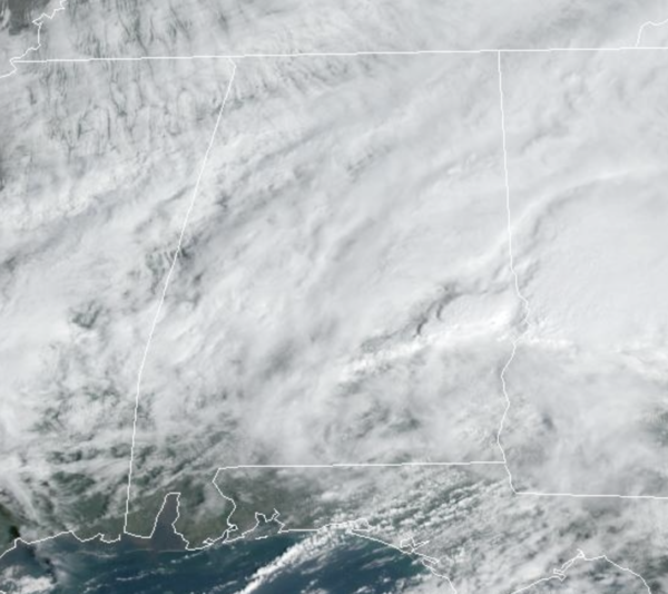
The morning rain and storms are pushing south and east out of the area. We are seeing a gradually clearing sky and cooler temperatures with upper 50s and lower 60s. Tonight will be clear and cold with lows in the 30s across North Alabama…a few colder spots might briefly touch the freezing mark.
ACROSS THE USA: A winter storm will produce copious amounts of heavy snow to the high terrain of northern and central California and significant rainfall and flood threats across much of California, as well as into far western Nevada. A winter storm will continue to bring several inches of snow and gusty winds across the Lower Great Lakes into the northern Mid-Atlantic. Both storms may cause travel disruptions.
WEEKEND WEATHER: Tomorrow will be mainly sunny and dry with highs in the 60s and 70s. On Sunday, a quick moving system will bring rain and thunderstorms back to the state by Sunday afternoon and Sunday night. The SPC has introduced a “slight risk” (level 2/5) of severe thunderstorms for areas along and south of I-20, and a “marginal risk” (level 1/5) for North Alabama.
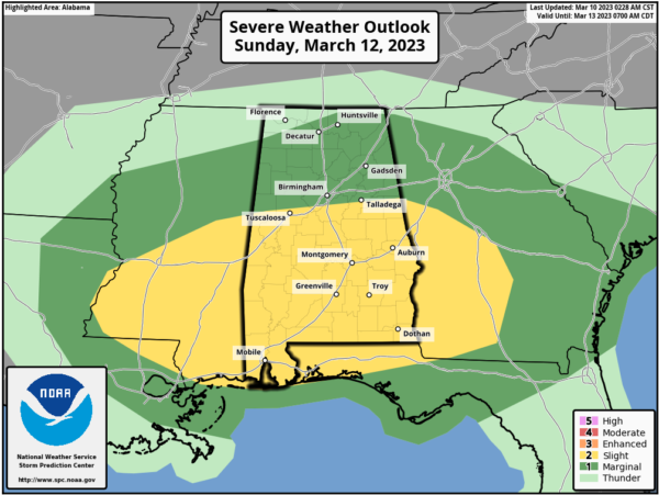
The main threat will be hail and strong, straight-line winds; the tornado threat is very low, but not zero. The main window for strong to severe thunderstorms will come from roughly 2PM-9PM. Highs Sunday afternoon will be in the 60s and 70s.
NEXT WEEK: The weather still looks dry Monday through Thursday, with temperatures below average for mid-March. Potential for a late season freeze is increasing Tuesday and Wednesday morning over the northern half of Alabama. Wednesday morning looks to be the coldest with lows in the 25-35 degree range. Highs will be in the 50s to start the week, but we warm up by the end of the week, and rain will likely return by Friday along with some risk of thunderstorms.
BEACH FORECAST CENTER: Get the latest weather and rip current forecasts for the beaches from Fort Morgan to Panama City on our Beach Forecast Center page. There, you can select the forecast of the region that you are interested in visiting.
WORLD TEMPERATURE EXTREMES: Over the last 24 hours, the highest observation outside the U.S. was 111.7F at Ondangwa, Namibia. The lowest observation was -91.5F at Mid Point, Antarctica.
CONTIGUOUS TEMPERATURE EXTREMES: Over the last 24 hours, the highest observation was 93F at Falcon Lake, TX. The lowest observation was -4F at Choteau, MT.
Category: Alabama's Weather, ALL POSTS
About the Author (Author Profile)
Macon, Georgia Television Chief Meteorologist, Birmingham native, and long time Contributor on AlabamaWX. Stormchaser. I did not choose Weather, it chose Me. College Football Fanatic. @Ryan_StinnetSubscribe
If you enjoyed this article, subscribe to receive more just like it.


