Sunny Tomorrow; Strong Storms Sunday
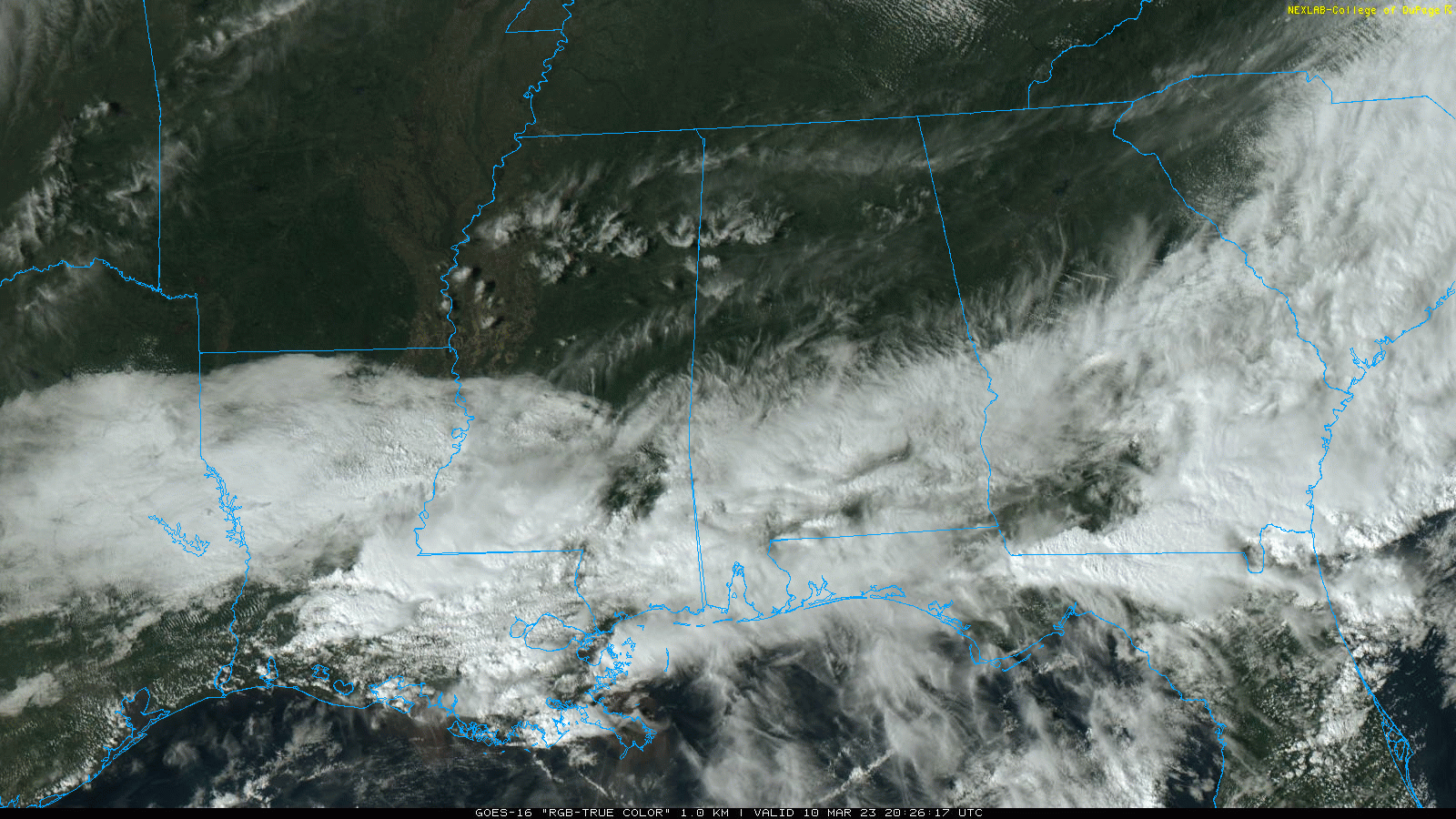
DRY AIR MOVING IN: As expected, the sky has cleared across the northern half of Alabama this afternoon as dry air works into the state. Lingering showers near the coast will end this evening. Tonight will be mostly fair with a low in the 30s for North Alabama… some colder spots could get close to the freezing mark by daybreak tomorrow.
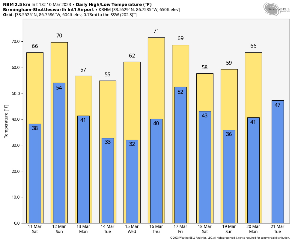
THE ALABAMA WEEKEND: Tomorrow will be a mostly sunny day with highs in the 60s and 70s. Then, a fast moving system will bring rain and storms back into the state Sunday. SPC has introduced a “slight risk” (level 2/5) of severe thunderstorms for areas along and south of I-20, and a “marginal risk” (level 1/5) for North Alabama.
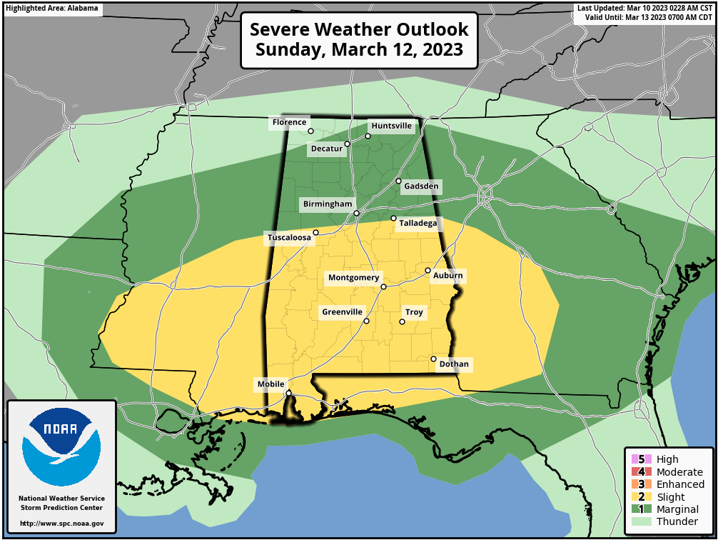
The main window for strong to severe thunderstorms will come from roughly 12:00 noon until 9:00 p.m… and the main threats will involve hail and strong straight line winds. But, an isolated tornado can’t be totally ruled out. Temperatures will rise into the 65-75 degree range Sunday afternoon.
NEXT WEEK: The sky becomes mostly sunny following the passage of a cold front, and highs drop into the 50s over the northern half of the state, with 60s to the south. The headline is the threat of a late season freeze Tuesday and Wednesday morning; lows will drop into the 25-35 degree range across North/Central Alabama both mornings. Some frost is possible down into South Alabama early Wednesday with a clear sky and light wind.
The weather will be dry Monday through Thursday, but rain is possible at the end of the week Friday as a cold front passes through the state. For now it doesn’t look like a severe weather threat. See the daily Weather Briefing video for maps, graphics, and more details.
ON THIS DATE IN 1884: John Park Finley issued the first experimental tornado prediction. Finley studied the atmospheric parameters that were present during previous tornadoes. Many of these same criteria are still used by operational forecasters today. But the use of tornado forecasts would be banned just a few years later and remain forbidden until 1952.
ON THIS DATE IN 1986: Severe thunderstorms and tornadoes hit Indiana, Kentucky, and Ohio. A total of 19 tornadoes occurred. Three of the tornadoes in Indiana reached F3 intensity. A densely populated subdivision of Southeast Lexington, Kentucky, was heavily damaged by a tornado. Twenty people were injured, and 900 homes were destroyed or demolished. A very strong thunderstorm downburst hit the Cincinnati area. At the Greater Cincinnati Airport, windows were blown out of the control tower, injuring the six controllers on duty.
BEACH FORECAST: Click here to see the AlabamaWx Beach Forecast Center page.
Look for my next video briefing here by 6:00 a.m. Monday… enjoy the weekend!
Category: Alabama's Weather, ALL POSTS, Weather Xtreme Videos
About the Author (Author Profile)
James Spann is one of the most recognized and trusted television meteorologists in the industry. He holds the AMS CCM designation and television seals from the AMS and NWA. He is a past winner of the Broadcast Meteorologist of the Year from both professional organizations.Subscribe
If you enjoyed this article, subscribe to receive more just like it.


