So Far, Storms Are Staying Below Severe Criteria
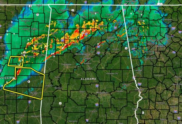
As we have nearly reached the 4 am hour, the storms have stayed below severe limits as they have pushed into the state. The line of storms will soon be approaching the I-59 corridor with heavy rain, lightning, and some gusty winds.
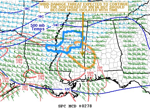
The latest Mesoscale Discussion from the SPC states that the wind-damage threat may continue to the southeast of the current Severe Thunderstorm Watch as the line of storms moves into eastern Mississippi over the next couple of hours. The threat is expected to become more isolated, but weather watch issuance remains possible to the southeast and into the southwestern and western parts of Central Alabama. Here is the rest of the discussion…
The latest radar imagery from Jackson shows a continuous line of storms across northwestern Mississippi, with a large-scale bowing structure. This line is located along the northern edge of a moist and unstable airmass with MLCAPE generally around 500 J/kg according to the RAP. This line is being supported by a 40 to 50 kt low-level jet, and a subtle shortwave trough evident on water vapor imagery. As the line moves southeastward, it will continue to encounter weak instability, with low-level flow becoming slightly more veered. This may result in a gradual weakening trend over the next few hours. However, a lingering threat for isolated wind damage should remain, especially if the line can remain somewhat organized.
If the line has already passed your location, the threat of severe storms has ended. Ahead of the storms, the threat goes from now through the rest of the morning until the strongest part of the line exits the area around noon. We’ll be with you with updates.
Category: Alabama's Weather, ALL POSTS, Severe Weather


