Loud Storms Approaching the Birmingham Metro
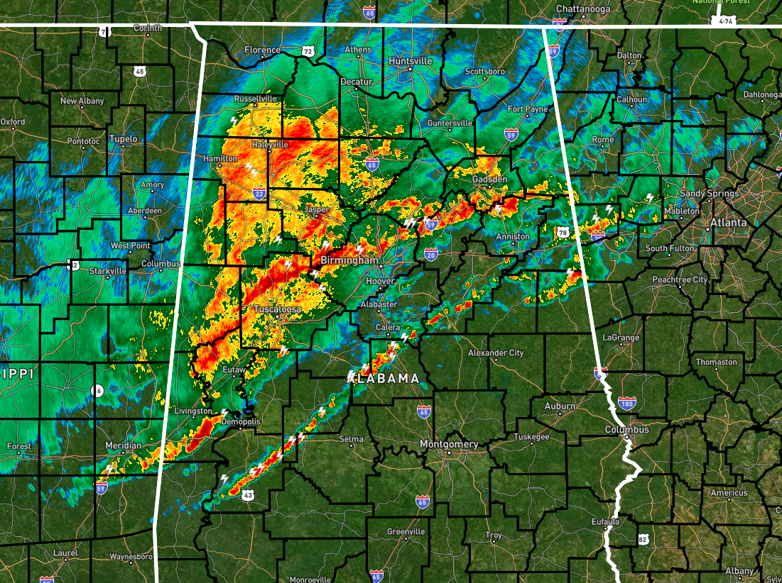
As of 5:30 am, a line of storms are lined up along and just north of the I-59 corridor and is very close to entering the Birmingham Metropolitan Area. You can expect heavy rain, lightning, and some breezy winds as it moves through, but the good news is that it is well below severe criteria.
South of that, we have another line that has developed out ahead of the main line of storms. We’ll have to watch this line as it will be moving through undisturbed air, but at this point, there is not very much instability to work with. The main pocket of instability in the state is over the southwestern areas, mainly south of a line from Demopolis to Selma to Fort Deposit.
Temperatures at 5 am were in the lower 50s to the upper 60s. Gadsden was the cool spot at 52º, while the warm spot was Montgomery at 67º. Dewpoints were ranging in the lower 50s to the mid 60s.
While the risk does not look likely, we may still see a storm or two become severe with isolated damaging winds up to 60 mph. While the threat is not completely zero, the tornado threat is really low.
Category: Alabama's Weather, ALL POSTS, Severe Weather
About the Author (Author Profile)
Scott Martin is an operational meteorologist, professional graphic artist, musician, husband, and father. Not only is Scott a member of the National Weather Association, but he is also the Central Alabama Chapter of the NWA president. Scott is also the co-founder of Racecast Weather, which provides forecasts for many racing series across the USA. He also supplies forecasts for the BassMaster Elite Series events including the BassMaster Classic.Subscribe
If you enjoyed this article, subscribe to receive more just like it.


