Severe Storms Likely Across Alabama Late Friday Night
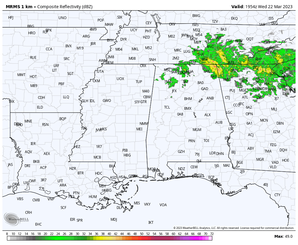
THIS AFTERNOON: The southern 2/3 of Alabama is enjoying a mostly sunny, mild day with temperatures in the 70s. A few showers linger over the northern counties this afternoon with a mostly cloudy sky; places like Huntsville are only in the 50s because of clouds and rain. Showers end this evening, and the sky will be mostly fair tonight with a low in the 50s.
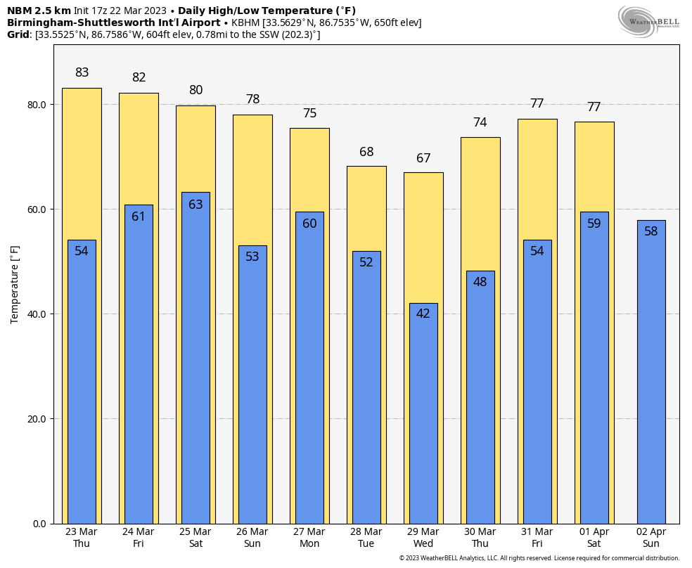
Tomorrow will be a mostly sunny, warm day with a high in the 80-85 degree range. The day Friday will also be warm and dry with a mix of sun and clouds… temperatures rise into the low to mid 80s again. South winds will increase by afternoon.
FRIDAY NIGHT: A cold front will push an organized band of thunderstorms into Alabama late Friday night and into the pre-dawn hours Saturday. SPC has defined a “slight risk” (level 2/5) of severe storms for areas west of a line from Fort Payne to Verbena to Camden to Jackson. A “marginal risk” extends as far east and south as Opelika and Geneva.
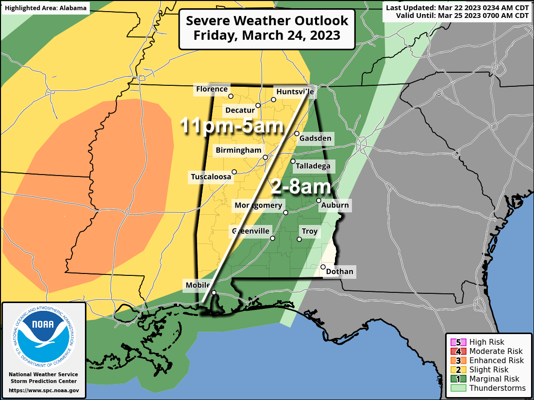
The surface and upper air synoptic pattern certainly favors severe thunderstorms… the main question involves the degree of surface based instability available. This will likely be a linear event with the main threat coming from strong, potentially damaging straight line winds, but a few tornadoes are very possible.
The window opens up for severe storms over far West Alabama around 11:00 p.m… the line will advance through the state through the pre-dawn hours Saturday. This will be a “middle of the night” type event, and everyone will need a reliable way of getting warnings. The baseline is a NOAA Weather Radio… every home and business needs one. Have Wireless Emergency Alerts enabled on your phone, and be sure “Do Not Disturb” is not active Friday night.
THE ALABAMA WEEKEND: Storms end early Saturday morning… the sky becomes partly to mostly sunny by afternoon with a high around 80 degrees. Clouds return Sunday, and we will bring in a chance of showers and thunderstorms by afternoon…. the high Sunday will be in the 75-80 degree range. The best chance of showers Sunday will be over the southern half of the state.
NEXT WEEK: Showers and storms are possible Monday and Tuesday. The rest of the week looks dry for now. Highs will be in the upper 60s and 70s through the week; See the video briefing for maps, graphics, and more details.
ON DATE IN 1893: The first tornado was recorded in Oklahoma City, Oklahoma, on this date. It destroyed 14 buildings and injured four people as it passed through the center of town. There was minor damage to the Weather Bureau office, which was located at Grand and Robinson in south Oklahoma City.
ON THIS DATE IN 2022: Three tornadoes touched down in Southwest Alabama, including an EF-1 that moved through Baldwin County from Summerdale to Robertsdale.
BEACH FORECAST: Click here to see the AlabamaWx Beach Forecast Center page.
Look for the next video briefing here by 6:00 a.m. tomorrow…
Category: Alabama's Weather, ALL POSTS, Weather Xtreme Videos
About the Author (Author Profile)
James Spann is one of the most recognized and trusted television meteorologists in the industry. He holds the AMS CCM designation and television seals from the AMS and NWA. He is a past winner of the Broadcast Meteorologist of the Year from both professional organizations.Subscribe
If you enjoyed this article, subscribe to receive more just like it.


