Sunday Weather Briefing Video — Strong to Severe Storms Possible Through the Day
SUNDAY’S WEATHER:
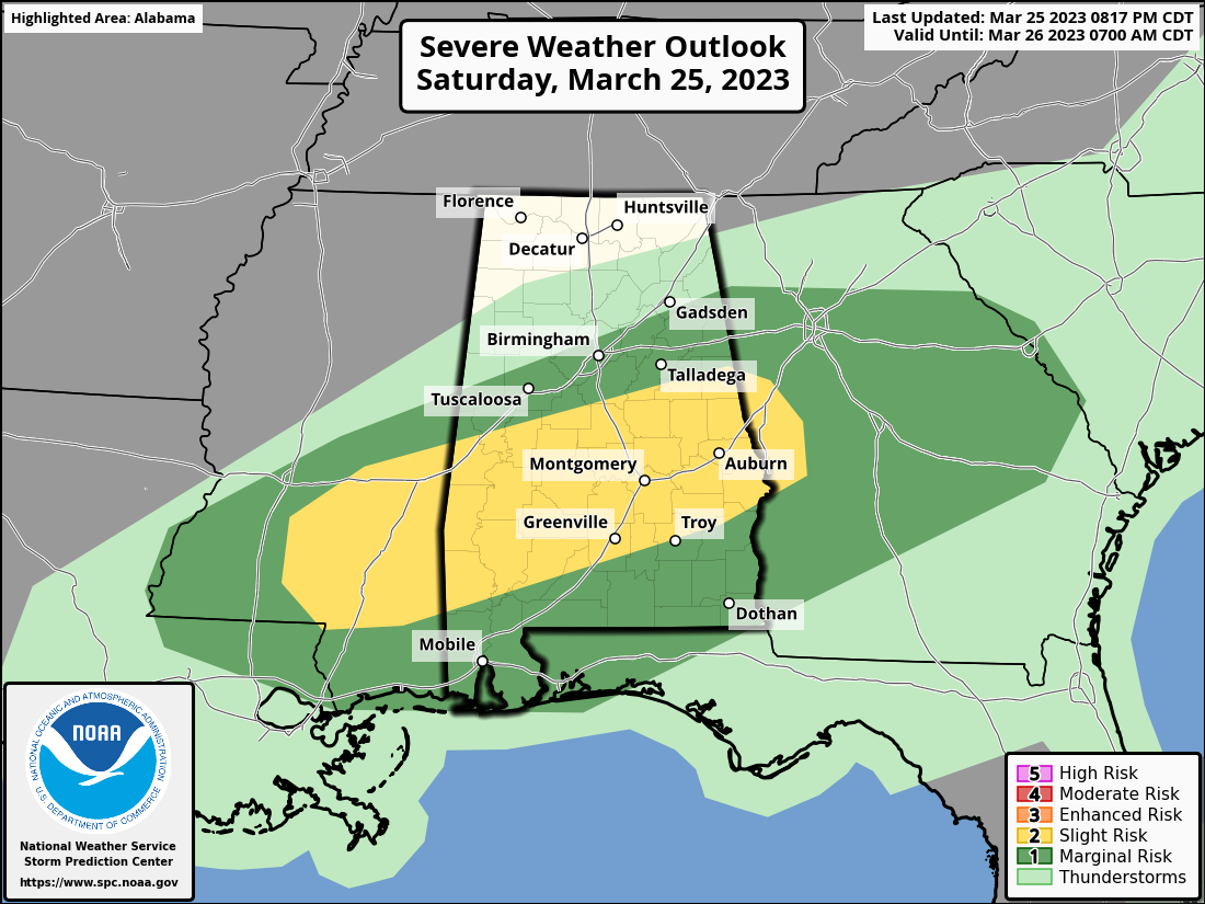
For now, it looks like showers and storms will start developing over the central parts of Central Alabama a couple of hours after midnight and will build through the rest of the pre-dawn hours. A Slight Risk continues for locations along and south of a line from Boligee to Calera to Lineville, and that will go until that product expires at 7 am Sunday.
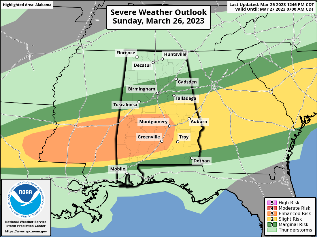
After that, the next Severe Weather Outlook goes into effect and an Enhanced Risk for severe storms is up for locations south and west of a line from Boligee to Wetumpka to Pike Road. A Slight Risk covers the rest of the southern half of the area, from Geiger to Montevallo to Lineville. A Marginal Risk extends northward of that to a line from Vernon to Garden City to Cedar Bluff.
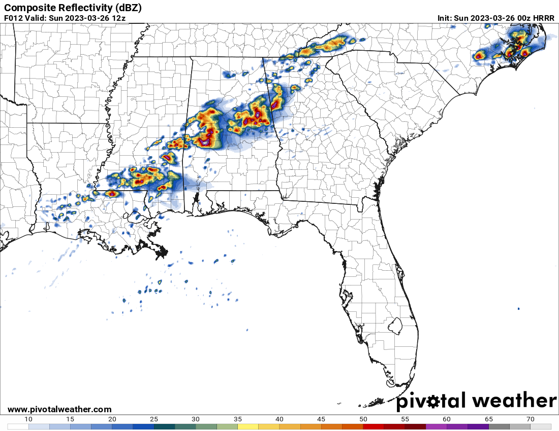
There will be two waves of storms, with the first one occurring from roughly 2-3 am to 6-7 pm…
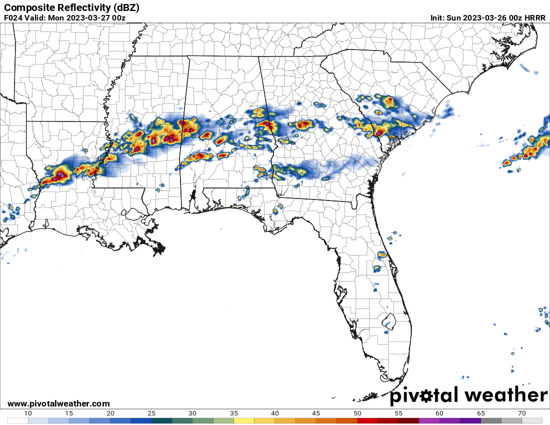
…and the second wave moving in around 6-7 pm and potentially persisting until 6-7 am Monday morning. Threats will mainly be from damaging thunderstorm wind gusts up to 60-70 mph, but large hail and a few tornadoes can’t be ruled out. A strong tornado or two will be possible in the Enhanced Risk locations. Highs in the mid 70s to the lower 80s.
MONDAY: The good news is, the front responsible for all of our severe weather activity will finally be pushed down toward the Gulf Coast on Monday. Other than the rain pushing out of the area during the first half of the day, the second half will be dry with clearing skies. Highs in the mid to upper 70s.
TUESDAY: The front will stall out over South Alabama and will be a focal point for showers and thunderstorm development during the heating of the day on Tuesday, mainly over the southern-third of the area. Everyone else will be dry with partly to mostly cloudy skies. Highs in the upper 60s to the lower 70s.
WEDNESDAY & THURSDAY: Much calmer weather can be expected on Wednesday and Thursday, as sunny skies and nice temperatures look to be in the cards. Wednesday’s highs in the mid to upper 60s, and warming into the 70s on Thursday.
FRIDAY: The next system will start to move into the northern half of the area during the second half of the day on Friday, and will bring showers and a few storms to those locations. At this point, severe weather does not look likely. Highs in the upper 70s to the lower 80s.
THE CENTRAL ALABAMA WEEKEND: The system continues to slowly move deeper into the area on Saturday, eventually bringing showers and storms to everyone. For now, a few stronger storms will be possible as the global models are showing enough instability, shear, and helicity for the potential of a severe storm. It’s too far out to be certain, so we’ll watch for later model runs to pin down what to expect. Highs in the lower 70s to the lower 80s.
The storms will be out of the area by midnight, and Sunday looks to be a much better day across Central Alabama. We’ll have mainly sunny skies, and highs in the 70s.
Category: Alabama's Weather, ALL POSTS, Severe Weather, Weather Xtreme Videos
About the Author (Author Profile)
Scott Martin is an operational meteorologist, professional graphic artist, musician, husband, and father. Not only is Scott a member of the National Weather Association, but he is also the Central Alabama Chapter of the NWA president. Scott is also the co-founder of Racecast Weather, which provides forecasts for many racing series across the USA. He also supplies forecasts for the BassMaster Elite Series events including the BassMaster Classic.Subscribe
If you enjoyed this article, subscribe to receive more just like it.


