Midday Nowcast: Strong Storms Arrive Tonight
We have been dealing with some showers across North/Central Alabama through the morning hours. These will continue at times through the afternoon hours as it remains mostly cloudy and very warm as highs surge into the upper 70s and lower 80s. Our winds are increasing out of the south as well today, they could gust as high as 40 mph, and wind advisory is in effect for the northern half of the state. To the north and west of Alabama, a significant outbreak of severe weather will occur, where the SPC has a “moderate risk” (level 4/5) of severe storms from North Mississippi, all the way north into Iowa. For Alabama tonight, the SPC maintains an “enhanced risk” (level 3/5) of severe thunderstorms for the areas along and north of a line from Reform to Jasper to Cullman to Scottsboro. A “slight risk” (level 2/5) extends as far east as Anniston to Hoover to Eutaw. And, there is a “marginal risk” (level 1/5) defined as far south as Thomasville to Prattville to Lafayette.
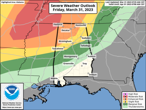
Late tonight, storms will enter Northwest Alabama in the 10PM to midnight window, the line of storms will move southeastward after midnight. The core tornado threat is in the “enhanced risk” across Northwest Alabama, and SPC suggests a strong tornado (EF-2 or higher) is possible there. The threats will be mainly damaging straight line winds and hail during the pre-dawn hours as the storms shift southward.
Another overnight event, everyone will need to have a reliable way of hearing severe weather warnings; the baseline is a NOAA Weather Radio. Be sure “Do Not Disturb” and “Sleep Mode” as disabled on your phone so you won’t miss any notifications.
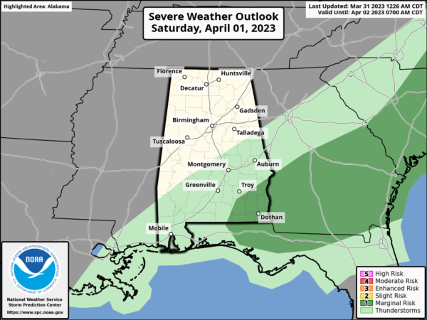
WEEKEND WEATHER: The weakening storms push south tomorrow morning, and the day will feature a clearing sky and highs in the upper 70s and lower 80s. Rain and storms Saturday afternoon will be confined to South Alabama and a few strong storms may be possible across the Wiregrass Section of the state.
On Sunday, dry air settles into the state and we are forecasting a mostly sunny sky highs will be in the 70s.
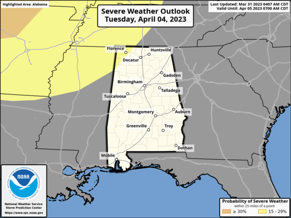
NEXT WEEK: Moisture begins to return Monday, and much of the week looks unsettled with the potential for multiple rounds for rain and storms. Another storm system will bring the risk of severe thunderstorms to the Deep South sometime in the Tuesday/Wednesday time frame, and the SPC has already issued a severe weather threat for the region; way too early to be specific on this threat.
The front becomes stationary, meaning showers and storms will remain possible Thursday and Friday. Highs through the week will be in the 70s and 80s.
BEACH FORECAST CENTER: Get the latest weather and rip current forecasts for the beaches from Fort Morgan to Panama City on our Beach Forecast Center page. There, you can select the forecast of the region that you are interested in visiting.
WORLD TEMPERATURE EXTREMES: Over the last 24 hours, the highest observation outside the U.S. was 111.9F at Matam, Senegal. The lowest observation was -83.9F Concordia, Antarctica.
CONTIGUOUS TEMPERATURE EXTREMES: Over the last 24 hours, the highest observation was 90F at Marathon, FL. The lowest observation was -17F at Sabin, MN.
Category: Alabama's Weather, ALL POSTS
About the Author (Author Profile)
Macon, Georgia Television Chief Meteorologist, Birmingham native, and long time Contributor on AlabamaWX. Stormchaser. I did not choose Weather, it chose Me. College Football Fanatic. @Ryan_StinnetSubscribe
If you enjoyed this article, subscribe to receive more just like it.


