Storms Settle Down After Sunset; Only Isolated Showers Tonight
RADAR CHECK: Showers and thunderstorms continue to increase across Alabama this afternoon thanks to a upper low and surface low just to the west… heavier storms are producing small hail and gusty winds as they move northward. SPC maintains a “slight risk” (level 2/5) of severe thunderstorms for areas east and south of a line from Ashland to Greenville to Geneva. A “marginal risk” extends as far north as Winfield, Cullman, and Centre.
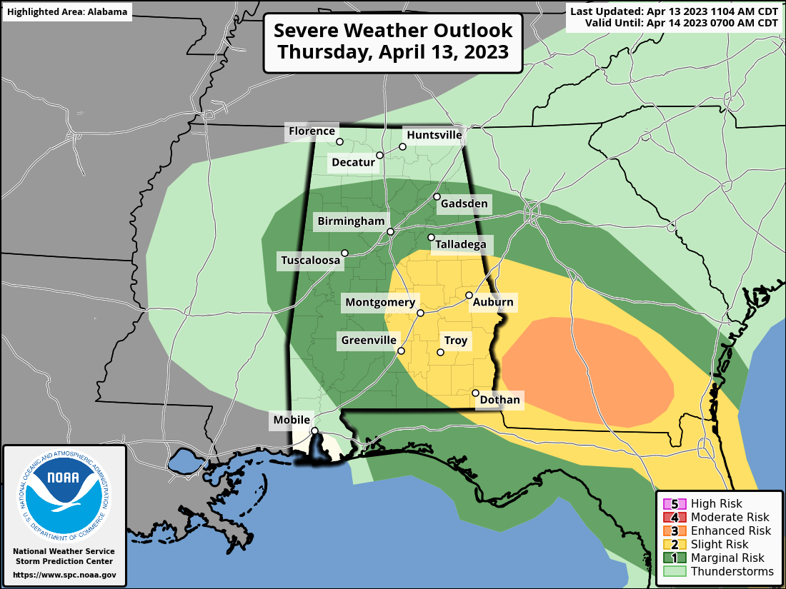
A brief, isolated tornado can’t be totally ruled out through the evening hours, but isn’t likely. The higher tornado probabilities are over South Georgia, where an “enhanced risk” (level 3/5) is up. Storms will weaken after sunset, and we expect only isolated showers tonight.
We should also mention a wind advisory is in effect for much of Alabama through the evening hours; gradient winds (not related to thunderstorms) could gust to 40 mph in spots.
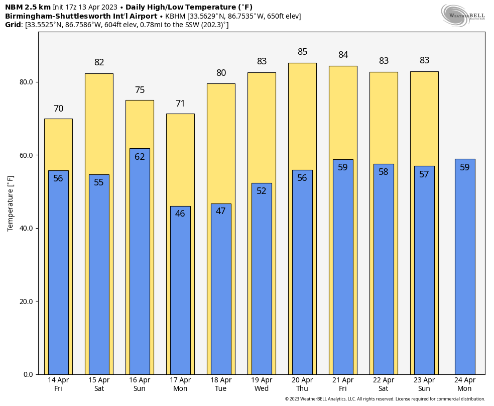
TOMORROW AND THE WEEKEND: We will maintain the chance of scattered showers tomorrow, but much of the day will be dry. The sky will remain mostly cloudy with highs generally in the upper 60s and low 70s. Then, Saturday looks to be a warm, dry day for much of the state with a high in the low 80s. The exception is the southwest corner of the state, where rain is possible across Mobile and Baldwin counties.
A cold front will bring showers statewide after midnight Saturday night into Sunday. A few strong storms are possible initially over the northwest corner of the state, but they should be weakening and for now severe storms are not expected. The main window for rain with this feature will come from about 3:00 a.m to 3:00 p.m. Sunday. Highs will remain in the 67-74 degree range.
NEXT WEEK: New global model data showers rain-free weather for the state pretty much all of next week with sunny days and fair nights. Highs will be I the 70s Monday and Tuesday, followed by low to mid 80s over the latter half of the week. See the video briefing for maps, graphics, and more details.
ON THIS DATE IN 1999: A two-mile-wide area of wind-driven hail pounded residences and farm equipment for about a 5 mile stretch at least as far as State Highway 158 in west Texas near Midland/Odessa. Hail grew up to about golf ball size and winds peaked at approximately 80 mph. The wind-driven hail broke windows in houses and blasted paint off the wooden siding.
ON THIS DATE IN 2006: An F2 tornado hit Iowa City, Iowa and trekked across other Southeast parts of the University of Iowa campus doing 15+ million dollars damage hurting 30 people and damaging or destroying 1051 buildings.
BEACH FORECAST: Click here to see the AlabamaWx Beach Forecast Center page.
Look for the next video briefing here by 6:00 a.m. tomorrow…
Category: Alabama's Weather, ALL POSTS, Weather Xtreme Videos
About the Author (Author Profile)
James Spann is one of the most recognized and trusted television meteorologists in the industry. He holds the AMS CCM designation and television seals from the AMS and NWA. He is a past winner of the Broadcast Meteorologist of the Year from both professional organizations.Subscribe
If you enjoyed this article, subscribe to receive more just like it.


