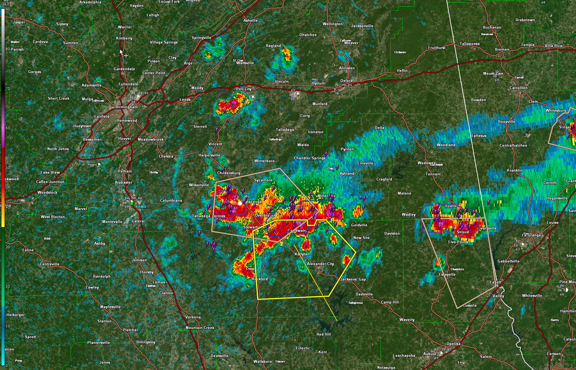
Severe Thunderstorm Warning for Parts of Coosa and Tallapoosa Counties Until 3 p.m.
The storms over East Alabama are feasting on good instability and have really blossomed. The strongest storms are near Goodwater now and will move to near Rockford, Kellyton, and Alexander City over the next 30 minutes.
Lots of lightning, torrential rain, hail to 1.25 inches in diameter, and wind gusts to 60 mph are expected.
The National Weather Service in Birmingham has issued a
* Severe Thunderstorm Warning for…
Northwestern Tallapoosa County in east central Alabama…
Eastern Coosa County in east central Alabama…
* Until 300 PM CDT.
* At 220 PM CDT, a severe thunderstorm was located over Hatchet, or
over Goodwater, moving southeast at 35 mph.
HAZARD…60 mph wind gusts and quarter size hail.
SOURCE…Radar indicated.
IMPACT…Hail damage to vehicles is expected. Expect wind damage
to roofs, siding, and trees.
* Locations impacted include…
Alexander City, Goodwater, Rockford, Kellyton, Hillabee Creek,
Hanover, Bradford, Cottage Grove, Northern Lake Martin, Highway 9
and Highway 22, Parkdale, Hatchet, Nixburg, Crewsville, Wind Creek
State Park, Western Lake Martin, Fishpond, Ray, Hackneyville and
Hissop.
Category: ALL POSTS
About the Author (Author Profile)
Bill Murray is the President of The Weather Factory. He is the site's official weather historian and a weekend forecaster. He also anchors the site's severe weather coverage. Bill Murray is the proud holder of National Weather Association Digital Seal #0001 @wxhistorianSubscribe
If you enjoyed this article, subscribe to receive more just like it.


