Warm, Humid Weather Continues With Scattered Storms
RADAR CHECK: Scattered strong to severe thunderstorms continue across parts of East-Central Alabama this afternoon. The storms are dropping southward, and heavier ones are producing strong gusty winds and some hail. A few counties have been placed under severe thunderstorm warnings. The rest of the state is warm and dry with a partly sunny sky…. away from showers temperatures are in the mid to upper 80s.
Scattered storms will fade this evening, and tonight will be mostly fair with a low in the 60s.
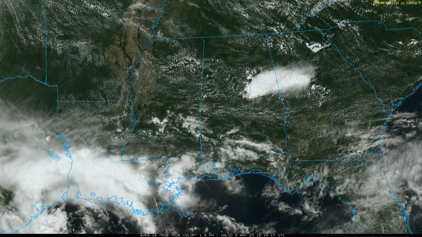
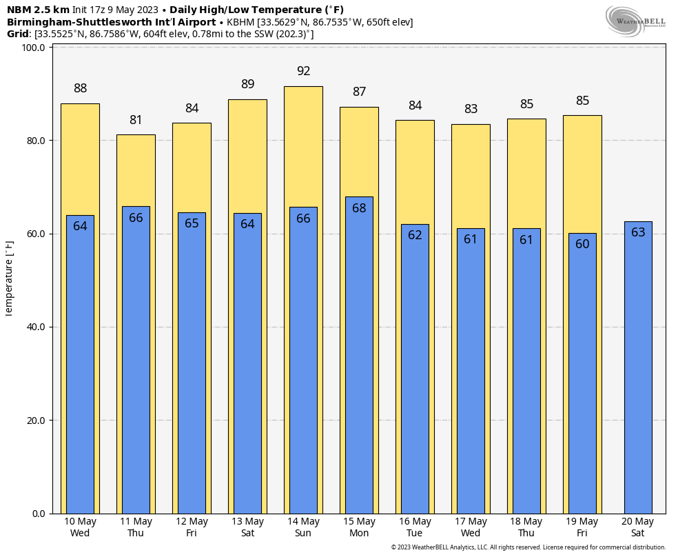
REST OF THE WEEK: Warm, humid weather continues with the daily chance of scattered showers and thunderstorms, mostly during the afternoon and evening hours. The chance of any one spot seeing rain is around 40 percent tomorrow, and 50 to 60 percent Thursday and Friday, when moisture will be deeper and the air will be more unstable. Highs will remain in the 80s.
THE ALABAMA WEEKEND: As the upper ridge strengthens, heat levels will creep up with afternoon highs around 90. Otherwise expect a mix of sun and clouds both days with just a small risk of a shower for any one given location. It should be the hottest weekend so far in 2023.
NEXT WEEK: Quite frankly we aren’t seeing much change, at least through the first part of the week. Warm, humid days continue with a few scattered showers and storms around. Some evidence humidity levels could drop during the latter half of the week as an upper trough forms over the eastern third of the U.S. See the video briefing for maps, graphics, and more details.
RAIN UPDATE: Here are rain totals so far this year, and the departure from average….
Tuscaloosa 22.48″ (+1.31″)
Mobile 22.47″ (-0.15″)
Birmingham 23.46″ (+1.46″)
Anniston 22.31″ (+1.44″)
Muscle Shoals 20.08″ (-0.58″)
Huntsville 19.65″ (-2.04″)
Dothan 19.21″ (-0.60″)
Montgomery 18.77″ (-0.90″)
ON THIS DATE IN 1933: An estimated F4 tornado moved through Monroe, Cumberland, and Russell Counties in Kentucky along a 60-mile path. The town of Tompkinsville, KY was the hardest hit with 18 people killed. Overall, 36 people lost their lives.
ON THIS DATE IN 1995: An F3 tornado produced $10 million in damages along its 40-mile path across central Illinois. The tornado caused significant damage in Cantrall where three homes were destroyed, 10 had significant damage, and 11 had minor damage. The roof and interior of a grade school suffered extensive damage. The tornado passed about 2 miles southeast of the new NWS Office in Lincoln, Illinois.
Look for the next video briefing here by 6:00 a.m. tomorrow…
Category: Alabama's Weather, ALL POSTS, Weather Xtreme Videos
About the Author (Author Profile)
James Spann is one of the most recognized and trusted television meteorologists in the industry. He holds the AMS CCM designation and television seals from the AMS and NWA. He is a past winner of the Broadcast Meteorologist of the Year from both professional organizations.Subscribe
If you enjoyed this article, subscribe to receive more just like it.


