Showers Across Alabama More Widely Scattered Today
RADAR CHECK: We have a few small spotty showers on radar early this morning across Southwest Alabama, but most of the state is dry with temperatures in the 60s. We expect some sun at times later today, and showers and storms that form this afternoon should be more widely scattered than recent days. The chance of any one place seeing rain today is 20-30 percent, and the high will be in the 78-82 degree range.
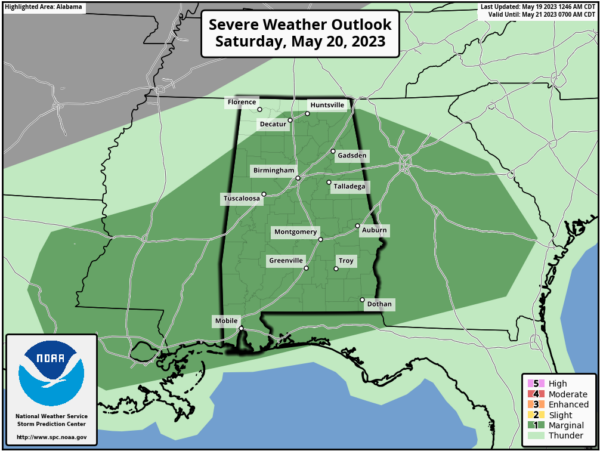
THE ALABAMA WEEKEND: An approaching front will bring scattered to numerous showers and thunderstorms to the Deep South tomorrow. Understand it won’t rain all day, and it won’t rain necessarily everywhere. But, a few passing showers and storms are likely during the day, and SPC maintains a “marginal risk” (level 1/5) of severe thunderstorms for most of Alabama.
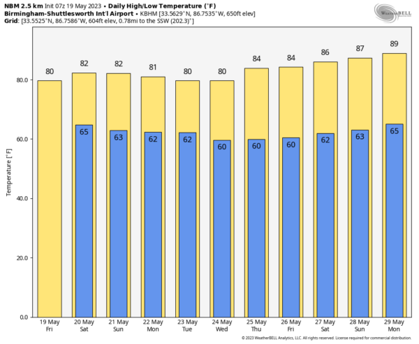
Heavier storms tomorrow will be capable of producing hail, strong winds, and lots of lightning. Most of the stronger storms will come from 2:00 until 9:00 p.m. Otherwise, tomorrow will be mostly cloudy with a high close to 80 degrees.
Then, on Sunday, drier air will creep into the northern and western counties of the state with slightly lower humidity. Showers will remain possible over East and South Alabama, however, south of the front. Sunday’s high will be in the low 80s.
NEXT WEEK: The front dissipates and moisture surges northward Monday, so scattered showers and storms are possible statewide. And, we will need to mention scattered showers and storms on a daily basis through the week, most active during the afternoon and evening hours. Daytime temperatures will likely remain below average with highs in the upper 70s and low 80s… See the video briefing for maps, graphics, and more details.
YESTERDAY’S SOAKERS: Flash flood warnings were issued for a number of pockets across Alabama yesterday, including Etowah County where radar estimated almost four inches of rain for Gadsden and Rainbow City in only about 90 minutes. The slow moving severe storms were also accompanied by hail and strong winds.
ON THIS DATE IN 1915: A spring storm came to an end after producing widespread snow. Total snowfall from the storm included: 17.6 inches in Scottsbluff, Nebraska, 8 inches at Cheyenne, Wyoming, 7 inches at Chadron and 3.9 inches in North Platte, Nebraska.
ON THIS DATE IN 1973: An F2 tornado chewed its way across the northern part of Fort Payne on Saturday evening, May 19, 1973; a total of 35 people were injured in the storm. Other tornadoes touched down the same day in parts of Madison and Jackson counties.
Look for the next video briefing here by 3:00 this afternoon… enjoy the day!
Category: Alabama's Weather, ALL POSTS, Weather Xtreme Videos


