Midday Nowcast: Plenty of Sunshine and Humidity
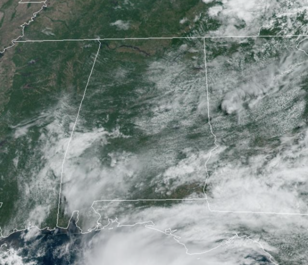
WELCOME TO JUNE: Pretty routine weather for early June in Alabama with a partly to mostly sunny sky, and highs in the mid to upper 80s and moisture levels have increased, making it more humid. During the afternoon and evening hours, expect those random, showers and storms. The chance of any one spot seeing rain will be in the the 10-20% range. Little change in the forecast for the weekend, but it will be a bit hotter as more and more locations will start seeing afternoon highs in the 90s.
ACROSS THE USA: Scattered showers and thunderstorms with the potential for isolated flash flooding and severe weather continue from the Intermountain West through the Plains into the weekend. This threat also extends into Florida as we are monitoring a disturbance in the Gulf of Mexico. Also, new record high temperatures are forecast for the Upper Midwest, Great Lakes and Northeast into the weekend.
INTO NEXT WEEK: The weather pattern persist into of next week as well, with no signs of a big ticket weather item showing up impacting Alabama the next seven to ten days. Expect hot and humid weather, highs in the upper 80s to lower 90s, and random, daily showers and storms on the radar during the afternoon and evening hours. We want to remind everyone, summertime storms can be strong…big heat, big storms, and can produce gusty winds, torrential rainfall, and the most dangerous, frequent lightning. Lightning deaths peak in the summertime, if you can hear thunder, you can be struck by lightning…always remember, WHEN THUNDER ROARS, HEAD INDOORS!!!
TROPICAL UPDATE: Hurricane season officially begins today, lasting though November 30th. Here is the list of names for this year: Arlene, Bret, Cindy, Don, Emily, Franklin, Gert, Harold, Idalia, Jose, Katia, Lee, Margot, Nigel, Ophelia, Philippe, Rina, Sean, Tammy, Vince, and Whitney.
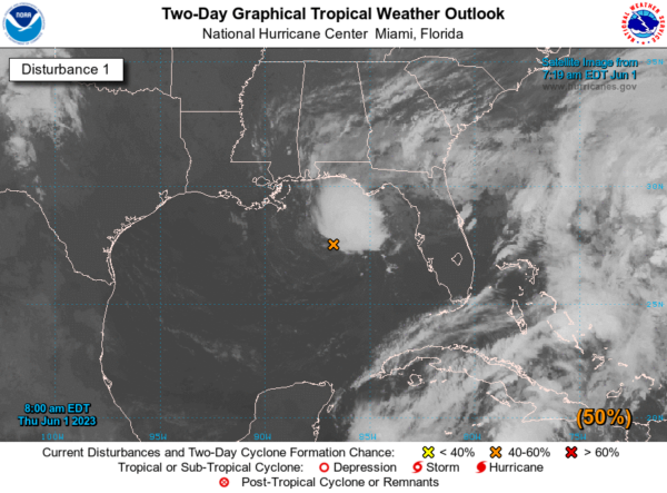
Showers and thunderstorms associated with an area of low pressure over the northeastern Gulf of Mexico have increased and become better organized during the overnight hours. Environmental conditions appear marginally favorable for additional development over the next day or so, and a short-lived tropical depression or storm could form over that time span as the system meanders over the northeastern Gulf of Mexico. However, by this weekend environmental conditions are forecast to become unfavorable for additional development as the system drifts southward, likely remaining offshore over the Gulf of Mexico. An Air Force Reserve Hurricane Hunter aircraft is scheduled to investigate the system later today, if necessary. Regardless of development, locally heavy rainfall could occur over portions of the Florida Peninsula through this weekend. Additional information on the rainfall and flooding potential can be found in products issued by your local National Weather Service forecast office and Excessive Rainfall Outlooks issued by the Weather Prediction Center. Formation chance through 48 hours…medium…50 percent. Formation chance through 7 days…medium…50 percent.
BEACH FORECAST CENTER: Get the latest weather and rip current forecasts for the beaches from Fort Morgan to Panama City on our Beach Forecast Center page. There, you can select the forecast of the region that you are interested in visiting.
WORLD TEMPERATURE EXTREMES: Over the last 24 hours, the highest observation outside the U.S. was 115.7F at Bilma, Niger. The lowest observation was -104.6F Vostok, Antarctica.
CONTIGUOUS TEMPERATURE EXTREMES: Over the last 24 hours, the highest observation was 103F at Rio Grande Village, TX. The lowest observation was 23F at Sand Creek Station, OR.
Category: Alabama's Weather, ALL POSTS
About the Author (Author Profile)
Macon, Georgia Television Chief Meteorologist, Birmingham native, and long time Contributor on AlabamaWX. Stormchaser. I did not choose Weather, it chose Me. College Football Fanatic. @Ryan_StinnetSubscribe
If you enjoyed this article, subscribe to receive more just like it.


