Alabama’s Weather Pattern Stays Quiet; Watching The Gulf
RADAR CHECK: As expected, most of Alabama is dry this afternoon with only small, isolated showers moving westward. Temperatures are mostly in the mid 80s, very close to seasonal averages for the first day of meteorological summer. The isolated showers will end after sunset, and tonight will be mostly fair with a low in the 60s.
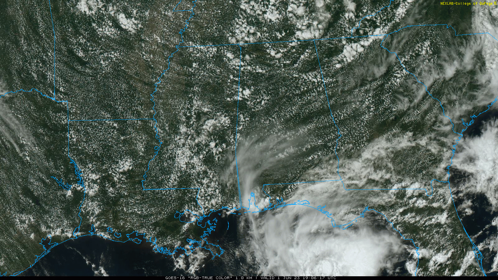
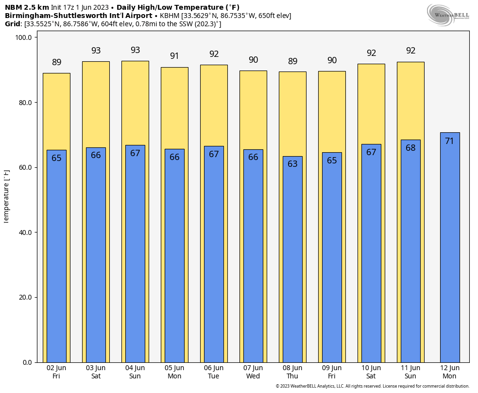
TOMORROW THROUGH THE WEEKEND: Alabama’s weather will remain calm through the weekend. We expect partly sunny days, fair nights, and only isolated afternoon and evening showers. Chance of any one spot seeing a brief shower each day is only 10-20 percent generally between 2:00 and 9:00 p.m. The high tomorrow will be in the mid to upper 80s, by the weekend highs will be near 90 degrees.
NEXT WEEK: The weather just won’t change much. Only isolated showers through the week with highs not too far from 90 degrees. There is no sign of any high impact or major rain event for Alabama for the next 7-10 days… See the video briefing for maps, graphics, and more details.
TROPICS: Recent satellite wind data, along with buoy and ship observations indicate the area of low pressure over the northeastern Gulf of Mexico (Invest 91L) has a broad but well-defined circulation with maximum sustained winds of about 35 mph. Shower and thunderstorm activity associated with the low is also showing signs of organization. Environmental conditions remain marginally favorable for additional development, and if these trends continue, a short-lived tropical depression or storm is likely to form as soon as early as this evening. The system is likely to meander over the northeastern Gulf of Mexico through tonight but begin a slow southward motion tomorrow. By this weekend, environmental conditions are forecast to become unfavorable for additional development as the system continues moving southward, likely remaining offshore over the Gulf of Mexico. An Air Force Reserve Hurricane Hunter aircraft is in the area as I write this. NHC gives the system now a 70 percent chance of becoming a brief depression or storm.
Regardless of development, locally heavy rainfall could occur over portions of the Florida Peninsula through this weekend.
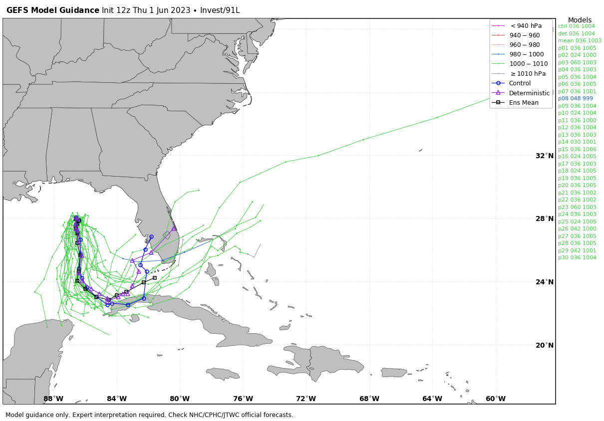
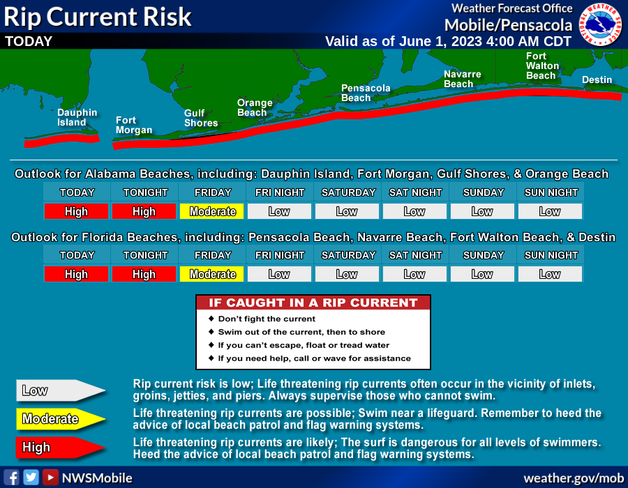
In terms of weather, the main impact will be increased shower coverage across the Florida Peninsula (not the panhandle) through the weekend. For the Central Gulf Coast (Gulf Shores to Panama City Beach), we expect only a few scattered showers through tomorrow, but the rip current risk will be high tonight and moderate tomorrow… then improving to just a low risk over the weekend.
ON THIS DATE IN 1903: During the early afternoon, one of the most destructive tornadoes in the history of Georgia up to this time, struck the outskirts of Gainesville. The track of the storm was about four miles in length and varied between 100 to 200 feet in width. The tornado touched down about one mile southwest of Gainesville, striking a large cotton mill at 12:45 pm, Eastern Time, just 10 minutes after 750 employees filed into the great structure from dinner. On the top floor of the mill were employed 250 children, and it was here that the greatest loss of life occurred.
ON THIS DATE IN 1934: June started off on a warm note as high temperatures surpassed the century mark across parts of the Midwest. Several locations tied or set a record high temperatures for June including: Rockford, IL: 106°, Mather, WI: 105°, Hatfield, WI: 103°, Mondovi, WI: 102°, Chicago, IL: 102° and Grand Rapids, MI tied their June record high with 102°.
Look for the next video briefing here by 6:00 a.m. tomorrow…
Category: Alabama's Weather, ALL POSTS, Weather Xtreme Videos
About the Author (Author Profile)
James Spann is one of the most recognized and trusted television meteorologists in the industry. He holds the AMS CCM designation and television seals from the AMS and NWA. He is a past winner of the Broadcast Meteorologist of the Year from both professional organizations.Subscribe
If you enjoyed this article, subscribe to receive more just like it.


