Sun And Scattered Storms This Afternoon
RADAR CHECK: As expected, we have random, scattered showers and storms on radar this afternoon mainly over the western half of the state. Storms that have formed are moving slowly to the west/southwest, and the heavier ones are capable of producing small hail and gusty winds. Elsewhere, the sky is partly to mostly sunny with temperatures in the 86-90 degree range. Storms will fade quickly after sunset, and tonight will be mostly fair with a low in the 60s.
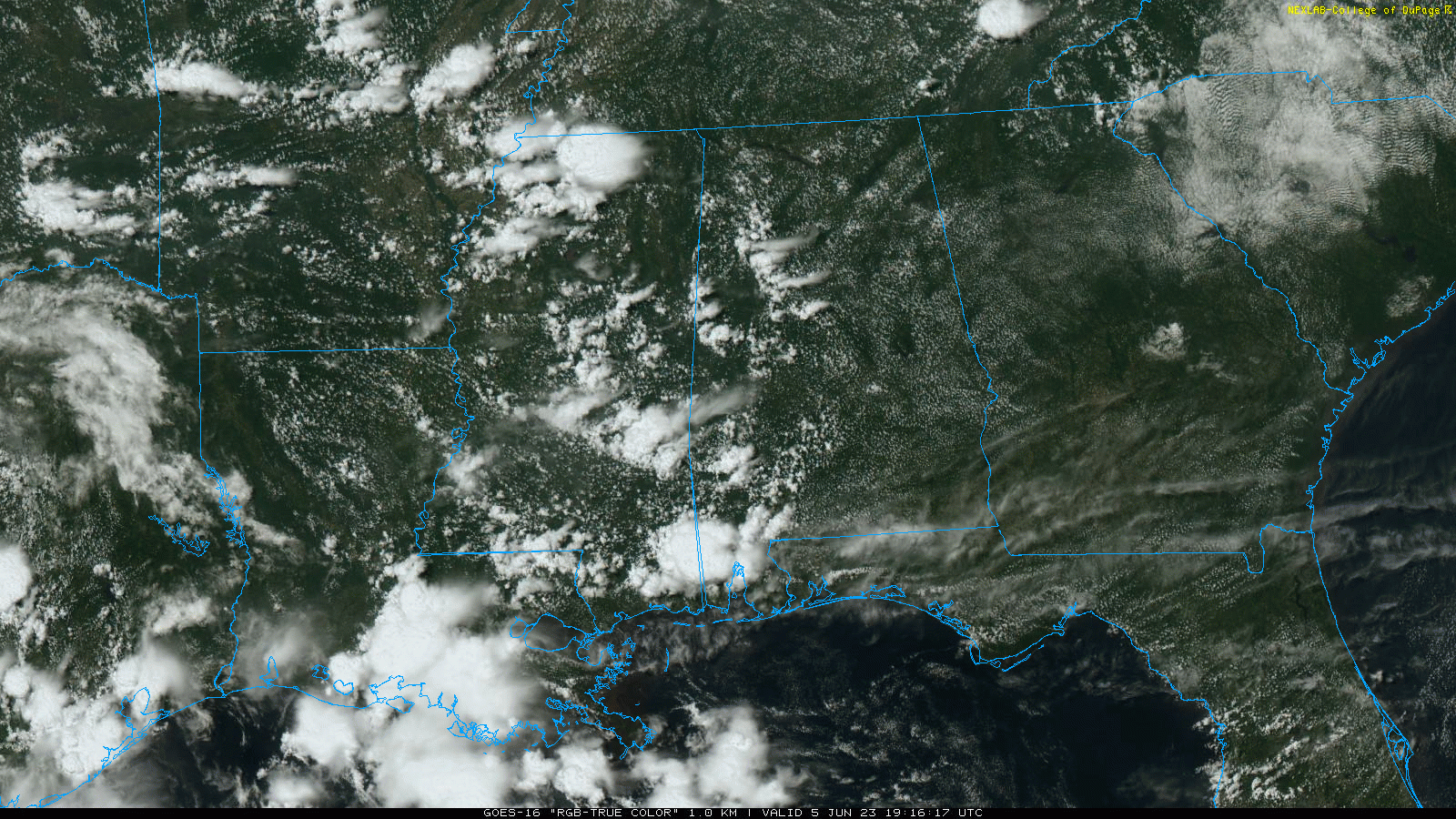
Alabama’s weather won’t change much through Thursday, with partly sunny days and “scattered, mostly afternoon and evening showers and thunderstorms”. Many places won’t see a drop, but some communities will experience a heavy storm with potential for small hail and strong gusty winds. The chance of any one specific location seeing a shower or thunderstorm each afternoon through Thursday is 20-30 percent, and most of the activity will come from 2:00 until 9:00 p.m.
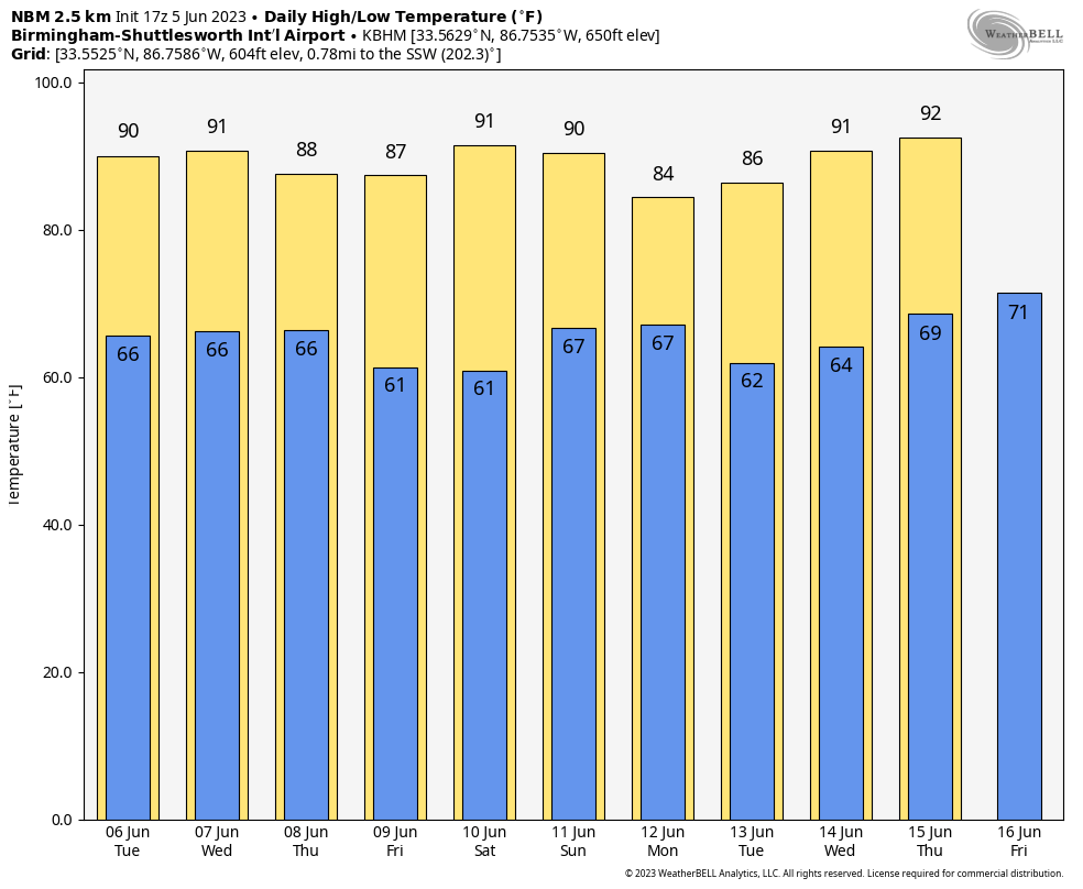
FRIDAY AND THE WEEKEND: Drier air will drop into the state Friday and Saturday; on these two days we expect a mostly sunny sky with few, if any showers around. Nights will be a bit cooler… some spots could reach the 50s early Friday and Saturday morning. Then, moisture levels rise on Sunday, and we will bring back the chance of scattered showers and thunderstorms with a mix of sun and clouds. Highs will remain in the upper 80s and low 90s.
NEXT WEEK: For now we see no real reason to deviate from the usual summer forecast through the week. Partly sunny days with the chance of a passing afternoon thunderstorm in scattered spots. Highs will be close to 90 degrees through the week. See the video briefing for maps, graphics, and more details.
TROPICS: Disorganized showers and thunderstorms and gale-force winds over the northeastern Atlantic Ocean between the Azores and Canary Islands are associated with a complex non-tropical area of low pressure. This system could acquire some subtropical characteristics during the next couple of days while it moves little. By late in the week, however, the system is expected to move northeastward over cooler waters ending its chances of subtropical development.
No tropical systems are expected close to the U.S. over the next seven days.
ON THIS DATE IN 1976: Warnings were frantic that Idaho’s new Teton Dam was about to break. As workers tried to shore up the crumbling dam, it crumbled shortly after 11 AM, sending 180 billion gallons of water pouring through Teton Canyon. 11 people lost their lives, but the toll would have been much higher if the dam had failed at night and residents had been asleep.
Look for the next video update here by 6:00 a.m. tomorrow…
Category: Alabama's Weather, ALL POSTS, Weather Xtreme Videos
About the Author (Author Profile)
James Spann is one of the most recognized and trusted television meteorologists in the industry. He holds the AMS CCM designation and television seals from the AMS and NWA. He is a past winner of the Broadcast Meteorologist of the Year from both professional organizations.Subscribe
If you enjoyed this article, subscribe to receive more just like it.


