Midday Nowcast: Hot and Getting Hotter
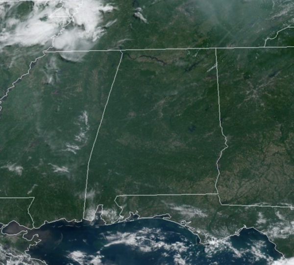
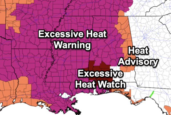
Mainly sunny and hot today with highs ranging from the low to upper 90s across Alabama today. Tomorrow and Friday the heat continues to build with upper 90s expected tomorrow, followed by upper 90s and low 100s Friday. Humidity levels are on the rise and by tomorrow, with hot temperatures and high humidity, heat index values will easily rise into the 105°-110° range and could rise closer to 115° in some spots Friday. Most of Alabama is now included in an “excessive heat warning” these days, while the rest of the state is included in a “heat advisory.”
Along with the heat issue, a Code Orange Air Quality Alert is in effect for Jefferson and Shelby Counties. Under Code Orange conditions, ground level ozone concentrations are expected to reach levels that are unhealthy for sensitive groups.Children and people with asthma are individuals most at risk under these expected conditions.
A few isolated pop-up afternoon storms remain possible daily, but most of Alabama will remain dry. However, where any storms develop, they will produce heavy downpours, and tremendous amounts of lightning and thunder..BIG HEAT, BIG STORMS. Also, around the edge of the ridge, we are watching complexes of storms, “the ring of fire.” These storms will be strong and some model data suggest some of the MCSs could impact portions of Alabama over the next several days. We will keep an eye on this possibility.
FOURTH OF JULY WEEKEND: We expect highs in the mid 90s Saturday and Sunday, followed by low 90s Monday and Tuesday. With higher moisture content, there will be a better chance for some afternoon showers and storms, but still, most locations will remain dry. Chance of any one location seeing a storm each day will be in 30-40% range. This is pretty typical Independence Day forecast across North/Central Alabama.
REST OF NEXT WEEK: Higher rain chances and lower heat levels as highs will be closer to 90° Wednesday through Friday. Scattered showers and thunderstorms becoming more numerous as the ridge continues to weaken.
IN THE TROPICS: An area of unsettled weather, associated with a surface trough, has formed about 400 miles south-southeast of Bermuda. Upper-level winds are marginally conducive for some slow development of this system during the next few days while it moves generally northward at about 5 mph. Formation chance through 7 days…low…20 percent.
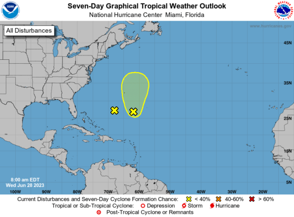
Also, a weak trough of low pressure, associated with the remnants of Cindy and located about 400 miles south-southwest of Bermuda, is producing disorganized shower activity. This system is expected to drift toward the west-northwest during the next couple of days, and redevelopment is not expected due to strong upper-level winds. Formation chance through 7 days…low…near 0 percent.
BEACH FORECAST CENTER: Get the latest weather and rip current forecasts for the beaches from Fort Morgan to Panama City on our Beach Forecast Center page. There, you can select the forecast of the region that you are interested in visiting.
WORLD TEMPERATURE EXTREMES: Over the last 24 hours, the highest observation outside the U.S. was 120.2F at Bahawalnagar, Pakistan. The lowest observation was -102.1F Concordia, Antarctica.
CONTIGUOUS TEMPERATURE EXTREMES: Over the last 24 hours, the highest observation was 115F at Rio Grande Village, TX. The lowest observation was 26F at Foxpark, WY.
Category: Alabama's Weather, ALL POSTS
About the Author (Author Profile)
Macon, Georgia Television Chief Meteorologist, Birmingham native, and long time Contributor on AlabamaWX. Stormchaser. I did not choose Weather, it chose Me. College Football Fanatic. @Ryan_StinnetSubscribe
If you enjoyed this article, subscribe to receive more just like it.


