

Strong Storms Over Far North Alabama; Heat Levels Rising
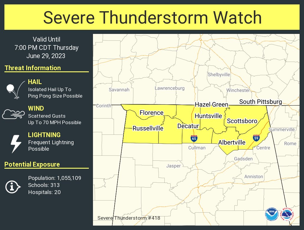
RADAR CHECK: An MCS (Mesoscale Convective System) is moving into extreme North Alabama as I write this discussion at 3p CT, and a severe thunderstorm watch has been issued for the Tennessee Valley until 7p CT. The main threat will come from strong winds, and there is a chance the upper ridge will win the battle and the storms will fizzle out quickly as they move southward below the Tennessee River. But some risk of strong storms will persist through the evening over the northern third of the state.
Otherwise, the weather is hot and hazy with temperatures generally in the low to mid 90s this afternoon; heat indices are over 100 in many places.
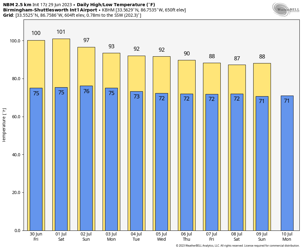
Heat levels remain elevated through the weekend. Expect a high in the 97-101 degree range tomorrow. Factor in the high humidity, and the heat index will peak at 105-110 over the western 2/3 of the state, where an “excessive heat warning” is in effect. There is a “heat advisory” for East Alabama, where the heat index will rise into the 100-105 degree range.
FOURTH OF JULY WEEKEND: The ridge slowly weakens, but the weather remains hot Saturday and Sunday with highs in the 94-98 degree range. The heat backs down Monday and Tuesday with a high close to 90 degrees. Each day we will mention the chance of a few random, scattered afternoon and evening showers and thunderstorms… odds of any one spot getting wet each day are around 30 percent. Most of the storms will come from 2:00 until 9:00 p.m.
REST OF THE WEEK: Showers and storms will increase in coverage over the latter half of the week as moisture levels rise and the air becomes more unstable; highs drop into the upper 80s, which is below average for early July in Alabama. See the video briefing for maps, graphics, and more details.
TROPICS: A surface trough continues to produce disorganized showers and thunderstorms a few hundred miles to the south-southeast of Bermuda. Upper-level winds do not appear conducive for development of this system during the next couple of days while it moves generally northward at 5 to 10 mph. The chance of development is only 10 percent.
The rest of the Atlantic basin, including the Gulf of Mexico, is very quiet and tropical storm formation is not expected through early next week.
ON THIS DATE IN 1998: “The Corn Belt Derecho of 1998” in the following states: NE, IA, IL, IN, KY. A derecho which originated in far southeast South Dakota moved across Illinois during the afternoon and evening and continued as far east as Ohio the next morning. Every county in central Illinois sustained some damage, as these severe thunderstorms passed. Winds gusted in the 60 to 80 mph range, with some localized microbursts producing winds more than 100 mph. Significant damage occurred in the microburst areas, including the towns of Morton, McLean, LeRoy, and Tolono.
Look for the next video update here by 6:00 a.m. tomorrow…
Category: Alabama's Weather, ALL POSTS, Weather Xtreme Videos
About the Author (Author Profile)
James Spann is one of the most recognized and trusted television meteorologists in the industry. He holds the AMS CCM designation and television seals from the AMS and NWA. He is a past winner of the Broadcast Meteorologist of the Year from both professional organizations.Subscribe
If you enjoyed this article, subscribe to receive more just like it.


