The Heat Is On; Isolated Strong Storms
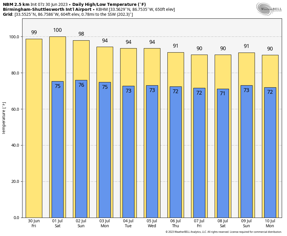
HOT: Temperatures will remain about 7-10 degrees above average across Alabama today… most places will experience a high in the 96-100 degree range this afternoon with hazy sun. Because of the high humidity, the heat index will top out between 104 and 110 this afternoon, and much of the state is under either an “excessive heat warning” or a “heat advisory”.
Like yesterday, a few isolated storms could form this afternoon and early tonight, and there they do form they will be rather intense with potential for hail and strong winds. SPC has defined a “slight risk” (level 2/5) of severe thunderstorms for parts of the Tennessee Valley, along with a “marginal risk” (level 1/5) down to Demopolis, Troy, and Eufaula.
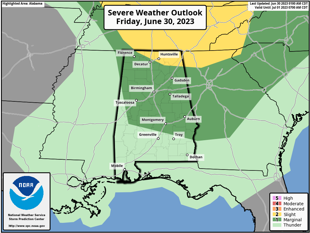
The chance of any one spot seeing a storm later today is 15-25 percent.
FOURTH OF JULY WEEKEND: The weather stays hot as a firecracker tomorrow and Sunday with highs in the mid to upper 90s; afternoon and evening thunderstorms remain possible in a few spots. And like today the storms could be heavy with potential for hail and strong gusty winds… odds of any one neighborhood seeing rain both days are around 30 percent, and most of the storms will come between 2:00 and 9:00 p.m.
Not much change on Monday and Tuesday, although heat levels will be falling with highs back in the low 90s.
REST OF THE WEEK: We expect an increase in the number of scattered showers and thunderstorms over the latter half of the week as the heat ridge continues to weaken, and the air becomes more unstable. Highs Wednesday through Friday will be in the 88-91 degree range for most places… See the video briefing for maps, graphics, and more details.
ON THIS DATE IN 1912: An estimated F4 tornado ripped through Regina, Saskatchewan, Canada on this day. The storm became the deadliest tornado in Canada’s history as it killed 28 people along a rare, 18.5-mile track from south to north.
ON THIS DATE IN 2010: Hurricane Alex made its final landfall along the northern Mexican coast around 110 miles south of Brownsville, Texas as a Category 2 storm with maximum sustained winds of 105 mph. Alex was the first Hurricane in June for the Altantic Basin since 1995, and the strongest in the month of June since Hurricane Alma in 1966.
Look for the next video briefing here by 3:00 this afternoon… enjoy the day!
Category: Alabama's Weather, ALL POSTS, Weather Xtreme Videos
About the Author (Author Profile)
James Spann is one of the most recognized and trusted television meteorologists in the industry. He holds the AMS CCM designation and television seals from the AMS and NWA. He is a past winner of the Broadcast Meteorologist of the Year from both professional organizations.Subscribe
If you enjoyed this article, subscribe to receive more just like it.


