Severe Thunderstorm Warning for Parts of Cherokee County Until 1 pm
Strong storms along the Alabama – Georgia border are capable of producing damaging wind gusts…
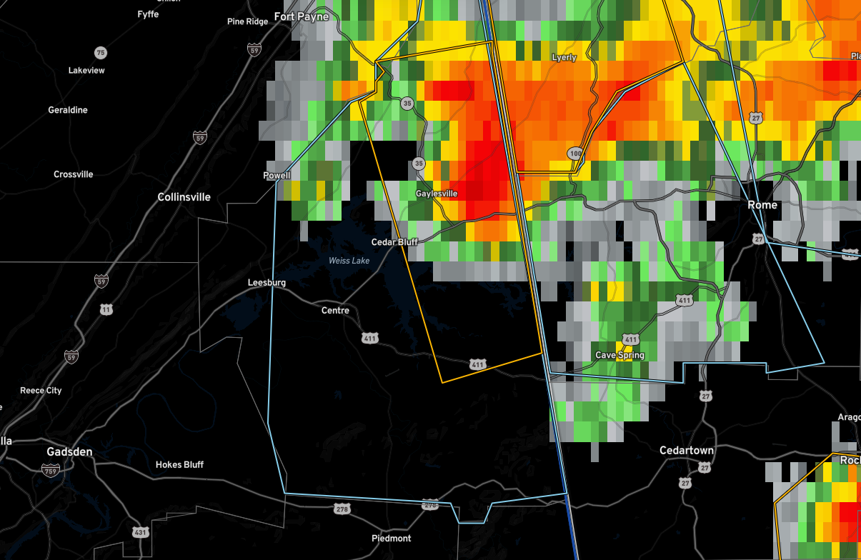
The warning is outlined in yellow…the light blue is a significant weather advisory…
The National Weather Service in Birmingham has issued a
* Severe Thunderstorm Warning for…
Northeastern Cherokee County in northeastern Alabama…
* Until 100 PM CDT.
* At 1213 PM CDT, a severe thunderstorm was located near Gaylesville,
or near Cedar Bluff, moving southeast at 15 mph.
HAZARD…60 mph wind gusts and quarter size hail.
SOURCE…Radar indicated.
IMPACT…Hail damage to vehicles is expected. Expect wind damage
to roofs, siding, and trees.
* Locations impacted include…
Cedar Bluff, Little River Canyon National Preserve, Gaylesville,
Cornwall Furnace Park, Blanche, Eastern Weiss Lake, Little River
Falls, Fullerton, New Moon, Broomtown, Howells Crossroads,
Waterhouse and Little River Canyon NP.
Category: Alabama's Weather, ALL POSTS, Severe Weather
About the Author (Author Profile)
Bill Murray is the President of The Weather Factory. He is the site's official weather historian and a weekend forecaster. He also anchors the site's severe weather coverage. Bill Murray is the proud holder of National Weather Association Digital Seal #0001 @wxhistorianSubscribe
If you enjoyed this article, subscribe to receive more just like it.


