Severe Thunderstorm Warning for Eastern Alabama Counties
The most dangerous storm is approaching Valley along I-85 and it will eventually move down toward Smiths Station. Damaging winds are the biggest threat. Hail is also possible.
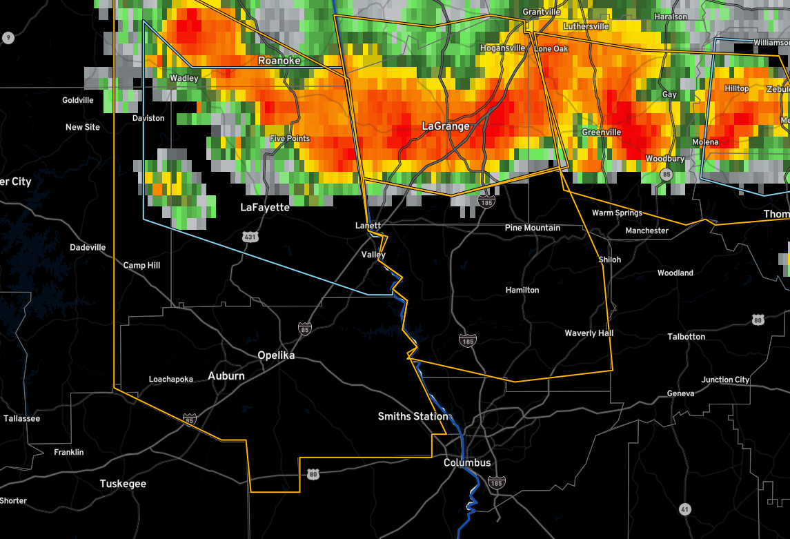
The National Weather Service in Birmingham has issued a
* Severe Thunderstorm Warning for…
Lee County in east central Alabama…
Southern Randolph County in east central Alabama…
Eastern Tallapoosa County in east central Alabama…
Chambers County in east central Alabama…
Southeastern Clay County in east central Alabama…
* Until 330 PM CDT.
* At 232 PM CDT, severe thunderstorms were located along a line
extending from near Goldville to near Buffalo to near Lakeview,
moving south at 40 mph.
HAZARD…60 mph wind gusts and quarter size hail.
SOURCE…Radar indicated.
IMPACT…Hail damage to vehicles is expected. Expect wind damage
to roofs, siding, and trees.
* Locations impacted include…
Auburn, Opelika, Valley, Lanett, Roanoke, Camp Hill, Notasulga,
Smiths, Stroud, Lake Wedowee, Lafayette, Smiths Station, La
Fayette, Wadley, Waverly, Lakeview, Five Points, Cusseta, Beulah
and Beauregard.
Category: Alabama's Weather, ALL POSTS, Severe Weather
About the Author (Author Profile)
Bill Murray is the President of The Weather Factory. He is the site's official weather historian and a weekend forecaster. He also anchors the site's severe weather coverage. Bill Murray is the proud holder of National Weather Association Digital Seal #0001 @wxhistorianSubscribe
If you enjoyed this article, subscribe to receive more just like it.


