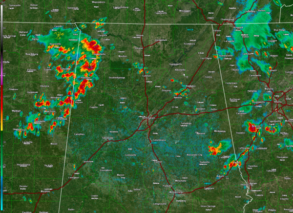
Thunderstorm Complex Moving East Southeast into Northwest Alabama
An interesting feature is moving across Northwest and West Central Alabama at this hour. It appears to be a vorticity maximum or mesoscale convective system, or just a complex of storms, moving east southeast.
The system definitely has some spin associated with it, as evidenced on regional radars and satellite imagery.
The storms now extend in an arc from Russellville in Franklin County to Hamilton in Marion County to northwest of Vernon in Lamar County.
Significant weather advisories are in effect in Colbert and Lauderdale and parts of Lamar County.
Gusty winds to 40 mph, brief torrential rains, and deadly lightning will accompany the storms.
It will affect areas from Huntsville/Decatur down to Birmingham and Tuscaloosa over the next few hours.
Storms that developed over Northeast Alabama have mostly moved into western Georgia, but the southern extent is still trailing through Tallapoosa and Chambers counties.
In between the eastern and western storms, there are some developing storms near Gadsden and over southern Morgan and northwestern Cullman County.
There are a few showers developing over southern Walker and northwestern Jefferson County.
Category: Alabama's Weather, ALL POSTS, Severe Weather


