Sun, Heat, Storms Through The Weekend
RADAR CHECK: Scattered showers and storms continue to develop across Alabama on this summer afternoon… they are most numerous over the western and southern counties. Away from the showers temperatures are in the 88-92 degree range, not too far from average values for mid-July. Showers will fade this evening, and tonight will be mostly fair with a low in the 70s.
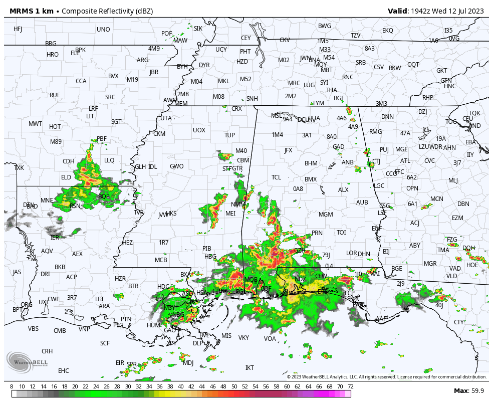
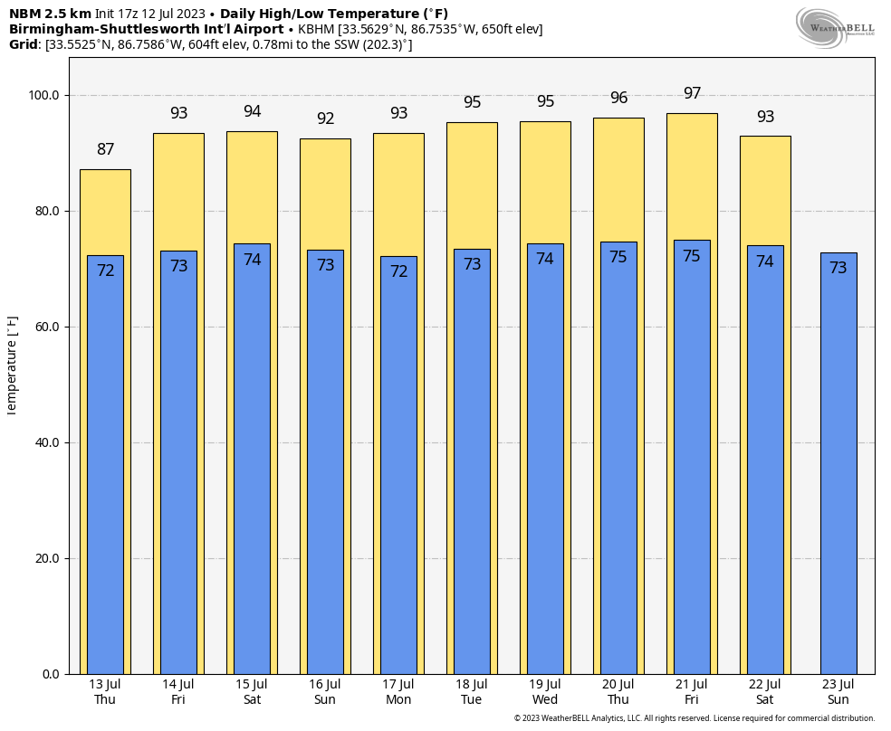
An ocean of humidity will cover the Deep South tomorrow through the weekend, and we expect scattered to numerous showers and thunderstorms around during the afternoon and evening hours (mostly between 2:00 and 10:00 p.m.). Chance of any one location seeing rain daily is 50-60 percent… otherwise we expect a mix of sun and clouds daily with highs generally in the low 90s.
NEXT WEEK: We will keep a close eye on a nasty heat ridge west of Alabama; global models are somewhat inconsistent on eastward extent of the ridge and the excessive heat. The latest runs are keeping the most intense heat to the west; for now it looks like we can expect routine summer weather with partly sunny days and “scattered, mostly afternoon and evening showers and storms”. Highs will be in the low to mid 90s… See the video briefing for maps, graphics, and more details.
TROPICS: An area of low pressure located a little more than 700 miles east of Bermuda continues to produce disorganized showers and thunderstorms well to the south of its center. Environmental conditions are forecast to be marginally conducive for this system to become a subtropical depression or storm during the next couple of days while it meanders over the central Atlantic. By the weekend, the low should turn northward bringing the system over cooler waters, potentially limiting additional development. NHC gives it a 50 percent chance of development over the next five days… one way or another it will remain far from land.
The rest of the Atlantic basin, including the Gulf of Mexico, remains very quiet.
ON THIS DATE IN 1995: An intense heat wave affected much of the Midwest for a 4-day period beginning on this day. The worst effects of the heat were noted in the Chicago metropolitan area, where 583 people died from the heat. Temperatures across the region reached as high as 104 degrees
ON THIS DATE IN 1996: Hurricane Bertha makes landfall near Wrightsville Beach, NC with maximum winds of 105 mph, but the storm surge dealt the most devastation. The U.S. Virgin Islands, along with North Carolina, were declared federal disaster areas. Surveys indicate that Bertha damaged almost 2,500 homes on St. Thomas and St. John. For many, it was the second hit in the ten months since Hurricane Marilyn devastated the same area. The primary effects in North Carolina were to the coastal counties and included storm surge flooding and beach erosion, roof damage, piers washed away, fallen trees and damage to crops.
Look for the next video briefing here by 6:00 a.m. tomorrow…
Category: Alabama's Weather, ALL POSTS, Weather Xtreme Videos
About the Author (Author Profile)
James Spann is one of the most recognized and trusted television meteorologists in the industry. He holds the AMS CCM designation and television seals from the AMS and NWA. He is a past winner of the Broadcast Meteorologist of the Year from both professional organizations.Subscribe
If you enjoyed this article, subscribe to receive more just like it.


