Alabama Update at 4:55 p.m.
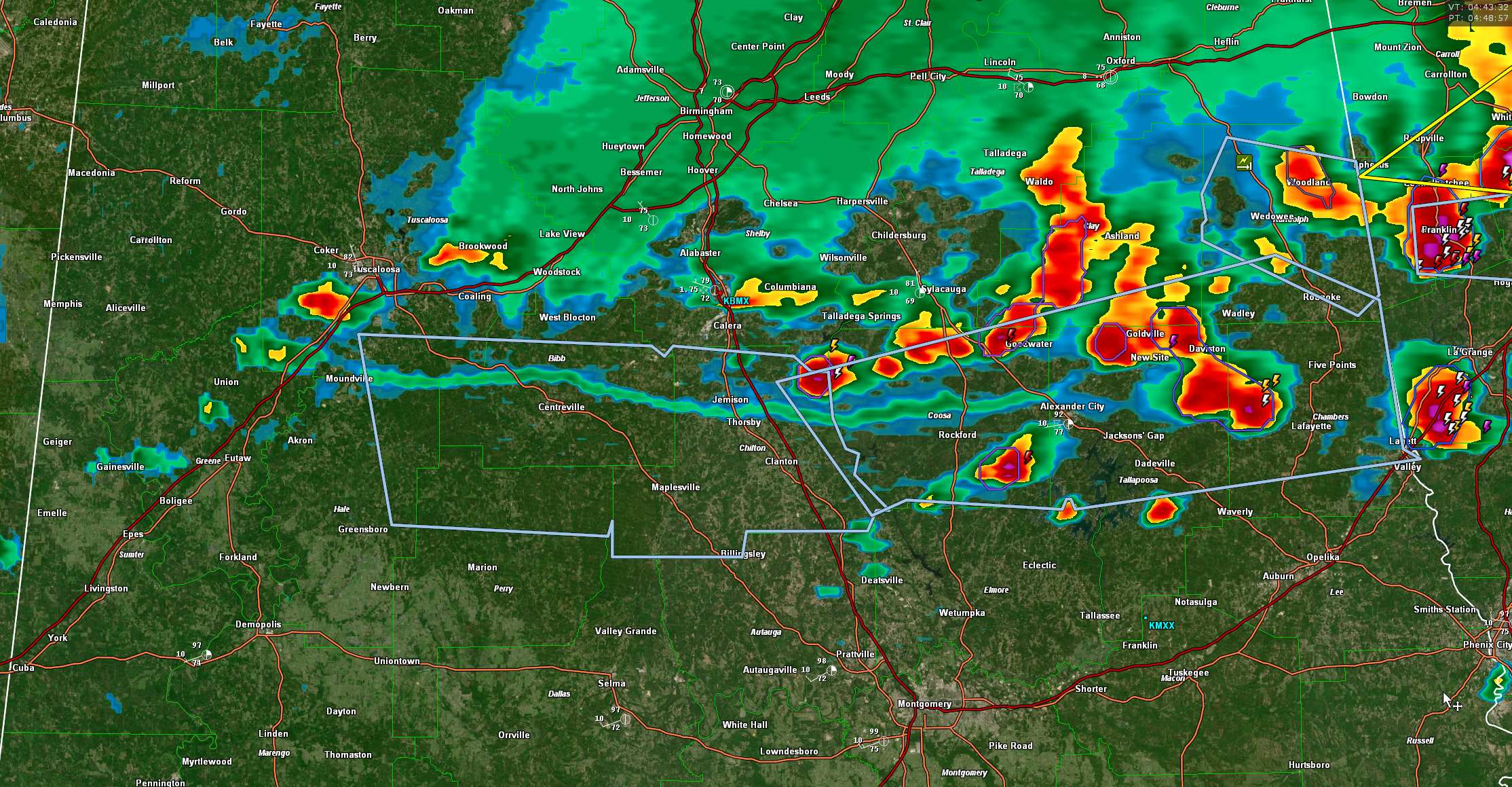
Our line of thunderstorms has weakened quite a bit since it’s zenith earlier this afternoon.
We watched it start to generate an outflow boundary and that was the beginning of the end for it and we’re grateful.
The line of storms now extends from Randolph County through Clay, Talladega, Shelby, and into Tuscaloosa County.
A few storms are ahead of it in Coosa, Tallapoosa, and Chambers Counties.
Wind gusts to 50 mph are possible with the storms. It is being handled with significant weather advisories for now.
The severe thunderstorm watch continues for 9 counties including Bibb, Clay, Greene, Hale, Randolph, Shelby, Sumter, Talladega, and Tuscaloosa. It goes til 7 p.m. The storms are still capable for producing a downburst as they drop into still unstable air, but the threat has diminished.
The excessive heat warning is canceled for the areas that have experienced storms, but continues ahead of the line.
Category: Alabama's Weather, ALL POSTS, Severe Weather
About the Author (Author Profile)
Bill Murray is the President of The Weather Factory. He is the site's official weather historian and a weekend forecaster. He also anchors the site's severe weather coverage. Bill Murray is the proud holder of National Weather Association Digital Seal #0001 @wxhistorianSubscribe
If you enjoyed this article, subscribe to receive more just like it.


