More Strong Storms Fire Up Later Today
MORE SUMMER STORMS: On the maps this morning we have a surface boundary (we don’t call them “cold fronts” this time of the year) lined up near I-20. North of the front, temperatures are in the 60s… but to the south it is very humid with 70s and low 80s just before daybreak. No rain on radar across Alabama, but we note strong storms over Arkansas, and those will ride along the boundary and move in here later this morning.
SPC has defined a “slight risk” (level 2/5) of severe thunderstorms south of a line from Moundville to Jamison to Valley, and a “marginal risk” (level 1/5) as far north as Hamilton, Oneonta, and Heflin.
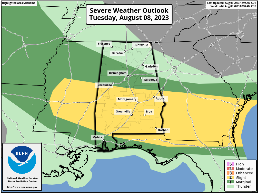
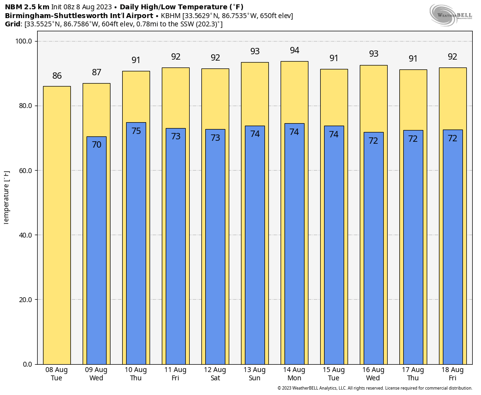
Like recent days, the main concern with the strong storms will come from strong straight line winds. The main window for strong to severe thunderstorms will come from 10:00 a.m. until 6:00 p.m. It won’t rain everywhere, however, and the sun will be out at times today. Heat levels will be down over the northern half of the state with highs in the 80s, but South Alabama will see low to mid 90s.
REST OF THE WEEK: A northwest flow pattern will persist across the state, with some risk of showers and strong storms on a daily basis. The higher coverage of storms will be over the northern half of Alabama, and most of them (but not all) will come in the noon to midnight window. The high tomorrow will be in the 87-91 degree range, followed by low 90s Thursday and Friday with a mix of sun and clouds.
THE WEEKEND AND NEXT WEEK: It looks like some pretty classic summer weather for Alabama with partly sunny, hot, humid days along with some risk of scattered showers and thunderstorms daily, most active during the afternoon and evening hours. Highs will be in the low to mid 90s; the most intense heat remains to the west. See the video briefing for maps, graphics, and more details.
TROPICS: Again today the Atlantic basin is calm as it ever gets in August. Tropical storm formation is not expected for at least the next seven days. Lot of dry air and subsidence (sinking air) in place.
LIGHTNING DEATH: One person was killed by lightning yesterday in Alabama; this happened in Florence. Police identified the victim as a 28 year old male on Kendall Drive in the Florence Industrial Park.
ON THIS DATE IN 2007: A tornado bounces across Staten Island and Brooklyn, New York, ripping off roofs and damaging dozens of buildings. The EF-2 twister hop-scotched through Brooklyn’s Bay Ridge and Sunset Park neighborhoods around 6:30 am.
Look for the next video briefing here by 3:00 this afternoon… enjoy the day!
Category: Alabama's Weather, ALL POSTS, Weather Xtreme Videos
About the Author (Author Profile)
James Spann is one of the most recognized and trusted television meteorologists in the industry. He holds the AMS CCM designation and television seals from the AMS and NWA. He is a past winner of the Broadcast Meteorologist of the Year from both professional organizations.Subscribe
If you enjoyed this article, subscribe to receive more just like it.


