A Marginal Marginal Severe Threat
Jason Davis just said it best at the NWS Birmingham. Tonight’s threat is looking like a “marginal” marginal one.
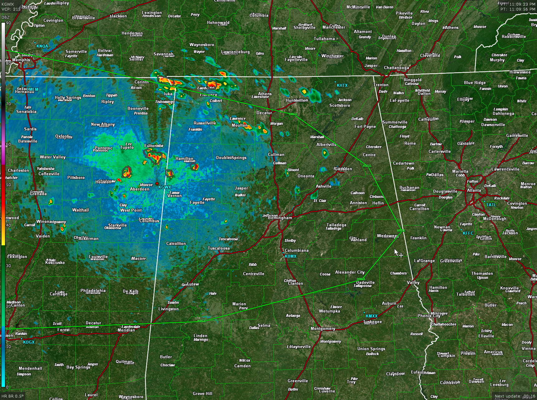
Areas west of a line from Florence to Guntersville to Heflin to Dadeville to Marion to Meridian have a very small chance of one of the heavy showers growing into a severe thunderstorm with damaging winds through about a.m. but the chance is VERY small.
Radar indicates groupings of scattered discrete heavy showers from the Shoals are and Lawrence and Morgan Counties back to Marion and Lamar Counties to around Fulton, Houston, and Aberdeen in Mississippi. These cells will continue moving east and sliding slowly southward overnight. They should weaken the closer we get to sunrise.
Poor lapse rates and the nightly inversion kicking in have doomed the event to its marginal marginal status.
There is just enough warm air advection at 5,000 feet in the form of 25 know southwesterly winds to power these showers.
Category: Alabama's Weather, ALL POSTS, Severe Weather
About the Author (Author Profile)
Bill Murray is the President of The Weather Factory. He is the site's official weather historian and a weekend forecaster. He also anchors the site's severe weather coverage. Bill Murray is the proud holder of National Weather Association Digital Seal #0001 @wxhistorianSubscribe
If you enjoyed this article, subscribe to receive more just like it.


