

Dry, Very Hot Summer Weather Continues Through Saturday
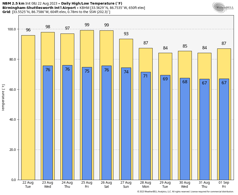
HOT IS THE WORD: A strong upper ridge covers much of the U.S. from the Rockies to the southern Atlantic coast, and that feature will keep Alabama and the Deep South dry and very hot through the beginning of the weekend. With mostly sunny days, afternoon highs will be in the 97-102 degree range. Heat index values will be well over 100 thanks to dew points in the 70s. This is the hottest week of the year.
The ridge begins to break down and shift westward Sunday; the high will drop back into the low to mid 90s, and we will introduce the chance of a few isolated showers or thunderstorms.
NEXT WEEK: Heat levels continue to fall. Highs drop into the 80s through the week, and we will have scattered showers and thunderstorms around daily, especially during the afternoon and evening hours (2-9 p.m.). See the video briefing for maps, graphics, and more details.
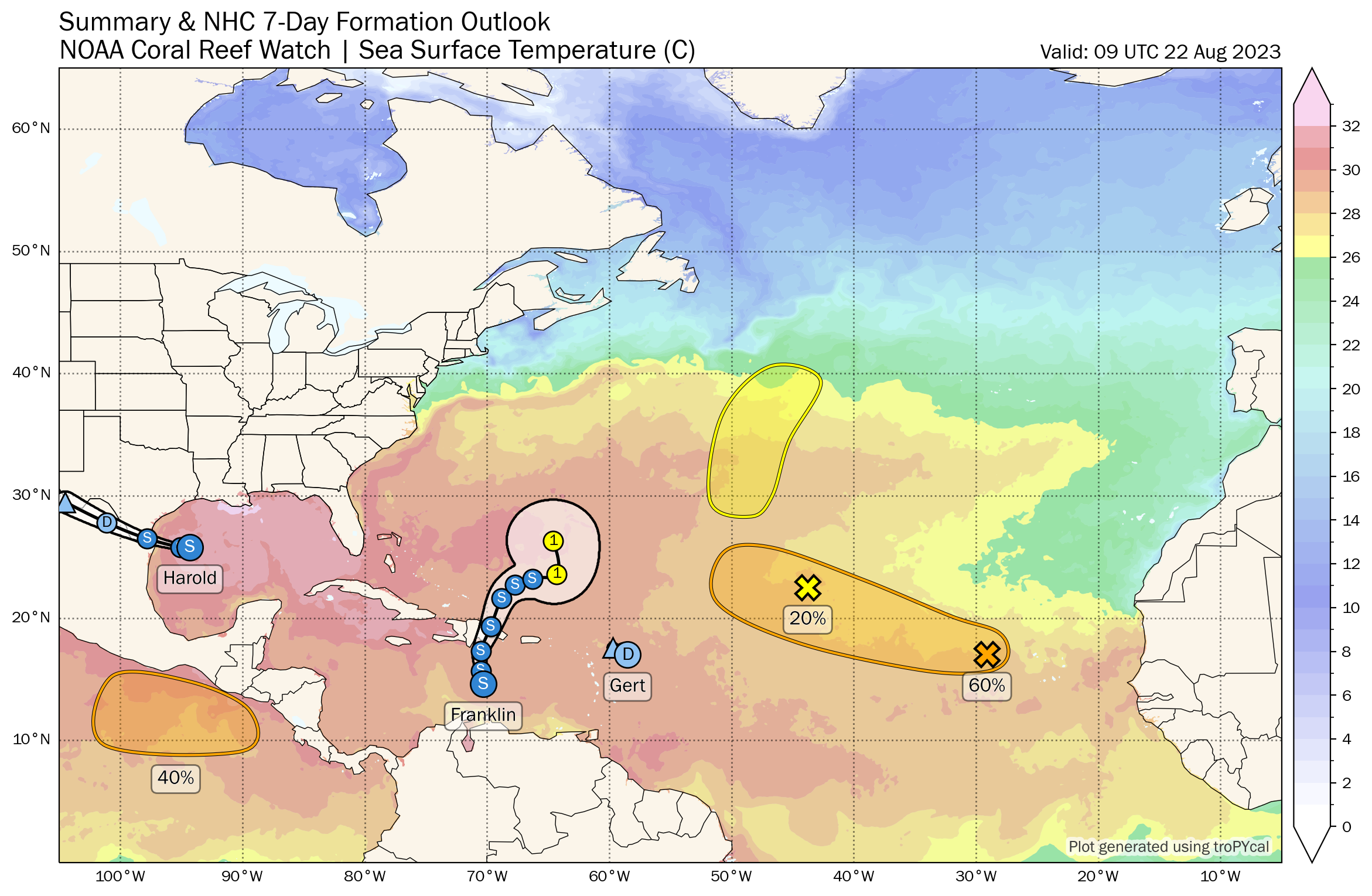
TROPICS: The Atlantic basin is active today. Concerning the named systems…
*Tropical Storm Harold, with winds of 45 mph in the western Gulf of Mexico, will move into the South Texas coast later this morning. It will bring beneficial rain and a break from the heat for the lower Rio Grande Valley.
*Tropical Storm Gert, in the Atlantic about 450 miles east of the northern Leeward Islands, is a junk system that will most likely dissipate today.
*Tropical Storm Franklin is in the Caribbean about 250 miles south of Santo Domingo, DR. Winds are 50 mph, and is it drifting to the northwest at only 3 mph. This system will bring heavy rain to Hispaniola tomorrow… from there it is forecast to ultimately become a category one hurricane well east of the Bahamas over the weekend. From there it will move north/northeast, and should remain east of the U.S. East Coast.
And, out in the eastern Atlantic, Invest 92L could become a tropical depression or storm over the next few days, but it should gain latitude and remain well east of the contiguous U.S.
After Harold makes landfall this morning, we see no tropical systems that threaten the U.S. for at least the next seven days.
ON THIS DATE IN 1893: Four hurricanes are observed in the Atlantic Ocean at the same time. Over a century would pass, 1998 before four hurricanes would again rage together in the Atlantic.
ON THIS DATE IN 1994: Hurricane John, about 345 miles south of Hilo, Hawaii had winds of 175 mph and pressure at 920 millibars or 27.17 inches of mercury, making it one of the strongest hurricanes ever in the Central Pacific. The 31-day existence made John the longest-lasting tropical cyclone recorded in both the Pacific Ocean and worldwide, surpassing both Hurricane Tina’s previous record in the Pacific of 24 days in the 1992 season and the 1899 San Ciriaco hurricane’s previous world record of 28 days in the 1899 Atlantic season. John was also the farthest-traveling tropical cyclone in both Pacific Ocean and worldwide, with distance traveled of 7,165 miles.
Look for the next video briefing here by 3:00 this afternoon…
Category: Alabama's Weather, ALL POSTS, Weather Xtreme Videos
About the Author (Author Profile)
James Spann is one of the most recognized and trusted television meteorologists in the industry. He holds the AMS CCM designation and television seals from the AMS and NWA. He is a past winner of the Broadcast Meteorologist of the Year from both professional organizations.Subscribe
If you enjoyed this article, subscribe to receive more just like it.


