Alabama Update at 5:50 p.m.: Strong Storms Continue, Flooding an Issue in Spots, Birmingham Sets Daily Rainfall Record
Heavy thunderstorms continue across parts of North and Central Alabama late this afternoon.
Here is the radar at 545 pm:
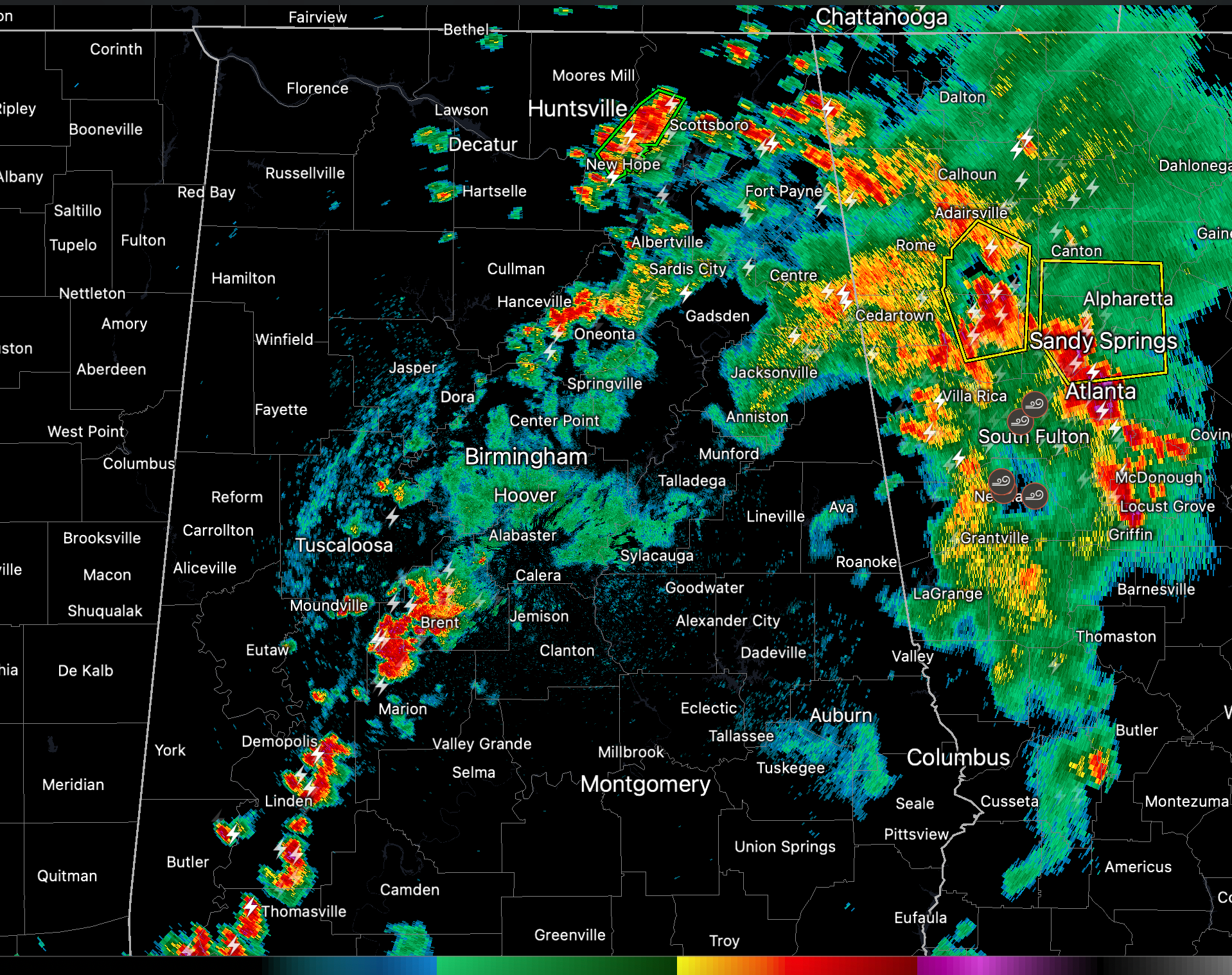
As you can see, the heaviest storms are over Jackson and Madison Counties in North Alabama where there is a flash flood warning in effect.
Strong storms are over Blount County. They could have wind gusts to 40 mph.
Further south, strong storms extend from Bibb down through Perry into Marengo Counties. Lots of torrential rain and lightning as well as wind gusts to over 40 mph.
The ATlanta area is socked in with storms. Numerous flight delays and missed flights at Hartsfield Jackson this evening. One of them will be me if we can ver get off the ground in Birmingham with the ground stop at ATL.
BIRMINGHAM PICKS UP RECORD RAINFALL FOR THE DATE
RERBHM
RECORD EVENT REPORT
NATIONAL WEATHER SERVICE BIRMINGHAM AL
0448 PM CDT MON AUG 28 2023
…RECORD DAILY MAXIMUM RAINFALL SET AT BIRMINGHAM…
A RECORD RAINFALL OF 1.44 WAS SET AT BIRMINGHAM TODAY.
THIS BREAKS THE OLD RECORD OF 1.06 SET IN 1923.
Category: Alabama's Weather, ALL POSTS, Severe Weather
About the Author (Author Profile)
Bill Murray is the President of The Weather Factory. He is the site's official weather historian and a weekend forecaster. He also anchors the site's severe weather coverage. Bill Murray is the proud holder of National Weather Association Digital Seal #0001 @wxhistorianSubscribe
If you enjoyed this article, subscribe to receive more just like it.


