A Few Showers Around Today; Good Looking Weekend Ahead
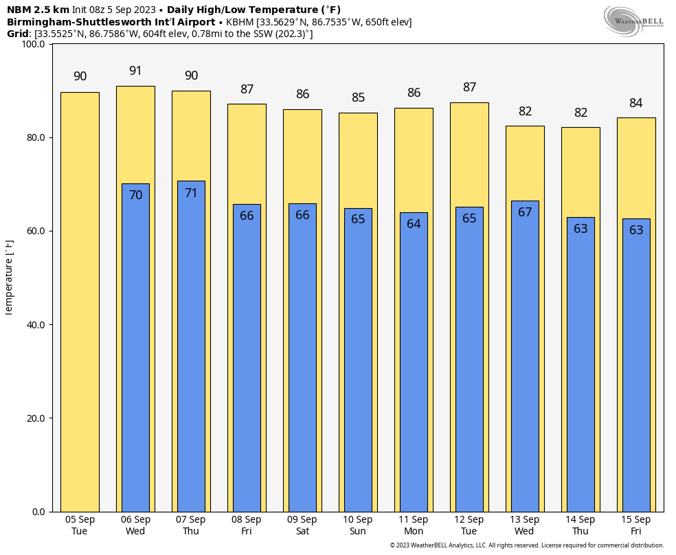
RADAR CHECK: We have a few isolated showers on radar early this morning over the northern third of Alabama moving northward. We will maintain the chance of isolated showers through the day, but many places will be dry today with a mix of sun and clouds. The high this afternoon will be in the 87-93 degree range… the average high for Birmingham on September 5 is 88.
We will also mention a chance of showers and thunderstorms tomorrow afternoon and tomorrow night, mainly over the northern half of the state. Chance of any one spot seeing rain is 25-35 percent… otherwise we expect a partly sunny sky with a high around 90 degrees.
THURSDAY THROUGH THE WEEKEND: Drier air drops into Alabama Thursday, and we are expect dry weather Thursday through the weekend with sunny days, lower humidity, and cooler nights. The high Thursday will be near 90, followed by mid to upper 80s Friday through Sunday. Lows will drop into the low to mid 60s for a nice “fall feel” to the air.
NEXT WEEK: Dry air will likely remain in place for much of next week with little risk of showers. Highs will hold in the 85-90 degree range most afternoons with lows in the 60s. See the video briefing for maps, graphics, and more details.
FOOTBALL WEATHER: The sky will be clear for the high school football games across Alabama Friday night with temperatures falling through the 70s.
Saturday, UAB will take on Georgia Southern in Statesboro, GA (5:00p CT kickoff)… the sky will be occasionally cloudy, and a passing shower or thunderstorm can’t be ruled out during the game. Temperatures will fall from near 90 degrees at kickoff through the 80s during the second half.
Alabama will host Texas Saturday evening at Bryant-Denny Stadium (6:00p CT kickoff)… the sky will be clear with temperatures falling from near 83 degrees at kickoff, into the 70s by the second half.
Auburn will be in Berkeley to take on the California Golden Bears (9:30p CT kickoff)… expect a clear sky with temperatures in the 60s during the game.
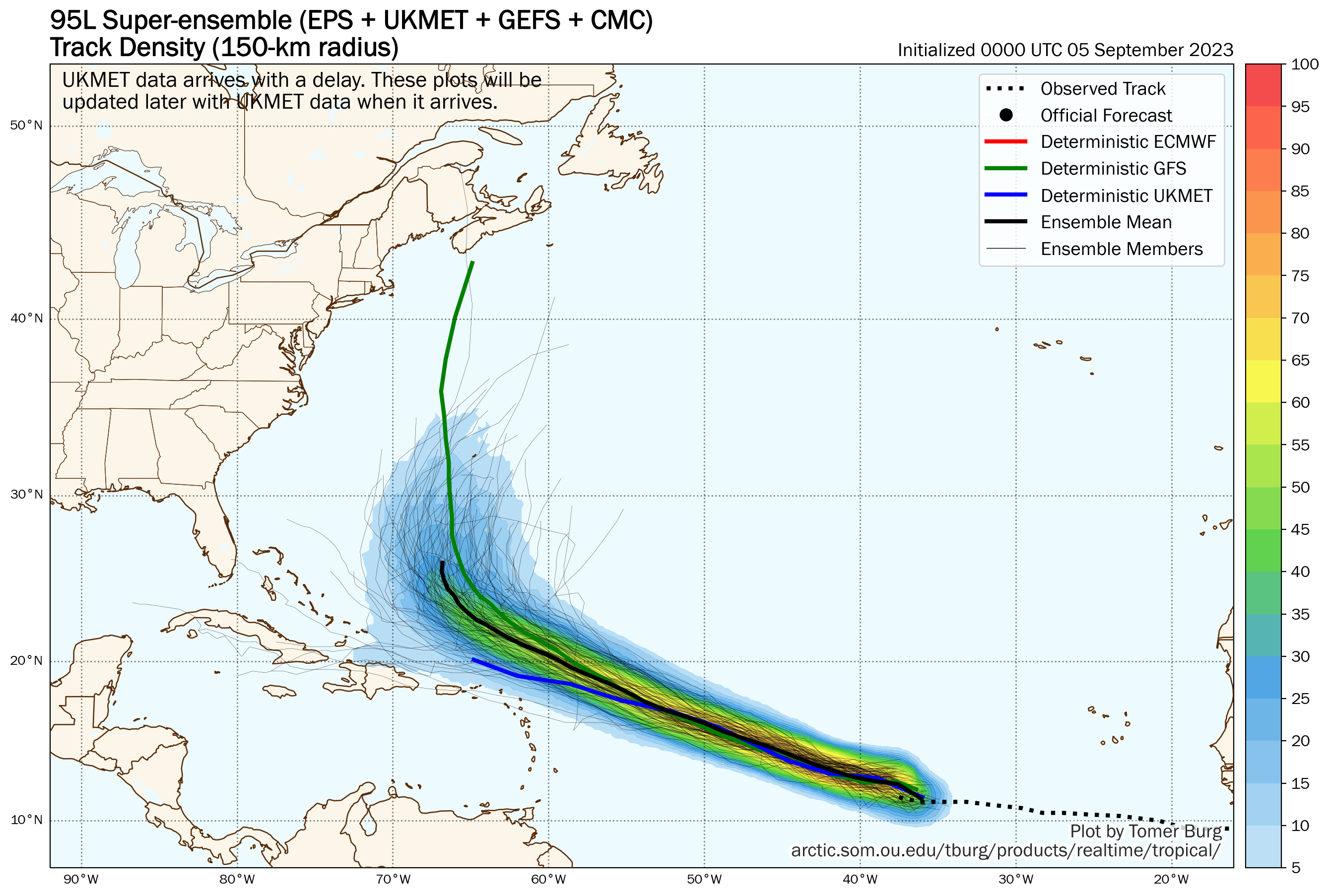
TROPICS: Invest 95L in the central Atlantic is expected to become a powerful hurricane in 3-5 days (the name will be “Lee”)… it is expected to pass north of the northern Leeward Islands, followed by a turn to the north before reaching the East Coast of the U.S.
A new wave coming off the coast of Africa also has a high chance of becoming a tropical storm or hurricane within the next 3-5 days, but it will gain latitude and most likely remain far from land.
No tropical systems will threaten the Gulf of Mexico or the Central Gulf Coast for at least the next 7-10 days.
ON THIS DATE IN 1925: Alabama’s all-time record heat wave was at its height on this date in 1925. Birmingham was recording its third of seven straight days with temperatures over 100 degrees. On the 5th and 6th, the temperature in Birmingham topped out at 106. After letting up a bit, the temperature would once again reach the century mark on September 22nd (the latest the Magic City has ever seen 100 degrees.) The high temperatures were made worse by a severe drought.
The state recorded its hottest temperature ever, 112 degrees, at Centreville on September 5, 1925. Every reporting station in the state of Alabama recorded a high of 100 degrees or higher on this date, an unprecedented event that has never been repeated.
Look for the next video briefing here by 3:00 this afternoon… enjoy the day!
Category: Alabama's Weather, ALL POSTS, Weather Xtreme Videos
About the Author (Author Profile)
James Spann is one of the most recognized and trusted television meteorologists in the industry. He holds the AMS CCM designation and television seals from the AMS and NWA. He is a past winner of the Broadcast Meteorologist of the Year from both professional organizations.Subscribe
If you enjoyed this article, subscribe to receive more just like it.


