

Midday Nowcast: Drier Air Settling into Alabama
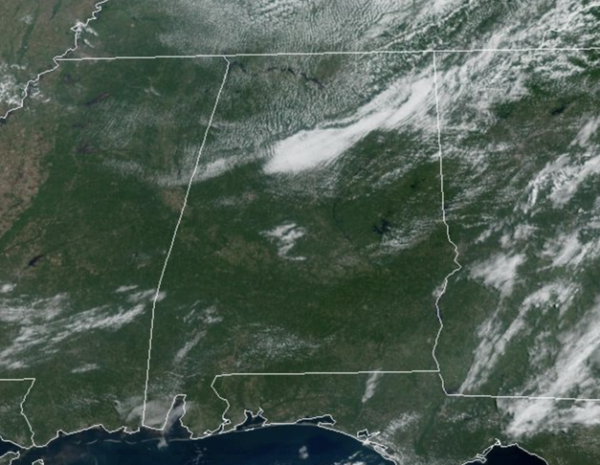
Drier air is setting into Alabama today and we are seeing more sunshine than clouds with highs in the mid to upper 80s. Low 90s are more coming across the southern counties of the state and near the Gulf Coast where some showers are showing up as well.
GREAT WEEKEND WEATHER: Tomorrow through Sunday, dry air will cover Alabama, and we expect mostly sunny days, fair pleasant nights, and lower humidity levels. A few isolated showers are possible over far east Alabama, but the chance of any one spot seeing rain there is small, close to 10%. Highs will be in the mid to upper 80s over the northern half of the state, and in the low 90s to the south. Lows will be well down in the 60s, and some of the cooler spots across North/Central Alabama could reach the 50s.
FOOTBALL WEATHER: The sky will be clear for the high school football games across Alabama Friday night with temperatures falling through the 70s.
Saturday, UAB will take on Georgia Southern in Statesboro, GA (5:00p CT kickoff)… the sky will be occasionally cloudy, and a passing shower or thunderstorm can’t be ruled out during the game. Temperatures will fall from near 87 degrees at kickoff through the 80s during the second half.
Alabama will host Texas Saturday evening at Bryant-Denny Stadium (6:00p CT kickoff)… the sky will be clear with temperatures falling from near 83 degrees at kickoff, into the 70s by the second half.
Auburn will be in Berkeley to take on the California Golden Bears (9:30p CT kickoff)… expect a clear sky with temperatures in the 60s during the game.
NEXT WEEK: The weather stays dry Monday; we will mention some risk of scattered showers Tuesday and Wednesday with the approach of a front, but moisture will be limited and rain amounts will be light and spotty. Highs will remain in the mid to upper 80s over North/Central Alabama through Wednesday, then dropping into the low 80s Thursday and Friday following the frontal passage.
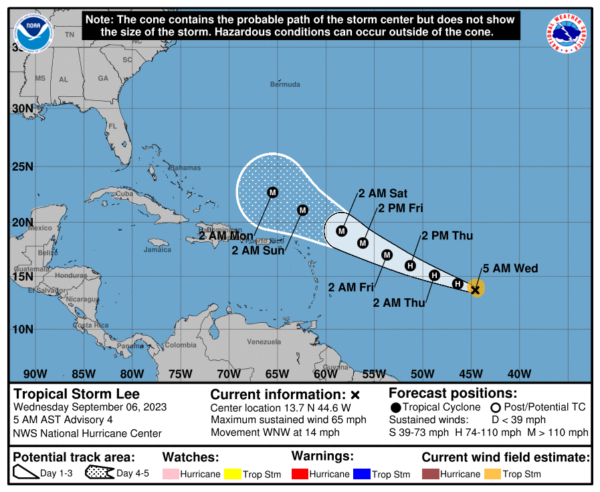
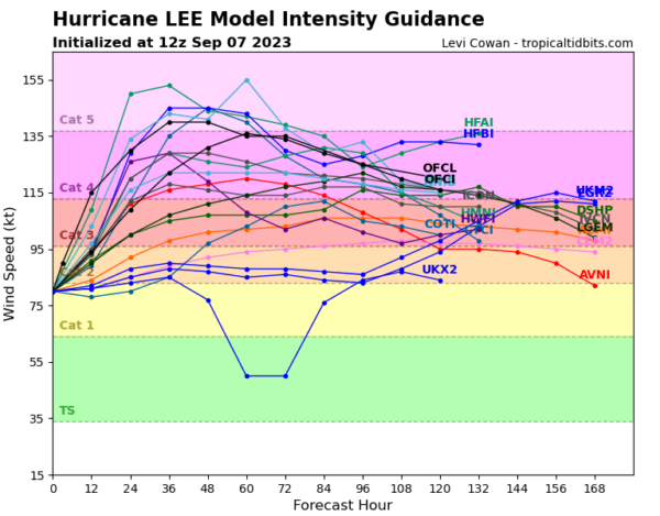
TROPICS: Hurricane Lee is moving toward the west-northwest near 15 mph, and this motion is expected to continue through Friday. A slower motion toward the west-northwest is forecast over the weekend. On the forecast track, the core of Lee will move north of the northern Leeward islands during the next few days. Maximum sustained have quickly increased to near 105 mph with higher gusts. Rapid intensification is expected today and tonight. Lee will likely become a major hurricane later today. Lee is forecast to remain a very strong major hurricane through the weekend, and it is very possible it reaches category 5 intensity at some point.
Ensemble output from global models continues to show a sharp north turn next week, and Lee is expected to remain east of the U.S. East Coast. However, the hurricane will bring huge swells, waves, and a major rip current threat as it passes to the east.
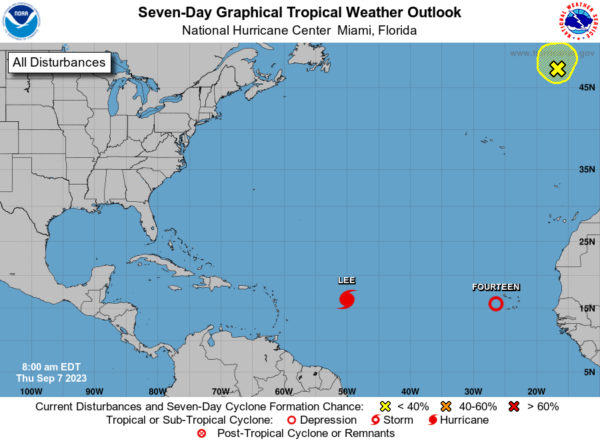
Tropical Depression 14 will become Margot in the coming days, but will remain in the Open Waters of the Atlantic.
BEACH FORECAST CENTER: Get the latest weather and rip current forecasts for the beaches from Fort Morgan to Panama City on our Beach Forecast Center page. There, you can select the forecast of the region that you are interested in visiting.
WORLD TEMPERATURE EXTREMES: Over the last 24 hours, the highest observation outside the U.S. was 121.1F at Kuwait International Airport, Kuwait. The lowest observation was -110.4F Vostok, Antarctica.
CONTIGUOUS TEMPERATURE EXTREMES: Over the last 24 hours, the highest observation was 111F at Rio Grande Village, TX. The lowest observation was 30F at Grand Lake, CO.
Category: Alabama's Weather, ALL POSTS
About the Author (Author Profile)
Macon, Georgia Television Chief Meteorologist, Birmingham native, and long time Contributor on AlabamaWX. Stormchaser. I did not choose Weather, it chose Me. College Football Fanatic. @Ryan_StinnetSubscribe
If you enjoyed this article, subscribe to receive more just like it.


