Midday Nowcast: More Clouds than Sun with Scattered Showers
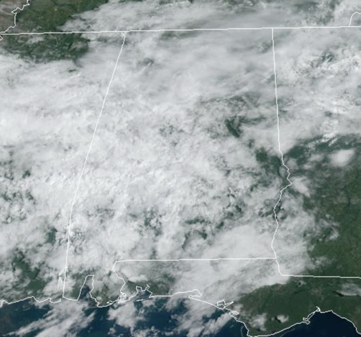
More clouds than sun, with some showers across the Alabama landscape today, but nothing too heavy or widespread. Temperatures are ranging from the 70s into the mid 80s this afternoon.
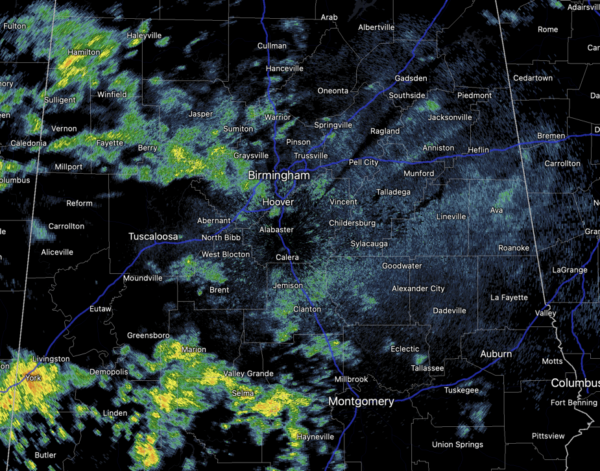
FRIDAY & THE WEEKEND: The next couple of days, scattered showers and storms will remain in the forecast. It won’t rain all day or every where, but a few showers and possibly a thunderstorm are a good bet tomorrow and Saturday. Rain chances Friday and Saturday are in the 40-50% range. Highs will remain in the low 80s for North Alabama, with mid to upper 80s to the south. Sunday, rain chances begin to decrease as drier air is expected to settle into the state. Sunday look to be the best day of weather this weekend with more sunshine than clouds and highs in the low 80s.
FRIDAY NIGHT LIGHTS: For the high school games tomorrow night, we have a risk of scattered showers, but nothing especially widespread or heavy. Temperatures will fall through the 70s.
FOOTBALL FORECAST: Saturday, Alabama travels to Tampa to take on South Florida (2:30p CT kickoff)… the day will be hot and humid with a kickoff temperature around 90 degrees. A passing shower or thunderstorm is likely during the game. Which, of course, means potential for a lightning delay.
Auburn hosts Samford Saturday evening at Jordan-Hare Stadium (6:00p CT kickoff)… the sky will be mostly cloudy with a passing shower possible. Temperatures will be in the mid to upper 70s.
And, UAB will host Louisiana Saturday evening in downtown Birmingham at Protective Stadium (6:00p CT kickoff)… much like Auburn, a shower can’t be ruled out during the game. Mostly cloudy conditions with temperatures falling from near 80 at kickoff, to mid 70s by the fourth quarter.
NEXT WEEK: It still looks like most of the week will be rain-free with highs in the 80s and lows in the 60s, right at seasonal averages.
IN THE TROPICS: Soon to be Nigel…Invest 97L is an area of showers and thunderstorms associated with a broad low pressure area located about 1000 miles west-southwest of the Cabo Verde Islands have increased and become a little better organized since yesterday. Environmental conditions are expected to be conducive for additional development, and this system is likely to become a tropical depression during the day or so while it moves west-northwestward to northwestward at 10 to 15 mph across the central tropical Atlantic. Formation chance: High…90 percent.
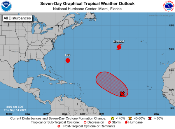
HURRICANE LEE: Lee is moving toward the north near 14 mph and this general motion with an increase in forward speed is expected through Saturday. A turn toward the north-northeast and then northeast is forecast Saturday night and Sunday. On the forecast track, the center of Lee will pass west of Bermuda today and tonight, approach the coast of New England and Atlantic Canada Friday and Saturday, and move across Atlantic Canada Saturday night and Sunday.
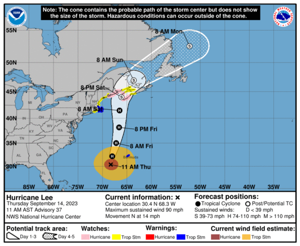
Data from Air Force Reserve and NOAA reconnaissance aircraft indicate that the maximum sustained winds are near 90 mph with higher gusts. Weakening is forecast, but Lee is expected to remain a large and dangerous hurricane for the next couple of days. Lee is a large hurricane. Hurricane-force winds extend outward up to 90 miles from the center and tropical-storm-force winds extend outward up to 310 miles The latest minimum central pressure estimated from reconnaissance aircraft data is 956 mb (28.23 inches).
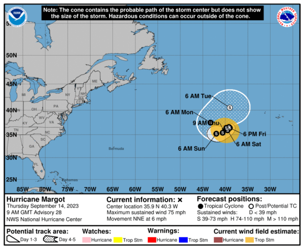
HURRICANE MARGOT: Margot is moving toward the north-northeast near 6 mph, and a slower forward motion is expected today. Margot is forecast to meander within weak steering currents on Friday and make a small clockwise loop over the weekend. Satellite-wind data indicate that the maximum sustained winds are near 80 mph with higher gusts. Gradual weakening is forecast over the next few days. Hurricane-force winds extend outward up to 80 miles from the center and tropical-storm-force winds extend outward up to 230 miles. The estimated minimum central pressure is 978 mb (28.88 inches).
BEACH FORECAST CENTER: Get the latest weather and rip current forecasts for the beaches from Fort Morgan to Panama City on our Beach Forecast Center page. There, you can select the forecast of the region that you are interested in visiting.
WORLD TEMPERATURE EXTREMES: Over the last 24 hours, the highest observation outside the U.S. was 121.3F at Omidieh, Iran. The lowest observation was -92.6F Dome A, Antarctica.
CONTIGUOUS TEMPERATURE EXTREMES: Over the last 24 hours, the highest observation was 108F at Death Valley, CA. The lowest observation was 24F at Mackay, ID.
Category: Alabama's Weather, ALL POSTS
About the Author (Author Profile)
Macon, Georgia Television Chief Meteorologist, Birmingham native, and long time Contributor on AlabamaWX. Stormchaser. I did not choose Weather, it chose Me. College Football Fanatic. @Ryan_StinnetSubscribe
If you enjoyed this article, subscribe to receive more just like it.


