The Latest On Lee
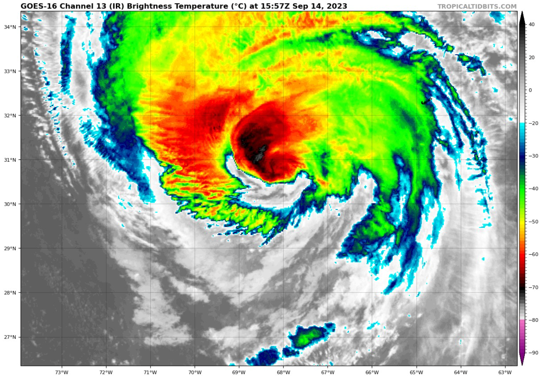
Lee has weakened to a category one hurricane this morning with top winds of 90 mph and a central pressure of 958 mb.
But it is a large and dangerous hurricane and its impact will be felt over a wide area. Hurricane force winds extend out 90 miles from the centrer and tropical storm force winds extend out 310Tropic miles.
Winds just gusted to 48 mph at the main airport in Bermuda.
Storm surge values will reach the following peak heights in New England:
Chatham, MA to Sagamore Beach, MA…2-4 ft
Cape Cod Bay…2-4 ft
Nantucket…2-4 ft
Sagamore Beach, MA to Border of US/Canada…1-3 ft
Boston Harbor…1-3 ft
Flushing, NY to Chatham, MA…1-3 ft
Montauk Point, NY to Flushing, NY…1-3 ft
Long Island Sound…1-3 ft
Martha’s Vineyard…1-3 ft
Rockaway Inlet, NY to Montauk Point, NY…1-2 ft
The track is expected to bend back slightly to the west and approach the western tip of Nova Scotia Saturday evening. A hurricane watch is in effect from Stonington ME to the US/Canadian border.
Tropical storm watches are in effect from eastern Long Island to Stonington ME with tropical storm warnings for the Massachusetts coast from Woods Hole to Hull as well as Martha’s Vineyard and Nantucket.
Boston is expecting tropical storm force winds Saturday morning into early afternoon, with peak gusts in the 40-50 mph range.
Nantucket has a tropical storm warning and storm surge warning and winds will gust to 50-60 mph there. Their tropical storm force winds will begin in gusts tomorrow evening and last into Saturday afternoon. The duration will be about 21 hours or so.
14 inches of rain is expected across New England, and with the wet summer they’ve had, flooding is likely.
High surf is affecting areas all the way from the Leeward Islands and Puerto Rico to Atlantic Canada including the U.S. East Coast.
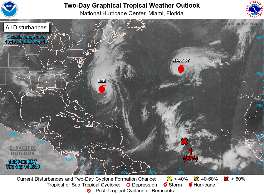
Elsewhere in the tropical , Margot is becoming a large hurricane over the Central Atlantic, but is no threat to land at this time.
That disturbance about 1,000 miles of the Cape Verde Islands will ikely become a depression today and is expected to become Tropical Storm Nigel in the next couple of days. It is not expected to affect any land areas over the next seven days, recurving well north of the islands of the Caribbean.
About the Author (Author Profile)
Bill Murray is the President of The Weather Factory. He is the site's official weather historian and a weekend forecaster. He also anchors the site's severe weather coverage. Bill Murray is the proud holder of National Weather Association Digital Seal #0001 @wxhistorianSubscribe
If you enjoyed this article, subscribe to receive more just like it.


