Showers Remain Possible Through Saturday
RADAR CHECK: We have widely scattered showers in progress across Alabama this afternoon with temperatures in the 77-84 degree range for most of the state. We do note Mobile and Dothan have reached the 90 degree mark. Isolated showers remain possible tonight, otherwise the sky will be mostly cloudy with a low between 65 and 72 degrees.
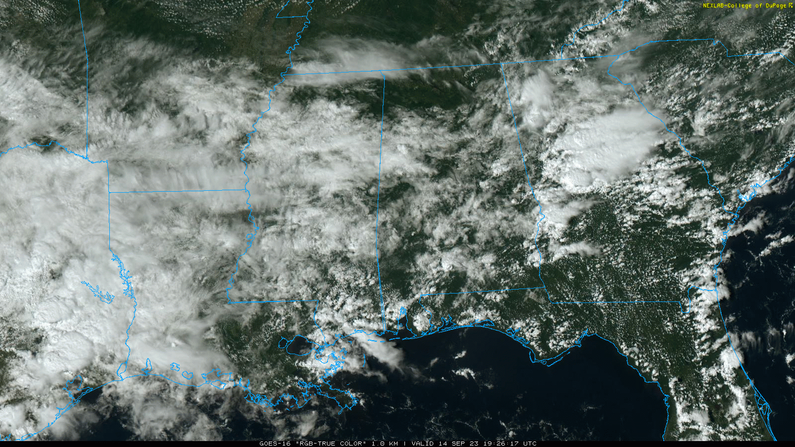
TOMORROW AND THE WEEKEND: The sky will be occasionally cloudy tomorrow and Saturday with a chance of showers both days statewide. A thunderstorm or two is possible as well, but the rain won’t be especially heavy or widespread. The chance of any one location seeing rain tomorrow is 30/40 percent, and 40/50 percent Saturday. Then, on Sunday, we have just an outside risk of a stray shower with a partly sunny sky. Highs all three days will be in the low to mid 80s.
NEXT WEEK: At this point it looks like much of Alabama will be dry through the week.. we will mention just the risk of a few isolated showers over the southern counties by Wednesday and Thursday. Highs will remain in the 80s, with lows in the 60s. See the video briefing for maps, graphics, and more details.
FOOTBALL WEATHER: For the high school games tomorrow night, we have a risk of scattered showers, but nothing especially widespread or heavy. Temperatures will fall through the 70s.
Saturday, Alabama travels to Tampa to take on South Florida (2:30p CT kickoff)… the day will be hot and humid with a kickoff temperature around 90 degrees. A passing shower or thunderstorm is likely during the game. Which, of course, means potential for a lightning delay.
Auburn hosts Samford Saturday evening at Jordan-Hare Stadium (6:00p CT kickoff)… the sky will be mostly cloudy with a passing shower possible. Temperatures will be in the mid to upper 70s.
And, UAB will host Louisiana Saturday evening in downtown Birmingham at Protective Stadium (6:00p CT kickoff)… much like Auburn, a shower can’t be ruled out during the game. Mostly cloudy conditions with temperatures falling from near 80 at kickoff, to mid 70s by the fourth quarter.
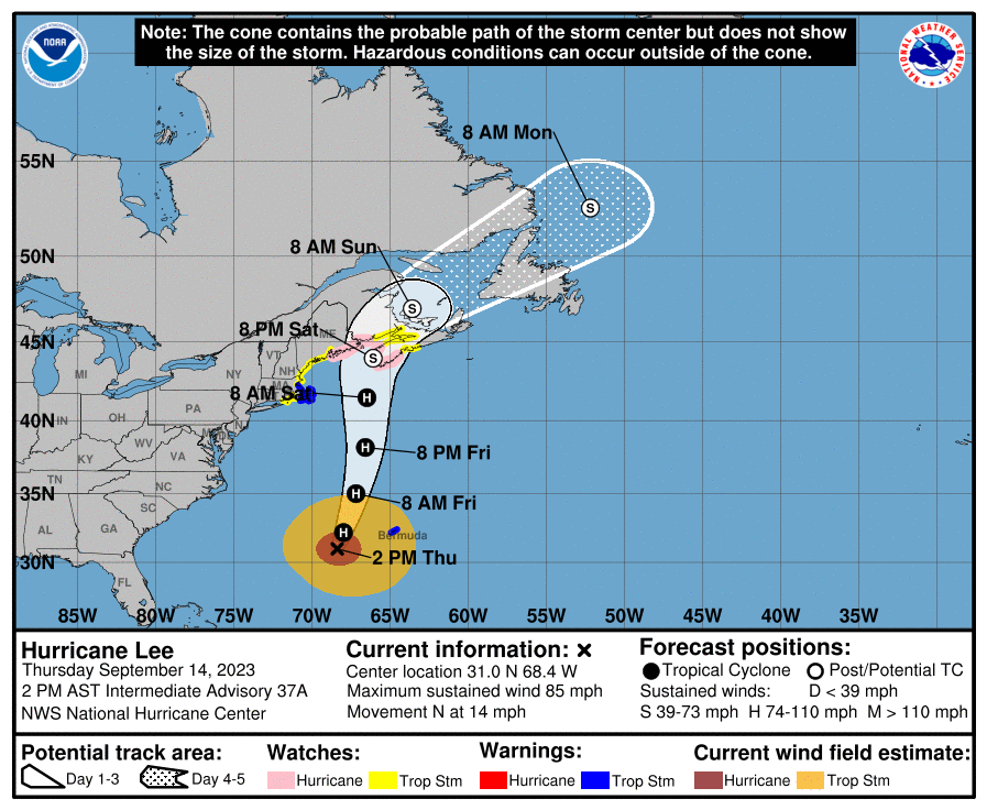
TROPICS: Hurricane Lee, with winds of 85 mph, is about 700 miles south of Nantucket this afternoon. Southwesterly vertical wind shear is expected to increase over Lee during the next 24 to 36 hours, and this is likely to lead to continued weakening during that time. Sea surface temperatures will decrease significantly just after 36 hours when Lee moves north of the Gulf Stream. \
The global model guidance suggests that Lee will begin extratropical transition Friday night and this is likely to be completed within 48 hours, if not a little sooner. It can’t be stressed enough, that regardless of Lee’s designation, it will remain a large and dangerous cyclone while it approaches eastern New England and Atlantic Canada.
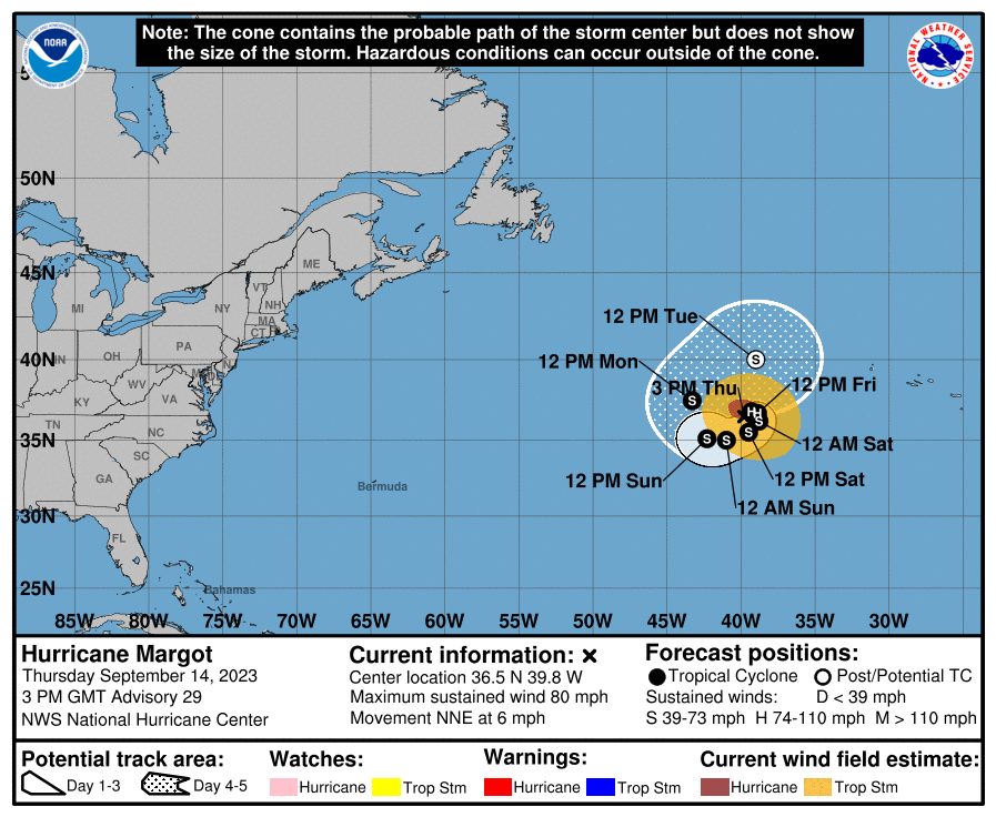
Elsewhere, Hurricane Margo is weakening with sustained winds of 80 mph in the Atlantic far from land. It will move little over the next five days, and should become post-tropical by early next week.
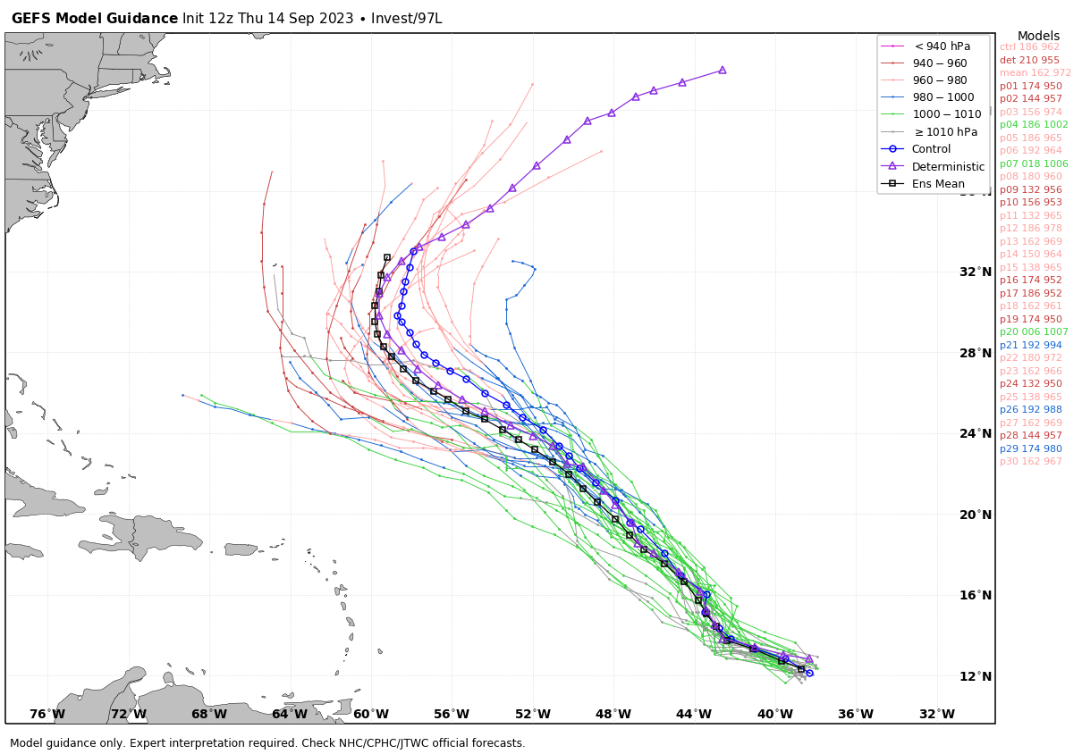
And, Invest 97L in the Central Atlantic is expected to become Tropical Storm Nigel over the next few days. It will be turning northward, and will likely remain far from land.
No tropical systems will threaten the Gulf of Mexico for at least the next seven days.
ON THIS DATE IN 1928: A violent, estimated F4 tornado, with winds of 200 mph, tore across Rockford, Illinois. The tornado first touched down 8 miles south-southwest of Rockford and moved across the southeast part of the city. The tornado was on the ground for 25 miles with a width varying from 200 to 500 feet. A total of 14 people were killed,
ON THIS DATE IN 2005: Hurricane Ophelia caused some damage and beach erosion along the United States coastline from Florida to North Carolina. The closest approach occurred on September 14 and 15 with its western eyewall crossing land and the eye remaining just offshore in the Carolinas.
ON THIS DATE IN 2018: Hurricane Florence, a large and slow moving category one hurricane, made landfall during the morning of September 14, 2018. After the eye crossed Wrightsville Beach, NC at 7:15 a.m. the storm spent the next two days producing record-breaking rainfall across eastern North Carolina and a portion of northeastern South Carolina. Over 30 inches of rain were measured in a few North Carolina locations, exceeding the highest single-storm rainfall amounts ever seen in this portion of the state. A station in Loris, SC recorded 23.63 inches rain, setting a new state tropical cyclone rainfall record for the state of South Carolina.
Look for the next video briefing here by 6:00 a.m. tomorrow…
Category: Alabama's Weather, ALL POSTS, Weather Xtreme Videos
About the Author (Author Profile)
James Spann is one of the most recognized and trusted television meteorologists in the industry. He holds the AMS CCM designation and television seals from the AMS and NWA. He is a past winner of the Broadcast Meteorologist of the Year from both professional organizations.Subscribe
If you enjoyed this article, subscribe to receive more just like it.


