Sunday Afternoon Update: Clouds to Thicken, Showers Return for Monday
Skies are mostly sunny across all of North and Central Alabama early on this Sunday afternoon. There are some cumulus clouds sprouting up over South Alabama where there is more moisture. Much of North and Central Alabama is very dry though, with dewpoints in the 50s. The HRRR is hinting that those dewpoints may drop even further into the 40s this afternoon and early this evening. That would make you think some really refreshing lows overnight, but that isn’t the case.
Deeper moisture to the west of Alabama will start working its way in during the afternoon and overnight leading to increasing cloudiness. Skies should be completely cloudy overnight, and overnight readings will drop only to between 58-61F for Fort Payne, Gadsden, and Cullman, to 64-65F for Tuscaloosa, Montgomery, and Birmingham.
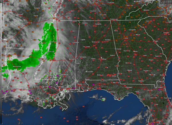
We are tracking an area of storms over western Mississippi at this hour. They are weakening pretty quickly, and should be just a few isolated showers by the time they reach Alabama’s western counties around sunset. They will begin to re-energize as another disturbance forms over southeastern Oklahoma and northeastern Texas overnight. This system will push across northern Louisiana and once again weaken as it moves into Mississippi after midnight.
These showers will hold together enough to work into western Alabama Monday morning. They will continue through the day with some isolated thunder from time to time, mainly south of I-20, as a weak frontal system settles into the central part of the state. I would not be surprised to have a strong storm somewhere across Central Alabama during the afternoon, but the SPC does not have any of Alabama outlooked on its Day Two Severe Weather Outlook. Some showers will continue into the overnight mainly over East Alabama.
Highs on Monday will be in the lower 80s Tennessee Valley, middle 80s North Central Alabama, and upper 80s South Central Alabama.
Tuesday will feature a few scattered showers and storms as that frontal system hangs around. The best rain chances on Wednesday will be over South Alabama, with a few isolated showers over the Tennessee Valley. Thursday now looks fairly dry. Temperatures in the midweek period will settle back into the lower 80s for highs with lows in the lower 60s.
By Friday, high pressure over the Northeast U.S. will begin to ridge down into Alabama setting the stage for a nice, warm weekend. Highs will be in the upper 70s northeast, with lower and middle 80s elsewhere. Next rain chances may not appear until Friday night into the weekend of the 7th and 8th.
IN THE TROPICS
We got the last advisory on Ophelia this morning. The remnants are passing southeast of Washington D.C. this afternoon, across the Chesapeake Bay.
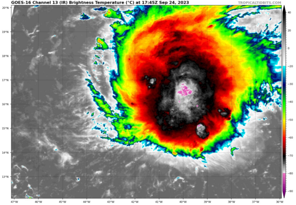
Philippe was about 1315 miles east of Guadeloupe at 10 a.m. this morning. Top winds are 50 mph and the central pressure is estimated to be 1000 millibars. Moving west northwest, it will gradually curve to the northwest with no ridge to the north to push it westward. It is expected to slowly strengthen but not become a hurricane, more likely a strong tropical storm. Interestingly, the GFS does make it about a 90 mph hurricane and I could see that happening. By early Friday, it will be about 700 miles northeast of Guadeloupe. By then, it will be getting ready to turn northeast and will head toward the Azores, where it could be a formidable storm around October 2nd.
The GFS still is hinting at some subtropical or tropical development again close in to the Mid-Atlantic coast around October 3rd and 4th. It could bring some stormy conditions to Georgia, the Carolinas, and Virginia again, but doesn’t look like much.
Category: Alabama's Weather, ALL POSTS


