Midday Nowcast: Rain Down South, Spreads North Overnight
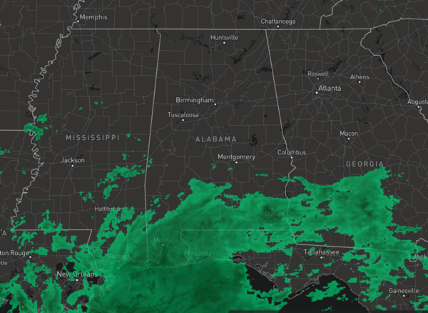
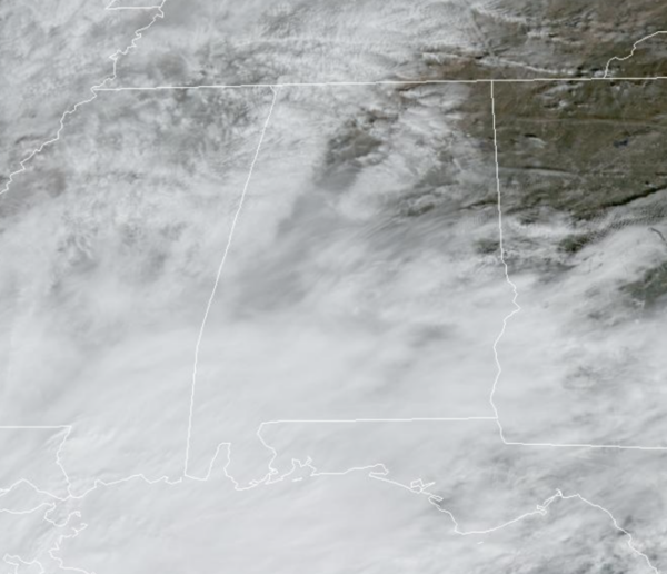
RAIN DOWN SOUTH: Widespread rain is ongoing over the southern portions of the state the day today. For the northern half of the state, we are seeing more clouds, but it remains generally dry with temperatures in the upper 60s to lower 70s.
The rain spreads north tonight and widespread rain is expected statewide tomorrow as a surface low moves along a stalled front near the Gulf Coast. With the clouds and rain, temperatures tomorrow are not likely to make it out of the 50s for much of North/Central Alabama.
Some lingering rain is possible in scattered spots Thursday, and a cold front will bring a chance of showers to the state Friday, so keep the rain gear close. Highs Thursday and Friday will be in the 60s for most locations.
The greater rainfall totals will continue to be across southern sections of the state, but rainfall totals for Central Alabama will be in the 1/2 inch to one inch. For the Tennessee Valley the amounts will be light, generally under 1/4?. Again, anything we can get will help, even though we will still need a lot more to help alleviate the droughts conditions across the state.
THE ALABAMA WEEKEND: The weekend looks generally dry, with more sun than clouds with highs generally in the low 60s, lows mostly in the in the upper 30s and lower 40s.
INTO NEXT WEEK: There remains a lot of model inconsistency for next week’s forecast. The GFS keeps us dry to start the week, with our next rainmaker coming in around Iron Bowl Saturday. The European, shows rain and possible strong storms moving through Alabama in the Tuesday/Wednesday timeframe. For now, we will lean towards the European forecast. We do note, at this time, both models have Thanksgiving as dry.
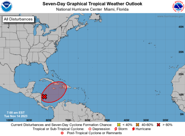
IN THE TROPICS: In the Southwestern Caribbean Sea, an area of disturbed weather located over the southwestern Caribbean Sea is currently associated with a broad area of showers and thunderstorms. Environmental conditions appear favorable for additional development of this system, and a tropical depression is likely to form towards the end of this week while the system begins moving northeastward across the western and central portions of the Caribbean Sea. Interests in Cuba, Jamaica, Haiti, and the Dominican Republic should monitor the progress of this system. Regardless of development, this system has the potential to produce heavy rains over portions of the Caribbean coast of Central America and the Greater Antilles through the end of this week. Formation chance through 7 days…high…70 percent.. Hurricane season ends November 30th and the remaining names on list this year are Vince and Whitney.
BEACH FORECAST CENTER: Get the latest weather and rip current forecasts for the beaches from Fort Morgan to Panama City on our Beach Forecast Center page. There, you can select the forecast of the region that you are interested in visiting.
WORLD TEMPERATURE EXTREMES: Over the last 24 hours, the highest observation outside the U.S. was 114.1F at Mariental, Namibia. The lowest observation was -69.0F Dome A, Antarctica.
CONTIGUOUS TEMPERATURE EXTREMES: Over the last 24 hours, the highest observation was 90F at Gila Bend, AZ. The lowest observation was 6F at Angel Fire, NM.
Category: Alabama's Weather, ALL POSTS
About the Author (Author Profile)
Macon, Georgia Television Chief Meteorologist, Birmingham native, and long time Contributor on AlabamaWX. Stormchaser. I did not choose Weather, it chose Me. College Football Fanatic. @Ryan_StinnetSubscribe
If you enjoyed this article, subscribe to receive more just like it.


