Rain Returns Late Sunday Into Christmas Day
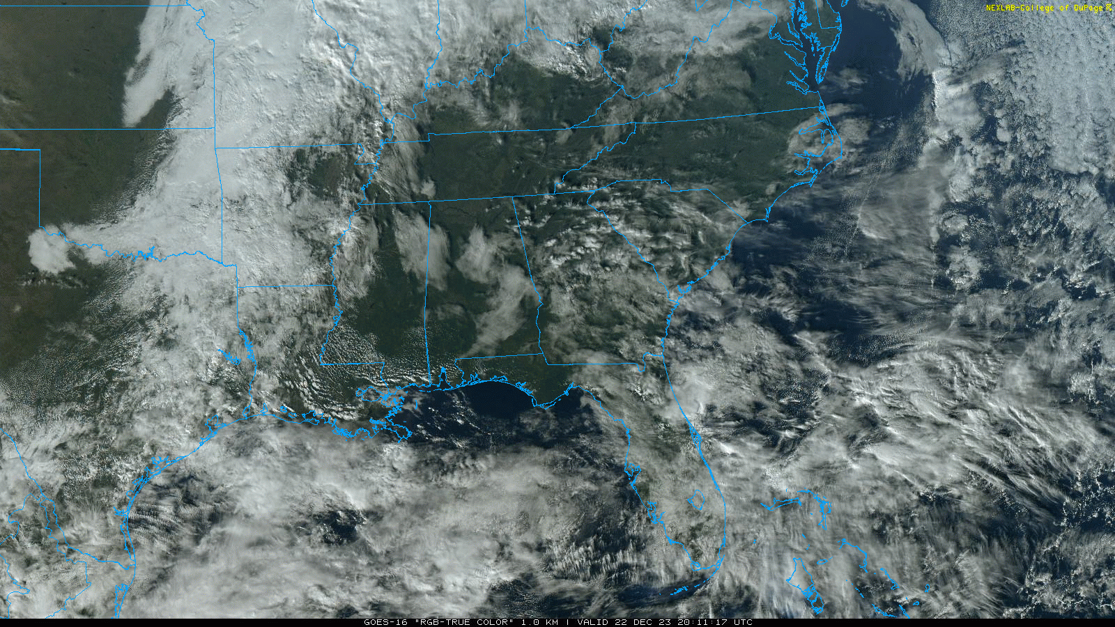
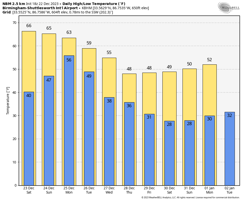
WARMER DAY: Temperatures are mostly in the 60s across Alabama this afternoon, but some places down south (like Mobile) have reached the low 70s. We have a mix of sun and clouds, and tonight will be dry with a low in the 40s.
CHRISTMAS WEEKEND: Tomorrow will be dry and mild for late December. The sky will be partly sunny with a high in the 60s; some places near the Gulf Coast will reach 70 degrees. Clouds increase Sunday, and rain moves into the southwest counties during the day. Then, rain is likely statewide Sunday night and Monday. Some thunder is possible, but no severe thunderstorms are expected. Rain amounts will be around one inch over the northern 2/3 of the state, with potential for 2 inches near Mobile.
REST OF NEXT WEEK: Rain will move out of the state Monday night, and the rest of the week will be dry with a cooling trend. By Thursday and Friday highs will be in the upper 40s over North Alabama, with low to mid 50s to the south. Sub-freezing temperatures are likely by early Friday morning over the northern half of the state. See the video briefing for maps, graphics, and more details.
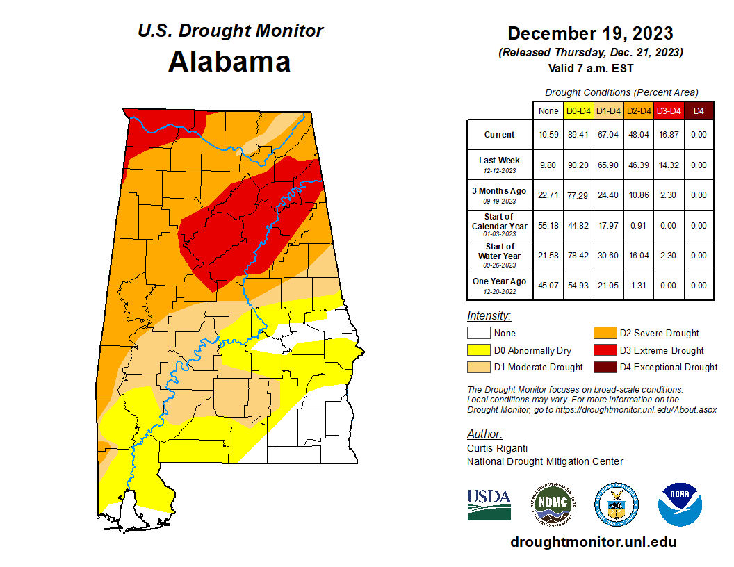
DROUGHT MONITOR: The new drought monitor released yesterday shows that 89 percent of Alabama remains in drought conditions. A D3 “extreme drought” is defined around Muscle Shoals, Birmingham, and Gadsden.
FOOTBALL WEATHER: For tomorrow’s Birmingham Bowl (Troy vs Duke, 11a CT kickoff at Protective Stadium)… the sky will be partly sunny with temperatures rising from near 60 at kickoff into the mid 60s by the final whistle. A very comfortable day.
ON THIS DATE IN 1989: The most significant cold spell of the century for the Deep South occurred from the 22 to the 26. New Orleans experienced 64 consecutive hours at or below 32 degrees Fahrenheit and a total of 81 out of 82 hours below freezing. Birmingham’s low on December 22, 1989 was 4 degrees… it was even colder on December 23/24 with a low of 1 degree both mornings. On those days the low at Huntsville was -3F.
Even more amazing was the snowfall that was occurring over the eastern Florida Panhandle and Florida Peninsula up the Georgia Coast. A Gulf low that crossed the Sunshine State was responsible. It snowed in Tampa and Daytona Beach. It was the most widespread snowstorm in the history of the state. Two inches fell at Savannah and 3.9 inches in Charleston, South Carolina. As the low moved up the coast, it intensified, dumping an astonishing 15 inches of snow at Wilmington, North Carolina and 13.3 inches at Cape Hatteras.
I will be taking some time off next week to spend with family; my next video briefing will be up by 6:00 a.m. on Monday January 1, 2024. See the videos next week over on the blog, alabamawx.com. MERRY CHRISTMAS!
Category: Alabama's Weather, ALL POSTS, Weather Xtreme Videos
About the Author (Author Profile)
James Spann is one of the most recognized and trusted television meteorologists in the industry. He holds the AMS CCM designation and television seals from the AMS and NWA. He is a past winner of the Broadcast Meteorologist of the Year from both professional organizations.Subscribe
If you enjoyed this article, subscribe to receive more just like it.


