A Cold Rain For Central/South Alabama Later Today
RADAR CHECK: Light rain is falling across South Alabama early this morning, where temperatures are in the 38-45 degree range. North Alabama is dry but colder with temperatures mostly in the mid to upper 20s at daybreak.
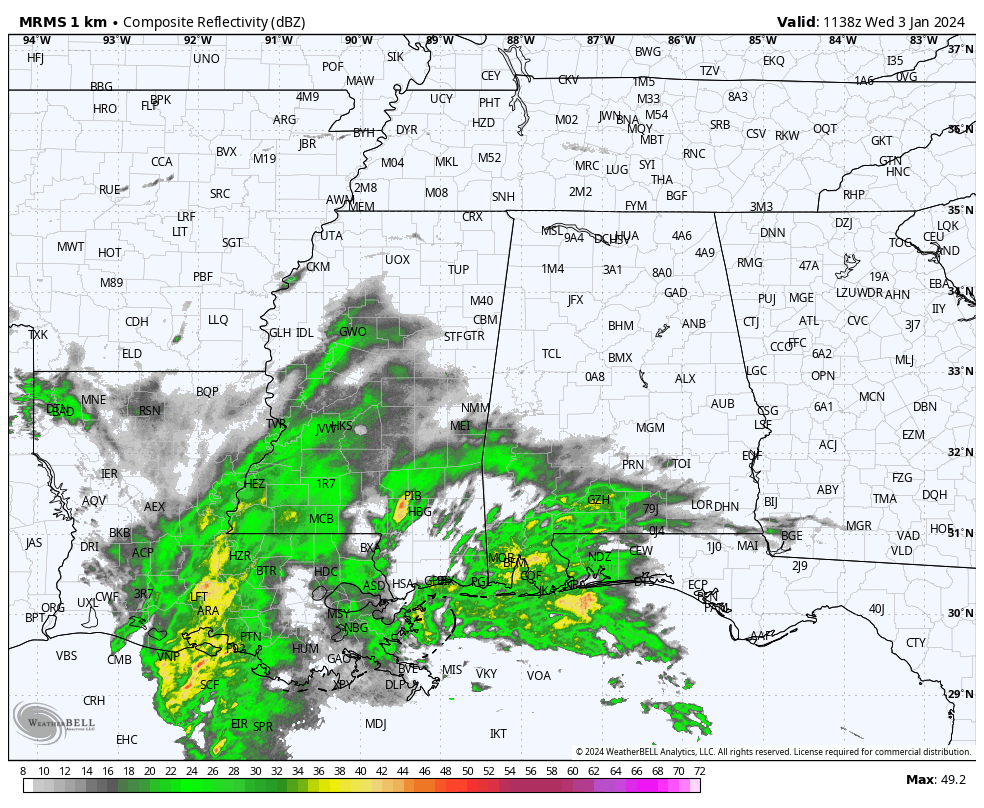
Light rain will slowly spread northward over the next few hours. The air over the northern half of the state is very dry, and initially the precipitation will evaporate and not reach the ground. As the air becomes saturated and rain does begin, we could see some sleet in the mix for a brief period thanks to the evaporative cooling process.
Temperatures should be above freezing as the light rain falls, reaching the 38-44 degree range this afternoon. Most of the rain today will be along and south of I-20 with just a few sprinkles over the northern third of Alabama. There is still a chance a snow flake or two could mix with the light rain before ending over Northeast Alabama, but if that happens there won’t be any accumulation or impact.
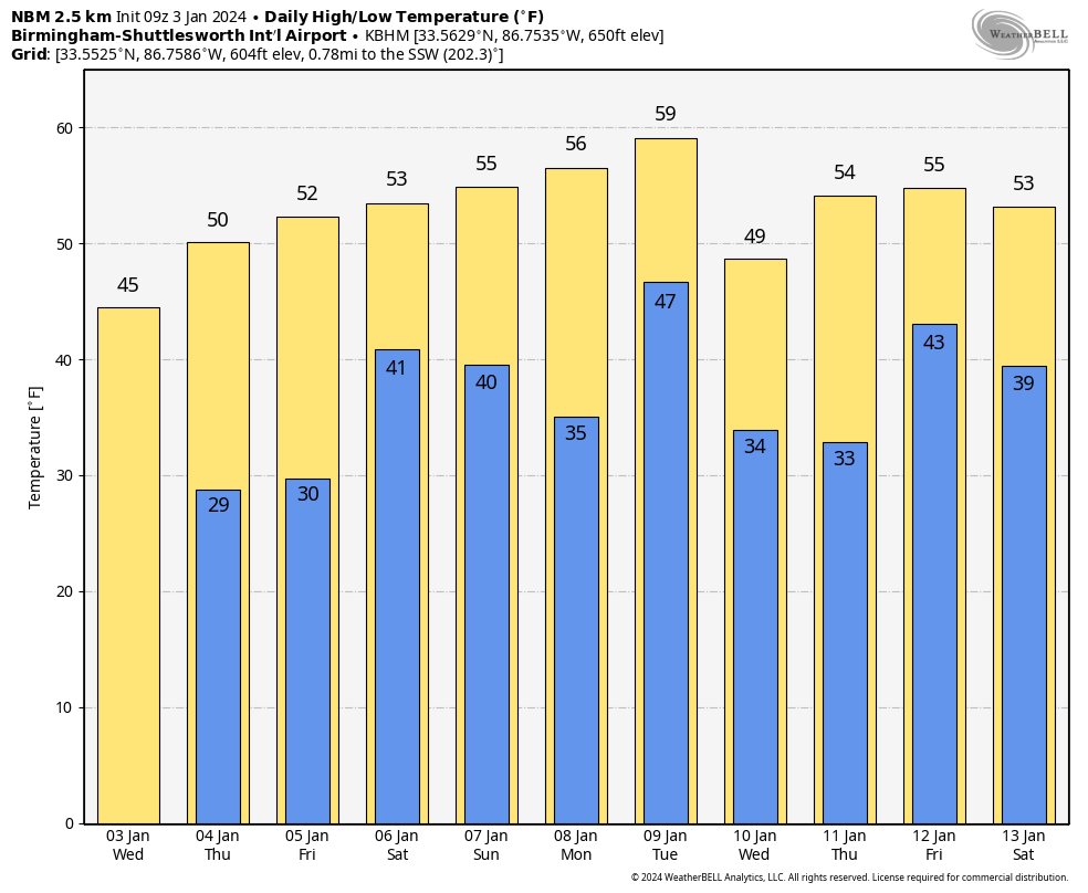
Tomorrow will be a dry day with ample sunshine along with a high in the 50s.
FRIDAY AND THE WEEKEND: Clouds return Friday, and rain will begin Friday afternoon with the next weather system across Southwest Alabama. A good soaking is likely statewide Friday night, with potential for over one inch of rain. We note SPC has defined a “marginal risk” of severe thunderstorms for the Gulf Coast Friday night, where storms could produce strong gusty winds. A brief, isolated tornado can’t be ruled out near the coast.
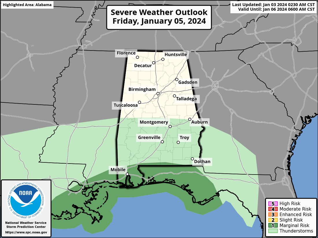
Rain will end Saturday morning… for most of the state it now looks like the bulk of the rain will come from about 6:00 p.m. Friday through 6:00 a.m. Saturday. The sky will begin to clear Saturday afternoon as dry air arrives, and Sunday will be rain-free with a partly to mostly sunny sky. Highs will be in the 50s over the weekend.
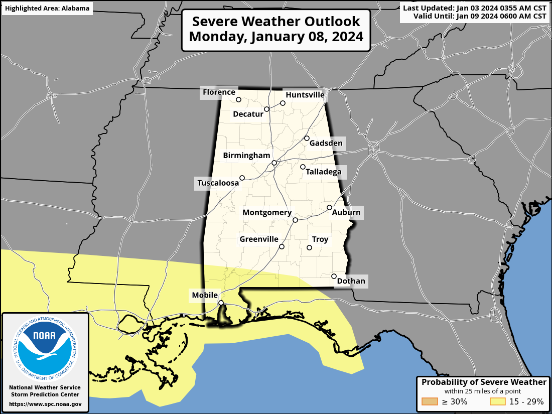
NEXT WEEK: Another dynamic weather system will bring more rain to Alabama Monday afternoon through Tuesday. This one has potential to produce 1-2 inches of rain, and SPC has defined a risk of severe storms again near the Gulf Coast.
Dry weather is likely Wednesday through Friday with seasonal temperatures; highs mostly in the 50s with lows mostly in the 30s. See the video briefing for maps, graphics, and more details.
ON THIS DATE IN 1949: During the late afternoon hours, an estimated F4 tornado destroyed Warren, Arkansas. The tornado killed 55 people and injured more than 250 others. The destruction of the Bradley mill displaced 1,000 employees.
ON THIS DATE IN 2018: The first time in 28 years, light snowfalls in Tallahassee, Florida. The NWS Office in Tallahassee measured 0.1″ of snow/sleet at 8:30a ET.
ON THIS DATE IN 2023: A total of 14 tornadoes touched down across Alabama, including an EF-2 over northeast Elmore County that crossed Lake Jordan.
Look for the next video briefing here by 3:00 this afternoon… enjoy the day!
Category: Alabama's Weather, ALL POSTS, Weather Xtreme Videos
About the Author (Author Profile)
James Spann is one of the most recognized and trusted television meteorologists in the industry. He holds the AMS CCM designation and television seals from the AMS and NWA. He is a past winner of the Broadcast Meteorologist of the Year from both professional organizations.Subscribe
If you enjoyed this article, subscribe to receive more just like it.


