Saturday Briefing — We Begin to Dry Out Today; Strong/Severe Storms Possible on Monday Evening
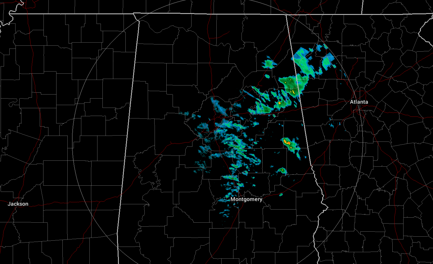
As of 5:54 am this morning, we still have some shower activity mainly over the eastern half of Central Alabama. The heaviest activity was located in-between the I-59 and I-20 corridors, while a few stray showers were lined up south of I-20 just to the east of I-65. All of this activity will move out of the area by the afternoon, but a few stray light showers may be left over the Tennessee Valley and the extreme northern portions of Central Alabama this evening and tonight. Skies will stay mostly cloudy with highs in the upper 40s to the lower 60s from northwest to southeast.
The good news is that Sunday is looking to be a little bit brighter as clouds will be decreasing slowly. It will remain cool with highs in the lower to mid 50s.
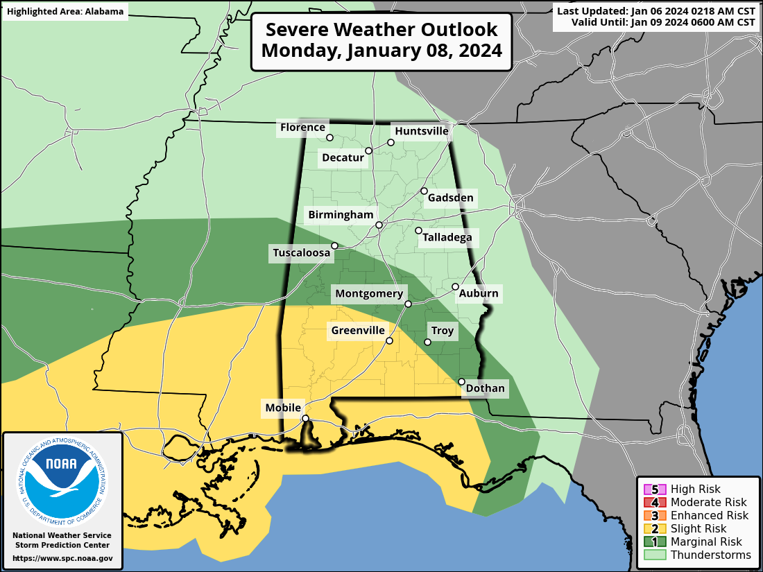
Strong to severe storms will be possible over the southern half of the area and down to the Gulf Coast late on Monday evening through the overnight hours as a potent surface low will be moving eastward from Texas and eventually turning northeast and going just to the north. As of now, this looks to be a wind event as damaging winds up to 60 mph will be possible in those risk locations. Before the storms arrive, much of the day will be dry, but it will become very windy as gradient winds may reach as high as 40-45 mph. Highs in the lower 50s to the lower 60s.
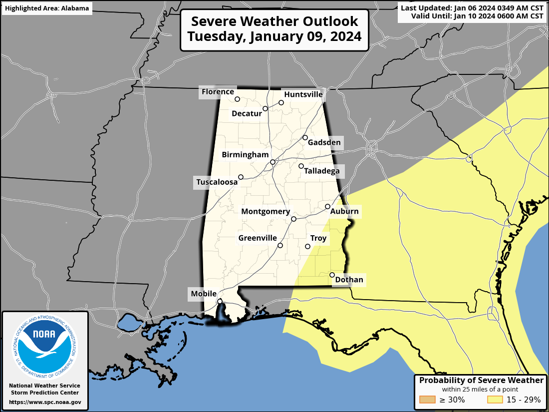
Storms will still be moving through the area after daybreak on Tuesday, with the severe threat shifting to the southeastern parts of the area. Temperatures will be warmer as the flow will be out of the south until the associated cold front passes through. Rain will eventually come to an end by the afternoon, but we could see some wrap-around moisture move across the northern portions during the evening and overnight. Highs in the mid 50s to the mid 60s.
Dry and cool weather returns for Wednesday as skies will be mostly sunny with highs in the mid 40s to the mid 50s.
Thursday will be dry with partly sunny skies during the daylight hours, but a few showers may become possible during the late night and overnight hours. Highs in the mid 50s to the lower 60s.
And at the end of the forecast period on Friday, another surface low will be moving in our direction, bringing with it rain and a few claps of thunder. This doesn’t look to be a severe threat for now, but we’ll keep an eye on it throughout the upcoming week, especially after we get through the Monday night/Tuesday event. Highs in the mid 50s to the mid 60s.
Category: Alabama's Weather, ALL POSTS, Severe Weather, Weather Xtreme Videos
About the Author (Author Profile)
Scott Martin is an operational meteorologist, professional graphic artist, musician, husband, and father. Not only is Scott a member of the National Weather Association, but he is also the Central Alabama Chapter of the NWA president. Scott is also the co-founder of Racecast Weather, which provides forecasts for many racing series across the USA. He also supplies forecasts for the BassMaster Elite Series events including the BassMaster Classic.Subscribe
If you enjoyed this article, subscribe to receive more just like it.


