Wintry Mischief Will Continue Through The Overnight and Pre-Dawn Hours
The latest Mesoscale Discussion just released by the Storm Prediction Center tells us that the wintry mix of sleet and freezing rain will continue for several more hours, with the possibility of some of that still falling at daybreak. Road conditions continue to deteriorate across the northern parts of the state, with more people having accidents and/or becoming stuck on the interstates. Here is the text from the Mesoscale Discussion:
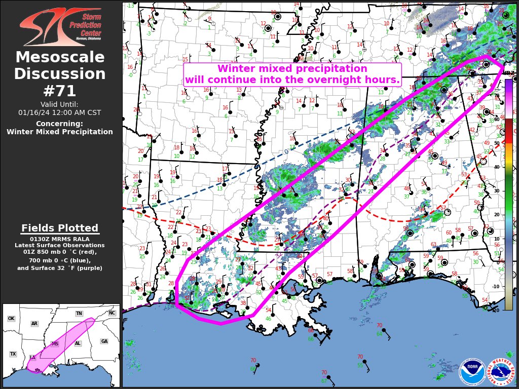
SUMMARY… Winter mixed precipitation (primarily freezing rain and sleet) will continue across portions of the Southeast into the overnight hours.
DISCUSSION… Latest surface observations and webcams show a continuation of light freezing rain extending from southern LA northeastward into southeast TN this evening. This precipitation is generally being aided by a persistent low-level frontogenetic circulation and steady low-level warm advection across the region. This forcing for ascent should remain fairly persistent and quasi-stationary through about 06Z, with a slight southeastward evolution of the frontogenetic band with time.
The 00Z observed JAN sounding depicts an 8 dec C warm nose atop a substantial (albeit shallow) sub-freezing layer (minimum wet bulb temperature of -8 deg C). Any descending ice should completely melt before re-freezing at the surface, suggesting that freezing rain will remain the predominant precipitation type. Farther north toward northwest GA and southeast TN, a deeper sub-freezing layer and minimal warm nose may favor a mix of sleet and freezing rain. While dry air aloft overspreading the region (evident in water vapor imagery and observed/forecast soundings) and modest forcing for ascent may temper overall precipitation rates, the quasi-stationary forcing will support a fairly prolonged period of light to moderate freezing rain and sleet, with localized bursts of higher rates possible in the more robust cores.
Colder surface temperatures will gradually spread southeastward and support freezing rain in areas currently above freezing during the next few hours (i.e., portions of southeast LA and east-central MS).
Category: Alabama's Weather, ALL POSTS, Winter Weather
About the Author (Author Profile)
Scott Martin is an operational meteorologist, professional graphic artist, musician, husband, and father. Not only is Scott a member of the National Weather Association, but he is also the Central Alabama Chapter of the NWA president. Scott is also the co-founder of Racecast Weather, which provides forecasts for many racing series across the USA. He also supplies forecasts for the BassMaster Elite Series events including the BassMaster Classic.Subscribe
If you enjoyed this article, subscribe to receive more just like it.


