Midday Nowcast: More Rain and Storms for Alabama
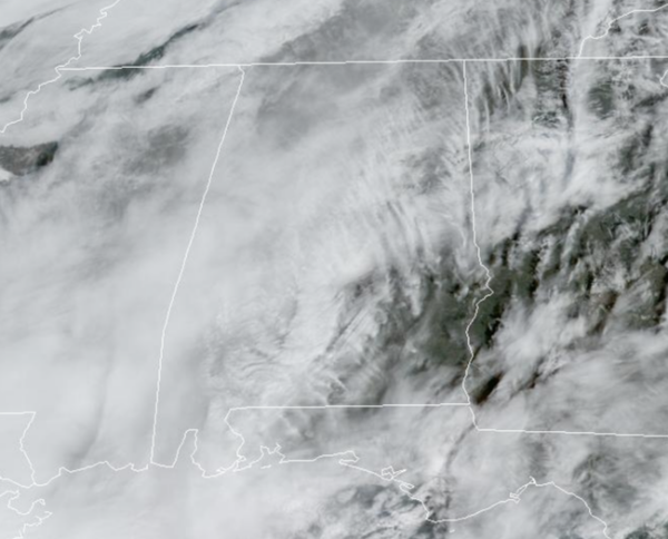
MILD AND MUGGY: Temperatures are above average again today with highs in the upper 60s to mid 70s with more clouds than sun. We are seeing some showers on the radar across the state, but not the coverage we have seen the past few days. However, through the rest of today, pockets of rain and storms are expected and these will continue into tonight and tomorrow morning
STORM THREAT TOMORROW: It will be a mild and breezy day and another wave of energy will move across Alabama associated with a cold front. We are going to see rain and storms develop across the state during the day ahead of the cold front and some of these storms could be strong. The Storm Prediction Center or SPC has defined a “slight risk” (level 2/5) of severe thunderstorms in the broad zone from Birmingham and Gadsden south to Mobile and Andalusia. A “marginal risk” (level 1/5) covers the rest of the state.
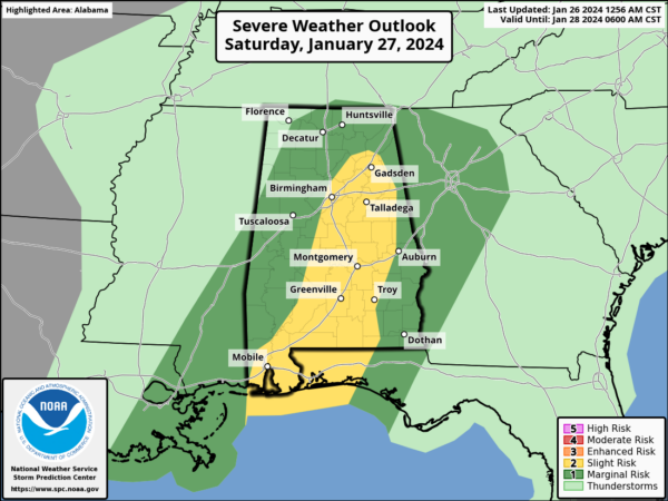
For tomorrow there is the potential for severe storms, but this is a conditional severe weather threat. Meaning if the air can recover or destabilize after the morning round of rain and storms, and instability builds, then storms are expected. The main threat will come from strong winds, although a brief, isolated tornado or two is possible. The line of storms will move into West Alabama around noon, and should be out of the state by 6-7PM. Tomorrow is just once of those days still weather aware because of the threat. Additional rain amounts will be in the 1-2 inch range across Alabama through tomorrow evening, and a flood watch remains in effect for most of the counties of the state.
SUNDAY: Much cooler returns to Alabama on Sunday behind the front. Sunday will be mostly cloudy, with highs in the 40s and 50s. Some lingering light rain is possible on Sunday, but it will not amount to much.
NEXT WEEK: For now the first half of next week looks dry with highs mostly in the 50s and 60s, while lows will be in the 30s and 40s. Some showers are possible, around midweek, but nothing especially heavy or widespread is in the forecast next week. .
BEACH FORECAST CENTER: Get the latest weather and rip current forecasts for the beaches from Fort Morgan to Panama City on our Beach Forecast Center page. There, you can select the forecast of the region that you are interested in visiting.
WORLD TEMPERATURE EXTREMES: Over the last 24 hours, the highest observation outside the U.S. was 115.0F at Ballera Gas Field, Australia. The lowest observation was -69.0F at Summit, Greenland.
CONTIGUOUS TEMPERATURE EXTREMES: Over the last 24 hours, the highest observation was 88F at Plant City, FL. The lowest observation was -8F at Mackay, ID.
Category: Alabama's Weather, ALL POSTS
About the Author (Author Profile)
Macon, Georgia Television Chief Meteorologist, Birmingham native, and long time Contributor on AlabamaWX. Stormchaser. I did not choose Weather, it chose Me. College Football Fanatic. @Ryan_StinnetSubscribe
If you enjoyed this article, subscribe to receive more just like it.


