Strong Storms Possible Tomorrow; Colder Air Arrives Sunday
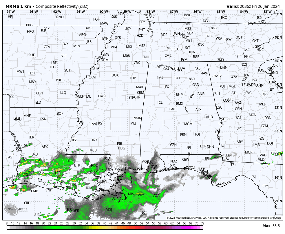
QUIET AFTERNOON: The sky is mostly cloudy across Alabama this afternoon, but most communities are dry with temperatures in the upper 60s and low 70s. Some rain is possible late tonight as an upper trough begins to approach from the west.
TOMORROW: An approaching cold front/upper trough will bring two rounds of rain and storms to the state. One during the morning, and one during the afternoon and evening hours. SPC maintains a “slight risk” (level 2/5) of severe thunderstorms in a broad zone from Birmingham and Gadsden south to Mobile and Andalusia. A “marginal risk” (level 1/5) covers the rest of the state.
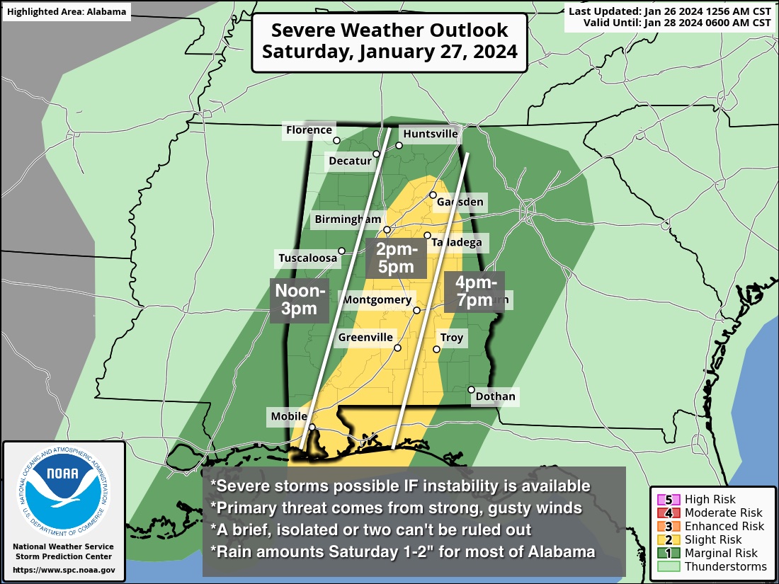
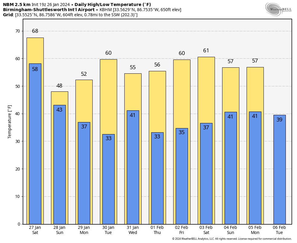
This is basically a conditional severe weather threat; severe storms are possible if there is the air can recover from the morning batch of rain, and surface based instability becomes available. The main threat will come from strong winds, although a brief, isolated tornado or two is possible. The line of storms will move into West Alabama around noon, and should be out of the state by 7:00 p.m. It will be another mild day with highs in the upper 60s and low 70s.
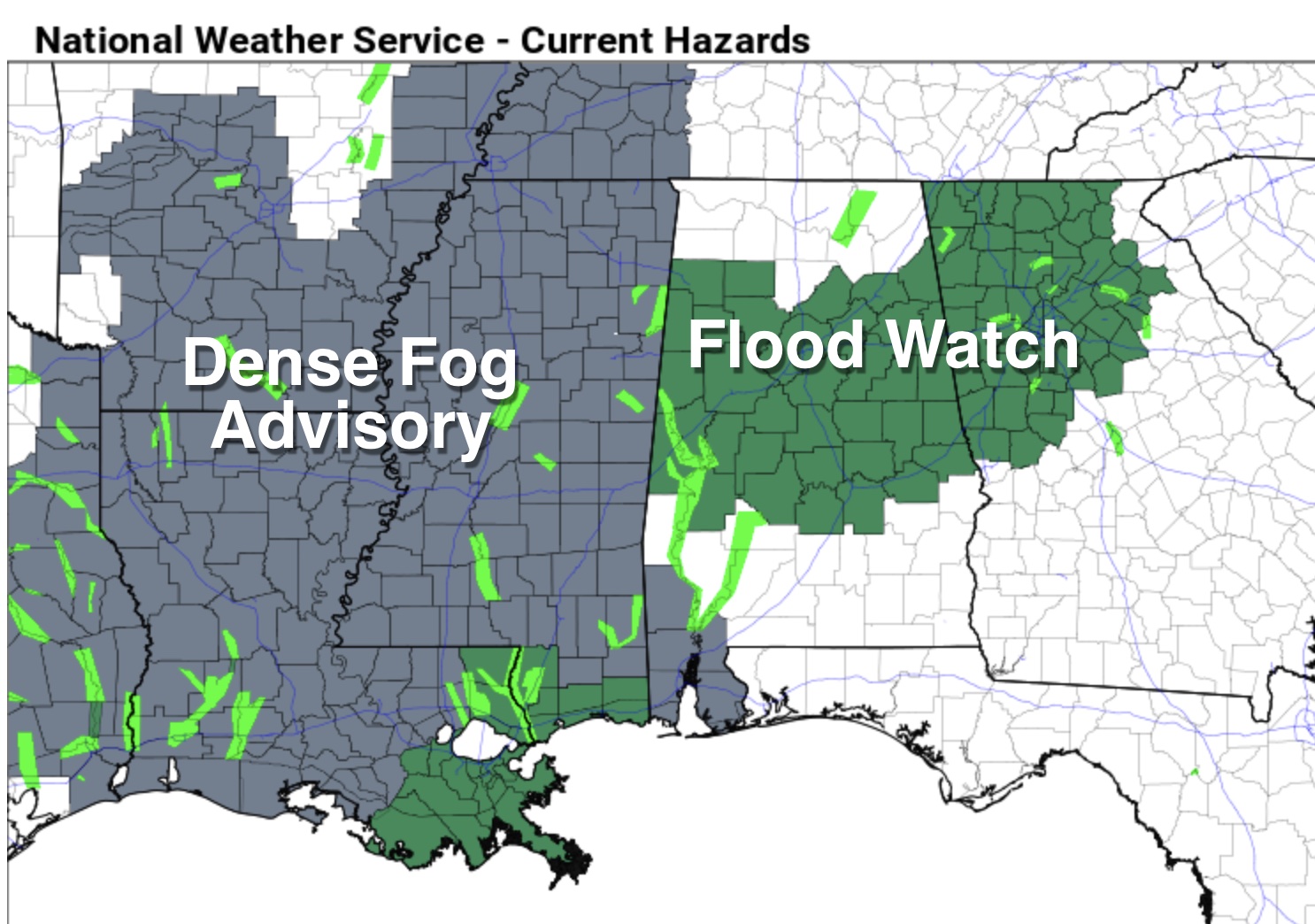
Additional rain amounts will be in the 1-2 inch range across Alabama through tomorrow evening, and a flood watch remains in effect for many central counties.
Sunday will be mostly cloudy and much cooler… temperatures will hold in the 40s over the northern third of the state with some patchy light rain possible. South Alabama should see some sun by afternoon with a high in the 50s.
NEXT WEEK: At this point most of the week looks dry, although global models suggest some scattered light rain could be possible Tuesday night or Wednesday morning over North Alabama as an upper trough passes through. Highs will be in the 50s and 60s, with lows mostly in the 30s. See the video briefing for maps, graphics, and more details.
ON THIS DATE IN 1772: Possibly the greatest snowfall ever recorded in the Washington DC area started on this day. When the storm began, Thomas Jefferson was returning home from his honeymoon with his new bride, Martha Wayles Skelton. The newlyweds made it to within eight miles of Monticello before having to abandon their carriage in the deep snow. Both finished the ride on horseback in the blinding snow. The newlyweds arrived home late on the night of January 26th. In Jefferson’s “Garden Book,” he wrote, “the deepest snow we have ever seen. In Albermarle, it was about 3. F. deep.”
ON THIS DATE IN 1940: Alabama and the Deep South were in the deep freeze, and much of our state was snow covered. The low on January 26, 1940 in Birmingham was 1 degree.
Look for the my video briefing here by 6:00 a.m. Monday… enjoy the weekend!
Category: Alabama's Weather, ALL POSTS, Weather Xtreme Videos
About the Author (Author Profile)
James Spann is one of the most recognized and trusted television meteorologists in the industry. He holds the AMS CCM designation and television seals from the AMS and NWA. He is a past winner of the Broadcast Meteorologist of the Year from both professional organizations.Subscribe
If you enjoyed this article, subscribe to receive more just like it.


