Severe Threat Very Minimal at Best
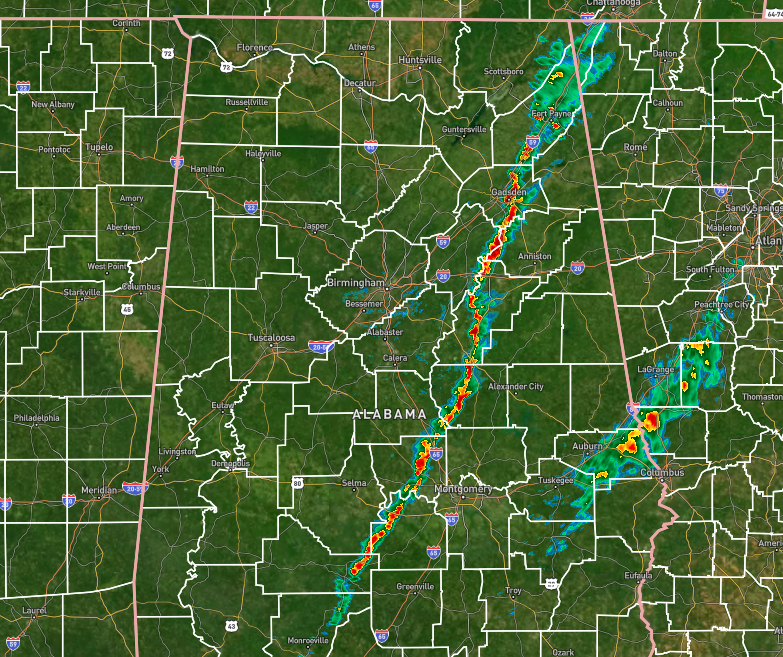
As of 6:07 pm, the line associated with the cold front has moved through much of the area and is currently set up from Fort Payne to Sylacauga to Autaugaville. There is not a lot happening with this line and no warnings have been issued with it at any time. While there have been a few instances of weak rotation showing up from time to time, nothing has been worrisome so far.
A very minimal risk for a strong to severe storm remains possible ahead of this line, and a Marginal Risk is up for those locations. However, with the inability for the atmosphere to recover from this morning’s action, that marginal risk is very, very low. If anything were to happen, the threat would be from damaging winds or a brief tornado. The threat will end around 8pm tonight.
Winds may become a little gusty behind the line, but nothing has been close to advisory levels. We’ll be here if needed.
Category: Alabama's Weather, ALL POSTS, Severe Weather
About the Author (Author Profile)
Scott Martin is an operational meteorologist, professional graphic artist, musician, husband, and father. Not only is Scott a member of the National Weather Association, but he is also the Central Alabama Chapter of the NWA president. Scott is also the co-founder of Racecast Weather, which provides forecasts for many racing series across the USA. He also supplies forecasts for the BassMaster Elite Series events including the BassMaster Classic.Subscribe
If you enjoyed this article, subscribe to receive more just like it.


