

Mid/Level Clouds Tomorrow; Wet Weekend Ahead
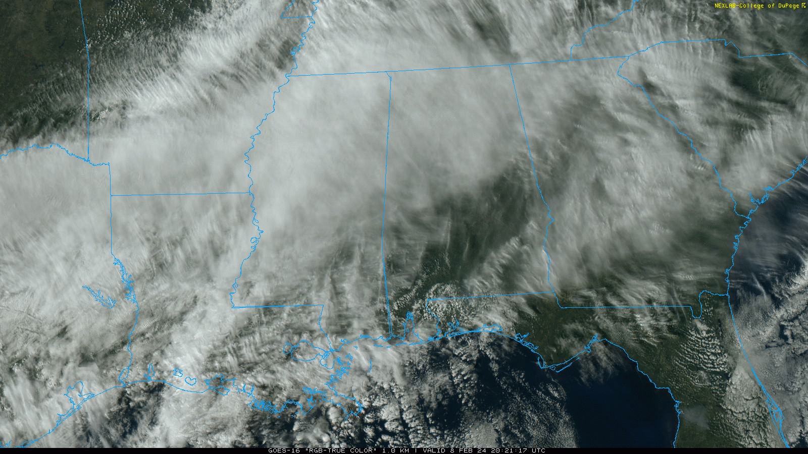
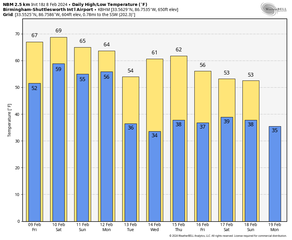
MID/HIGH CLOUDS: We have a thin veil of clouds about 15,000-25,000 feet off the ground over Alabama this afternoon filtering the sun; temperatures are in the 57-67 degree range. Keep in mind the average high for Birmingham on February 8 is 58. The weather will stay dry tonight with a low in the 40s and 50s.
Tomorrow will be a mostly cloudy, mild day with a high in the 67-73 degree range. Showers will creep into the northern quarter of the state late in the day and tomorrow night ahead of a cold front. But for many places, the day will be generally dry.
WET WEEKEND: The front will become stationary across Alabama, setting the stage for a wet weekend. Look for occasional rain and a few thunderstorms Saturday and Sunday with highs between 67 and 72 degrees. The most heaviest and most widespread rain Saturday will be over the northern half of the state, and on Sunday over Central and South Alabama.
Rain will continue on Monday, and there could be a few strong thunderstorms involved as a surface low moves to the north across Tennessee. But, for now the risk of severe storms looks low with very limited surface based instability. Rain amounts between tomorrow night and Monday will be in the 2-3 inch range over North/Central Alabama, and around one inch for the southern counties. A few flooding issues can’t be ruled out along the way, but all of this rain will likely knock out the remaining drought across Alabama.
REST OF NEXT WEEK: The rest of next week looks cool and dry with highs mostly in the 50s and lows in the 30s, very close to seasonal averages. Global models suggest we will deal with yet another wet weekend on February 17/18. See the video briefing for maps, graphics, and more details.
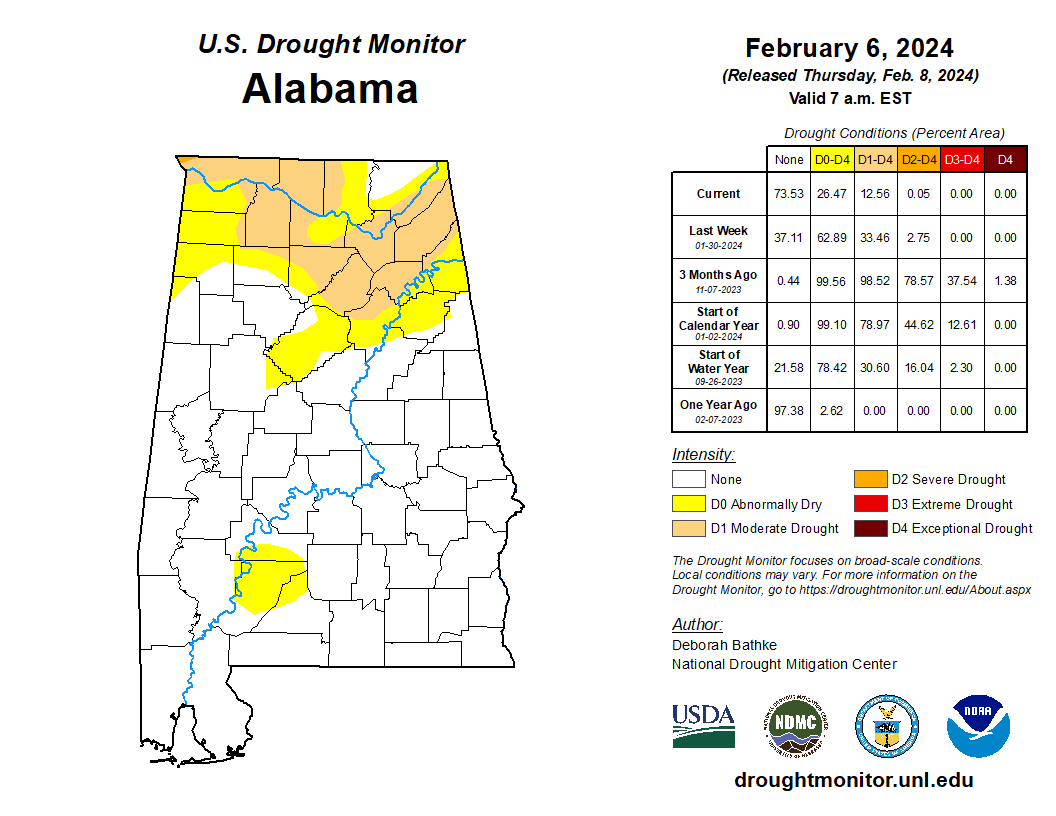
DROUGHT MONITOR: The new drought monitor released this morning continues to show improvement across Alabama… only 13 percent of the state is in drought, and that will likely vanish by next week thanks to the weekend rain event.
ON THIS DATE IN 1956: From February 1-8, heavy snow fell over the Panhandle of Texas. Snowfall amounts include 43 inches in Vega, 24 inches in Hereford, and 14 inches in Amarillo. The storm caused 23 deaths and numerous injuries. It snowed continuously for 92 hours in some locations.
ON THIS DATE IN 2010: Snow developed rapidly across northern portions of Alabama. A narrow band of snow moved eastward across the area…from Lauderdale and Colbert Counties…through Limestone, Madison, and into Jackson Counties. Some locations in eastern Lauderdale County received upwards of 6 inches of snow in just a few hours.
Look for the next video briefing here by 6:00 a.m. tomorrow…
Category: Alabama's Weather, ALL POSTS, Weather Xtreme Videos
About the Author (Author Profile)
James Spann is one of the most recognized and trusted television meteorologists in the industry. He holds the AMS CCM designation and television seals from the AMS and NWA. He is a past winner of the Broadcast Meteorologist of the Year from both professional organizations.Subscribe
If you enjoyed this article, subscribe to receive more just like it.


