

Midday Nowcast: Rain and Storms on the Way
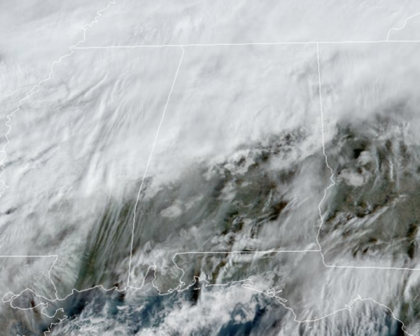
Today is featuring cloudy sky for most of the state, while some sun is shining through to the south. There are a few scattered showers across the northern half of the state as front slowly sinks south into the state. It is a very mild day with highs in the upper 60s and lower 70s across the state.
USA BRIEF: A deep upper level trough and associated surface low pressure system will drive several areas of hazardous weather today through the weekend and into next week while crossing the southern U.S. Heavy snow is possible in the southern Rockies and Plains today into Saturday while excessive rainfall and severe thunderstorms are outlooked across parts of the south Saturday into Monday.
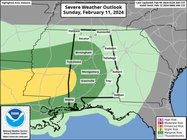
WET WEEKEND WEATHER: The front will stall across the state for the weekend, and several waves of rain will move across Alabama Saturday, Sunday, and Monday. These three days will feature periods of rain and some embedded thunderstorms. A few strong thunderstorms are very possible, and the SPC has defined a “marginal risk” (level 1/5) of severe storms for much of the state along and west of I-65. The main threat will come front strong, gusty thunderstorms winds, although a brief, isolated tornado or two can’t be ruled out Sunday night and Monday in the risk areas.
Rainfall totals will be in the 2-3 inch range, with isolated higher amounts possible. Highs hold in the 60s and 70s over the weekend.
NEXT WEEK: We are forecasting highs mostly in the 50s, lows in the 30s most of next week, which are right at seasonal values for mid-February. After the rain departs Monday, most of next week will be dry. However, it looks like our next rain event will arrive for the weekend.
BEACH FORECAST CENTER: Get the latest weather and rip current forecasts for the beaches from Fort Morgan to Panama City on our Beach Forecast Center page. There, you can select the forecast of the region that you are interested in visiting.
WORLD TEMPERATURE EXTREMES: Over the last 24 hours, the highest observation outside the U.S. was 113.0F at Shark Bay Airport, Australia. The lowest observation was -65.7F at Concordia, Antarctica.
CONTIGUOUS TEMPERATURE EXTREMES: Over the last 24 hours, the highest observation was 85F at Falcon Village, TX. The lowest observation was -10F at Grand Lake, CO.
Category: Alabama's Weather, ALL POSTS
About the Author (Author Profile)
Macon, Georgia Television Chief Meteorologist, Birmingham native, and long time Contributor on AlabamaWX. Stormchaser. I did not choose Weather, it chose Me. College Football Fanatic. @Ryan_StinnetSubscribe
If you enjoyed this article, subscribe to receive more just like it.


