Wet Weekend Ahead; A Few Strong Storms
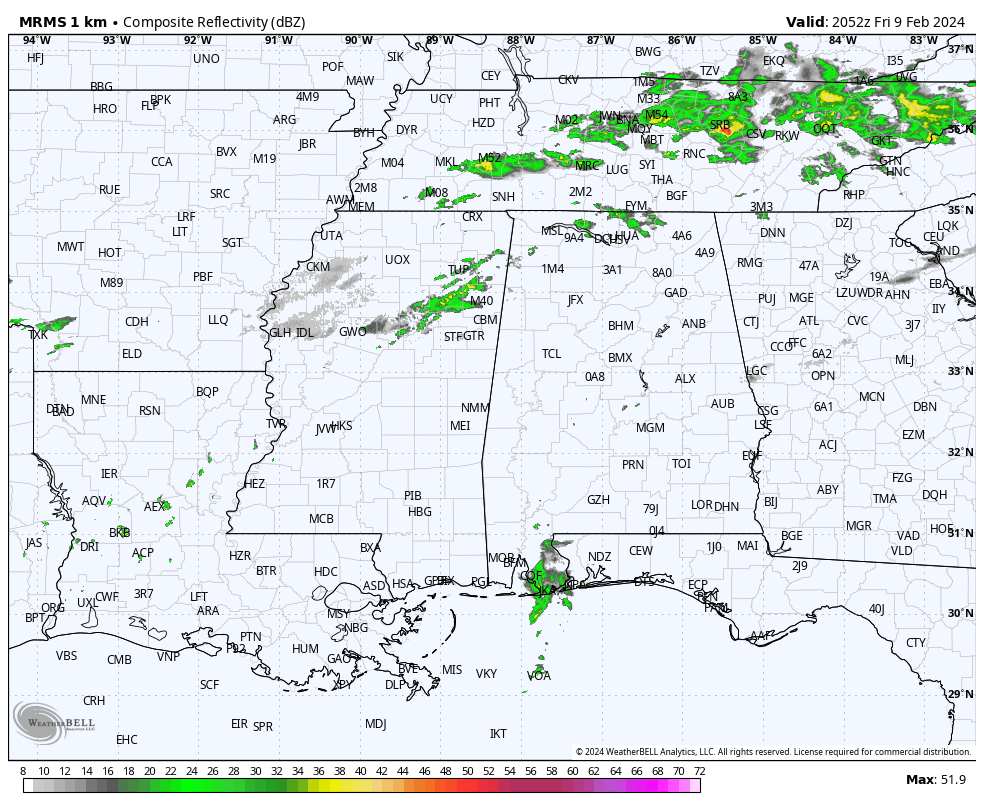
RADAR CHECK: We have showers over the Tennessee Valley of North Alabama this afternoon, and also near the Gulf Coast. The rest of the state is under a mostly cloudy sky, although there is some filtered sunshine across the central counties where temperatures have soared into the 70-75 degree range. Showers are possible tonight as a surface front approaches.
The most widespread rain tomorrow will over the northern quarter of Alabama, especially along and north of U.S. 278 (Hamilton to Cullman to Gadsden). A decent part of the day for the rest of the state will be dry with just scattered showers around. The big rain mass drops southward tomorrow night, and by Sunday most of the rain will be over the southern 3/4 of the state.
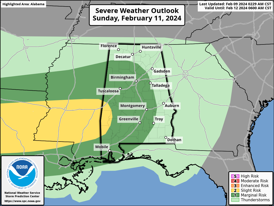
A few thunderstorms could be involved late Sunday and Sunday night as as surface low forms west of Alabama; SPC has defined a “marginal risk” (level 1/5) of severe storms for much of the state along and west of I-65. Keep in mind this “Day 3” outlook is valid through 6:00 a.m. Monday.
Then, after 6:00 a.m. Monday in the “Day 4” outlook, SPC has defined a risk of severe thunderstorms for parts of East and Southeast Alabama.
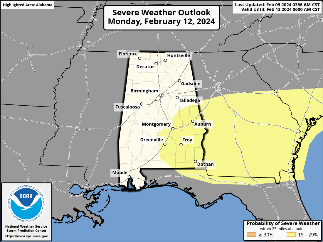
The main threat will come front strong, gusty thunderstorms winds, although a brief, isolated tornado or two can’t be ruled out Sunday night and Monday in the risk areas.
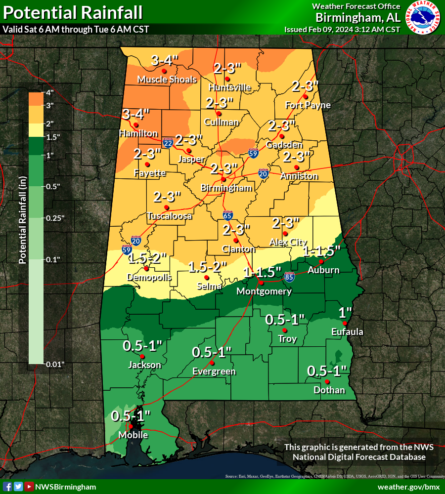
Rain amounts will be in the 2-3 inch range over the northern half of the state tomorrow through Monday, and a few isolated flooding issues could develop as the rain falls.
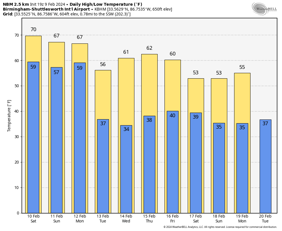
REST OF NEXT WEEK: Dry air returns to the state late Monday night, and the weather looks dry Tuesday through Friday with highs in the 50s and 60s, and lows in the 30s and low 40s. Global models continue to suggest yet another weekend rain event on Saturday, possibly into early Sunday (February 17-18). See the video briefing for maps, graphics, and more details.
ON THIS DATE IN 1973: One of the greatest snowstorms in Southeastern United States history occurred February 9-11, 1973. This storm dropped one to two feet of snow across a region that typically sees only an inch or two of snow per year. In Alabama, the heaviest snow was over the southeast counties of the state, where almost one foot was measured in some parts of Butler and Crenshaw counties, south of Montgomery.
ON THIS DATE IN 2011: A winter storm brought snow to the northern half of Alabama; the Birmingham metro picked up 3-4 inches.
Look for my next video briefing here by 6:00 a.m. Monday… enjoy the weekend!
Category: Alabama's Weather, ALL POSTS, Weather Xtreme Videos
About the Author (Author Profile)
James Spann is one of the most recognized and trusted television meteorologists in the industry. He holds the AMS CCM designation and television seals from the AMS and NWA. He is a past winner of the Broadcast Meteorologist of the Year from both professional organizations.Subscribe
If you enjoyed this article, subscribe to receive more just like it.


