Saturday Briefing: Strong to Severe Storms Possible Late Sunday Through Monday Morning
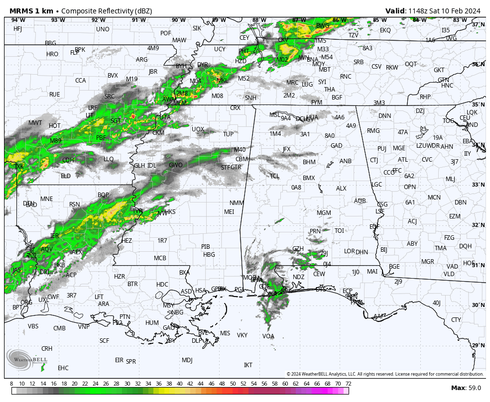
We are starting off this morning with showers and storms located off to our north and west back over portions of Mississippi, Tennessee, Arkansas, Louisiana, and Texas. A few light returns are showing up on radar over portions of North and Central Alabama at this point. However, that will change as this cold front will start to move in our direction, and rain chances will increase area wide, becoming likely for the Tennessee Valley and the northern parts of Central Alabama. Highs will reach the upper 60s to the mid 70s.
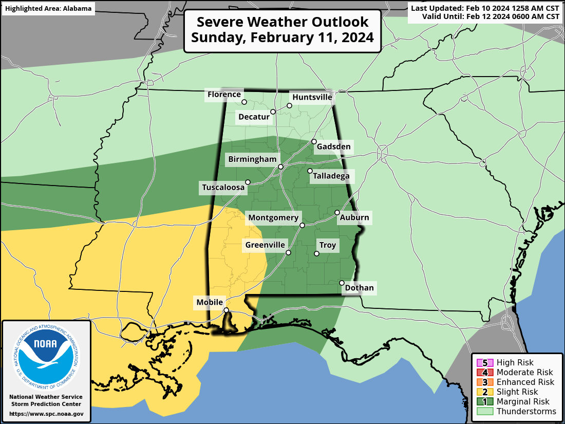
The cold front will be located over North Alabama on Sunday, and rain and storms will be likely area wide. Some rain may be heavy at times, and we could see a few strong to severe storms. Nearly all of Central Alabama has been placed in a Marginal Risk for severe storms, with the southwest corner of the area is under a Slight Risk. Tornadoes and damaging winds will be the threats, especially from Sunday evening through Monday morning. Highs in the lower 60s to the mid 70s.
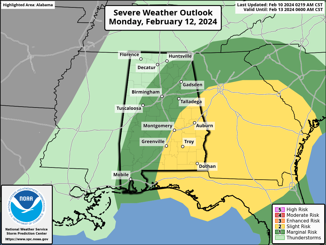
The front will have washed out over Central Alabama on Monday and once again, strong to severe storms will be possible through the morning. A Slight Risk is up for the east and southeastern parts of the area, with much of the rest of the area in a Marginal Risk. The good news is that we finally see an end to the rain and storms area wide by the evening hours. Highs in the lower 60s to the lower 70s.
Tuesday will be dry and cooler with sunny skies. Highs in the lower 50s to the lower 60s. Sunny skies can be expected once again on Wednesday, with highs in the upper 50s to the mid 60s. We’ll have a few clouds drift into the area on Thursday, but we’ll remain dry and highs in the upper 50s to the upper 60s. And the end of the forecast period on Friday, the first half of the day will be dry, but more clouds and showers will move into the area during the evening and overnight hours with our next system. Highs in the mid 50s to the mid 60s.
Category: Alabama's Weather, ALL POSTS, Severe Weather, Weather Xtreme Videos
About the Author (Author Profile)
Scott Martin is an operational meteorologist, professional graphic artist, musician, husband, and father. Not only is Scott a member of the National Weather Association, but he is also the Central Alabama Chapter of the NWA president. Scott is also the co-founder of Racecast Weather, which provides forecasts for many racing series across the USA. He also supplies forecasts for the BassMaster Elite Series events including the BassMaster Classic.Subscribe
If you enjoyed this article, subscribe to receive more just like it.


