Tornado Watch for Central Mississippi, Central Louisiana

Residents of central and southern Louisiana, as well as southern Mississippi, are on alert as a tornado watch has been issued for those areas. The watch, valid to 7:00 PM local time, highlights the imminent threat of severe weather, including the potential for tornadoes and large hail. The forecast warns of scattered supercell development along and just south of a warm front extending from central Louisiana into central Mississippi, with storms expected to propagate eastward throughout the evening.
The atmospheric conditions conducive to severe weather are evident, with upper 60s Fahrenheit dewpoints and a cirrus plume associated with the subtropical jet present across the region. Additional heating throughout the day is expected to escalate instability levels, potentially reaching 1000-1500 J/kg MLCAPE by the afternoon. Deep-layer shear is more than adequate to sustain supercell formations, already observed in southeast Texas, while boundary-layer rolls in central Louisiana and southwest Mississippi hint at further storm development later in the day. These conditions pose a significant risk for tornadoes, potentially strong, and very large hail ranging from 1.75 to 2.75 inches in diameter.
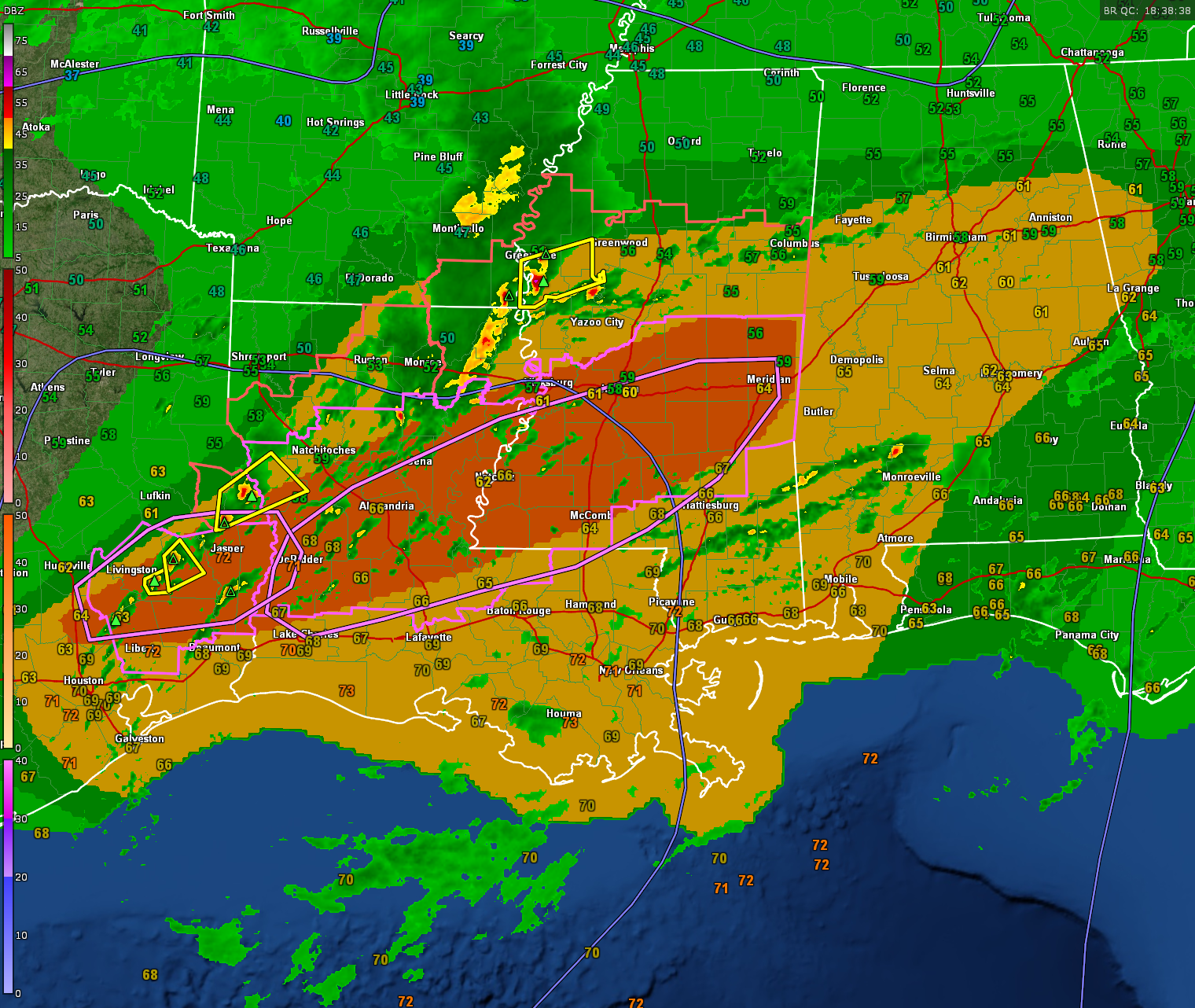
A severe thunderstorm watch has been issued for much of Central Mississippi, northeastern Louisiana, and southeastern Arkansas.
Stay tuned for frequent updates through the afternoon and evening.
Category: Alabama's Weather, ALL POSTS, Severe Weather
About the Author (Author Profile)
Bill Murray is the President of The Weather Factory. He is the site's official weather historian and a weekend forecaster. He also anchors the site's severe weather coverage. Bill Murray is the proud holder of National Weather Association Digital Seal #0001 @wxhistorianSubscribe
If you enjoyed this article, subscribe to receive more just like it.


