Midday Nowcast: Gorgeous Thursday; Strong Storms Return Tomorrow
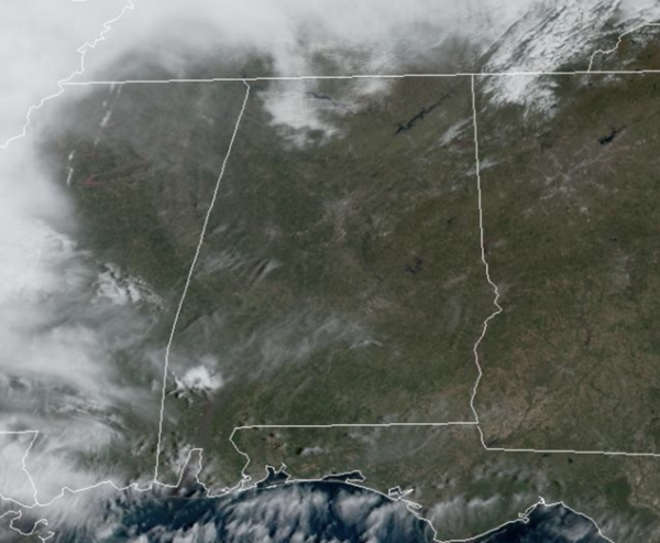
Plenty of sunshine today in the Alabama sky and temperatures are surging into the mid to upper 70s. It is a gorgeous day of weather; enjoy it because things will change fast. Moisture levels start to return tonight and that means clouds will as well. Expect lows tonight in the upper 50s and lower 60s.
TOMORROW/SATURDAY: Rain and storms develop across Alabama by tomorrow afternoon, becoming widespread tomorrow night and into Saturday. Some severe storms are possible for North-Central Alabama and the SPC maintains a “slight risk” (level 2/5) of severe thunderstorms for areas south of a line from Gordo to Tuscaloosa to Calera to Lafayette.
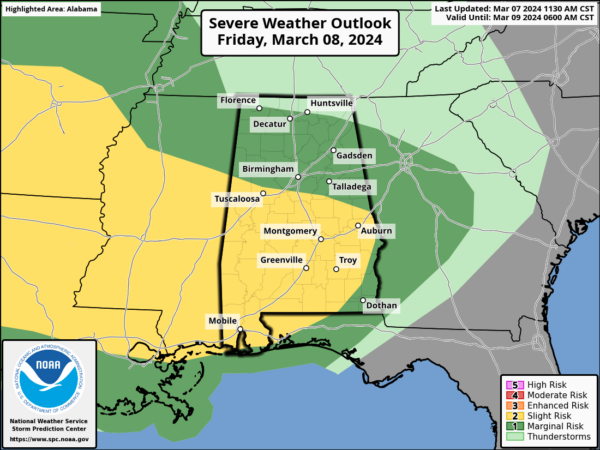
A “marginal risk” (level 1/5) is in place as far north as Florence, Huntsville, and Fort Payne. The better chance for severe weather will be across southern portions of the state.
This is a somewhat conditional risk; surface based instability is expected to be very limited, and mainly across the southern quarter of the state. If severe thunderstorms do develop, the main threat will come from strong gusty winds, but a brief, isolated tornado or two can’t be ruled out.
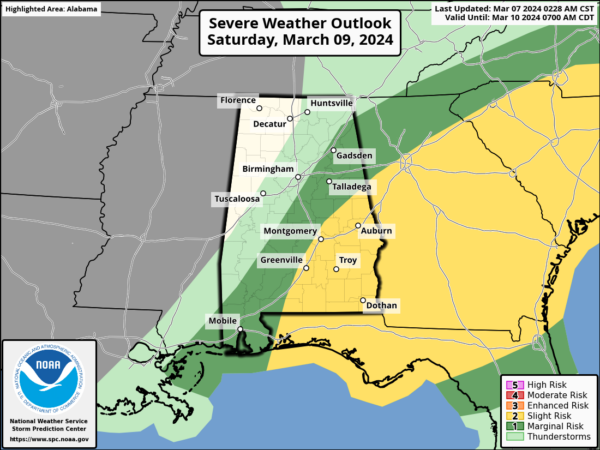
Rain will arrive tomorrow afternoon before the main storm threat. The core threat for the stronger storms will come from 9PM Friday-9AM Saturday. Also, for areas of across Southeast Alabama Saturday morning, the SPC has a “slight risk” (level 2/5) of severe thunderstorms in their “Day 3” outlook as storms are still likely through the late morning hours down that way.
The main issue will come from heavy rainfall across the state. Rain amounts of 1-3 inches are likely; isolated totals to 4 inches are possible.
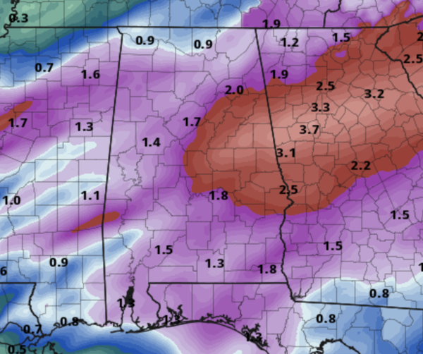
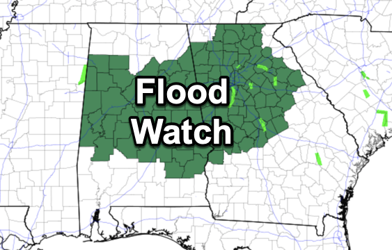
The NWS in Birmingham has issued a Flood Watch for all the counties in their coverage area.
The rain and storms will push east early Saturday, but clouds are likely to linger most of the day. Saturday night, a surge of drier and cooler air will drop into Alabama finally clearing us out.
SUNDAY: Sunshine is back for the second half of the weekend. Along with bright sunshine, Sunday will be cooler with highs in the upper 50s and lower 60s. Sunday night will be chilly as lows fall back into the upper 30s.
NEXT WEEK: A drier weather pattern settles into Alabama next week with plenty of sunshine and very comfortable temperatures. Highs Monday will be in the 60s, but low to mid 70s are expected the rest of the week. The next significant rain event most likely will come at some the following weekend (March 15/16). Way too early to know if severe storms will be an issue, but tis the season and we will be watching trends over the next seven days.
BEACH FORECAST CENTER: Get the latest weather and rip current forecasts for the beaches from Fort Morgan to Panama City on our Beach Forecast Center page. There, you can select the forecast of the region that you are interested in visiting.
WORLD TEMPERATURE EXTREMES: Over the last 24 hours, the highest observation outside the U.S. was 111.7F at Ndjamena, Chad. The lowest observation was -74.4F at Vostok, Antarctica.
CONTIGUOUS TEMPERATURE EXTREMES: Over the last 24 hours, the highest observation was 92F at Hidalgo, TX. The lowest observation was -24F at Culbertson, MT.
Category: Alabama's Weather, ALL POSTS
About the Author (Author Profile)
Macon, Georgia Television Chief Meteorologist, Birmingham native, and long time Contributor on AlabamaWX. Stormchaser. I did not choose Weather, it chose Me. College Football Fanatic. @Ryan_StinnetSubscribe
If you enjoyed this article, subscribe to receive more just like it.


