Northeastern Mississippi Storms A Little Stronger
The line of storms in northeastern Mississippi is becoming better organized early this morning.
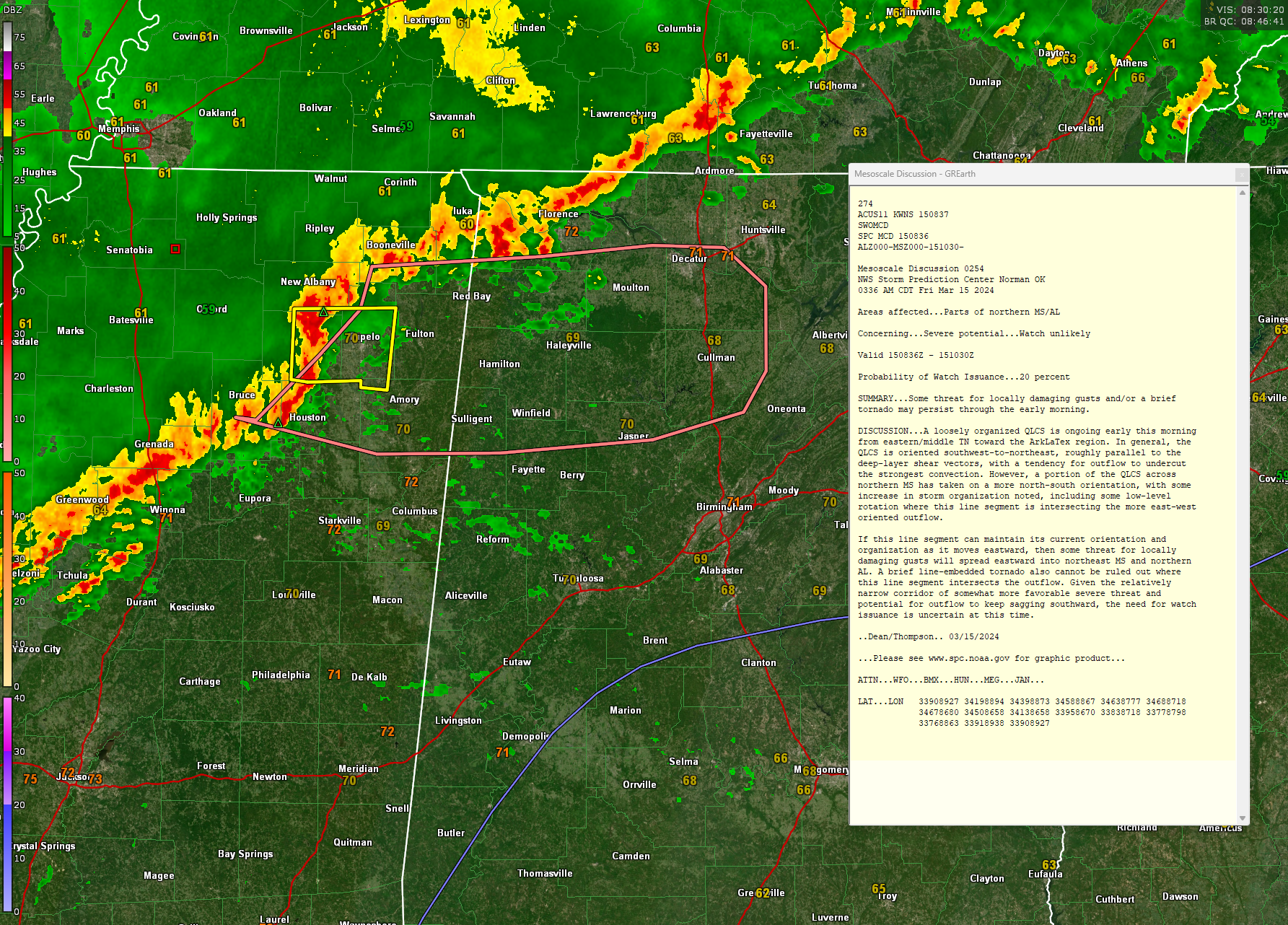
The storms from New Albany to near Houston have become more north-south oriented, which is an indication of better organization and intensity.
These storms have the potential to produce damaging winds and a couple of line embedded tornadoes.
At 3:55 a.m., storms are intense from Holmes County MS to Duck Hill. Also from near Houston to just west of Tupelo. Another is near Tishomingo, MS. Storms are also intense in Northwest Alabama from western Colbert County to Muscle Shoals, to Lexington and Anderson.
A severe thunderstorm warning is currently in effect for areas including Pontotoc and Tupelo in northeastern Mississippi.
The SPC has issued a new mesoscale discussion for Northeast Mississippi and Northwest Alabama. They say the chance of a tornado watch being issued is low, about 20 percent. The text of the discussion is overlain on the graphic.
Category: Alabama's Weather, ALL POSTS, Severe Weather
About the Author (Author Profile)
Bill Murray is the President of The Weather Factory. He is the site's official weather historian and a weekend forecaster. He also anchors the site's severe weather coverage. Bill Murray is the proud holder of National Weather Association Digital Seal #0001 @wxhistorianSubscribe
If you enjoyed this article, subscribe to receive more just like it.


